File:Map of Indiana highlighting Jay County.svg
Zur Navigation springen
Zur Suche springen

Größe der PNG-Vorschau dieser SVG-Datei: 391 × 599 Pixel. Weitere Auflösungen: 156 × 240 Pixel | 313 × 480 Pixel | 501 × 768 Pixel | 668 × 1.024 Pixel | 1.337 × 2.048 Pixel | 2.887 × 4.423 Pixel.
Originaldatei (SVG-Datei, Basisgröße: 2.887 × 4.423 Pixel, Dateigröße: 56 KB)
Bildtexte
Kurzbeschreibungen
Ergänze eine einzeilige Erklärung, was diese Datei darstellt.
Beschreibung[Bearbeiten]
| Beschreibung |
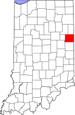
English: This is a locator map showing Jay County in Indiana. For more information, see Commons:United States county locator maps. |
| Datum | |
| Quelle |
Eigenes Werk: English: The maps use data from nationalatlas.gov, specifically countyp020.tar.gz on the Raw Data Download page. The maps also use state outline data from statesp020.tar.gz. The Florida maps use hydrogm020.tar.gz to display Lake Okeechobee. |
| Urheber | David Benbennick |
Lizenz[Bearbeiten]
| Ich, der Urheberrechtsinhaber dieses Werkes, veröffentliche es als gemeinfrei. Dies gilt weltweit. In manchen Staaten könnte dies rechtlich nicht möglich sein. Sofern dies der Fall ist: Ich gewähre jedem das bedingungslose Recht, dieses Werk für jedweden Zweck zu nutzen, es sei denn, Bedingungen sind gesetzlich erforderlich. |
Dateiversionen
Klicke auf einen Zeitpunkt, um diese Version zu laden.
| Version vom | Vorschaubild | Maße | Benutzer | Kommentar | |
|---|---|---|---|---|---|
| aktuell | 12:10, 12. Feb. 2006 | | 2.887 × 4.423 (56 KB) | David Benbennick (Diskussion | Beiträge) | {{subst:User:Dbenbenn/clm|county=Jay County|state=Indiana}} |
Du kannst diese Datei nicht überschreiben.
Dateiverwendung
Die folgenden 6 Seiten verwenden diese Datei:
Globale Dateiverwendung
Die nachfolgenden anderen Wikis verwenden diese Datei:
- Verwendung auf ar.wikipedia.org
- Verwendung auf bg.wikipedia.org
- Verwendung auf bpy.wikipedia.org
- Verwendung auf cdo.wikipedia.org
- Verwendung auf ceb.wikipedia.org
- Verwendung auf ce.wikipedia.org
- Verwendung auf cy.wikipedia.org
- Verwendung auf de.wikipedia.org
- Verwendung auf en.wikipedia.org
- List of counties in Indiana
- Jay County, Indiana
- Dunkirk, Indiana
- Bryant, Indiana
- Pennville, Indiana
- Portland, Indiana
- Redkey, Indiana
- Salamonia, Indiana
- Template:Jay County, Indiana
- Bearcreek Township, Jay County, Indiana
- Greene Township, Jay County, Indiana
- Jackson Township, Jay County, Indiana
- Jefferson Township, Jay County, Indiana
- Knox Township, Jay County, Indiana
- Madison Township, Jay County, Indiana
- Noble Township, Jay County, Indiana
- Penn Township, Jay County, Indiana
- Pike Township, Jay County, Indiana
- Richland Township, Jay County, Indiana
- Wabash Township, Jay County, Indiana
- Wayne Township, Jay County, Indiana
- Antioch, Jay County, Indiana
- Template:JayCountyIN-geo-stub
- Antiville, Indiana
- Balbec, Indiana
- Blaine, Indiana
- Bloomfield, Jay County, Indiana
- Brice, Indiana
- Center, Jay County, Indiana
- College Corner, Jay County, Indiana
- Collett, Indiana
- Como, Indiana
- Fiat, Indiana
- Greene, Indiana
- Kitt, Indiana
- Liber, Indiana
- New Corydon, Indiana
- New Mount Pleasant, Indiana
- Pony, Indiana
- Powers, Indiana
- Ridertown, Indiana
- Salem, Jay County, Indiana
Weitere globale Verwendungen dieser Datei anschauen.