File:Map of Indiana highlighting Vanderburgh County.svg
Naviqasiyaya keç
Axtarışa keç

Bu SVG-faylın PNG formatındakı bu görünüşünün ölçüsü: 391 × 599 piksel. Digər ölçülər: 156 × 240 piksel | 313 × 480 piksel | 501 × 768 piksel | 668 × 1.024 piksel | 1.337 × 2.048 piksel | 2.887 × 4.423 piksel.
Faylın orijinalı (SVG faylı, nominal olaraq 2.887 × 4.423 piksel, faylın ölçüsü: 56 KB)
Captions
Captions
Add a one-line explanation of what this file represents
Xülasə
[redaktə]
| İzah |
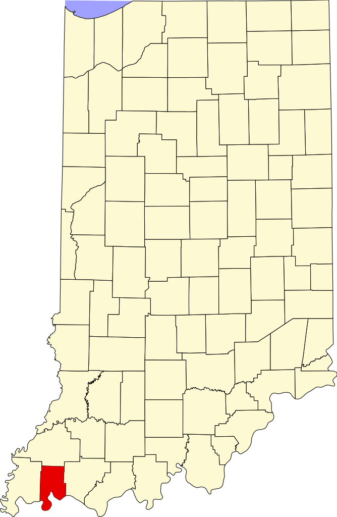
English: This is a locator map showing Vanderburgh County in Indiana. For more information, see Commons:United States county locator maps. |
| Tarix | |
| Mənbə |
Öz işi: English: The maps use data from nationalatlas.gov, specifically countyp020.tar.gz on the Raw Data Download page. The maps also use state outline data from statesp020.tar.gz. The Florida maps use hydrogm020.tar.gz to display Lake Okeechobee. |
| Müəllif | David Benbennick |
Lisenziya
[redaktə]
| Mən, bu əsərin müəllif hüquqlarının sahibi kimi, əsəri ictimai mülkiyyətə verirəm. Bu icazə bütün dünyada qüvvədədir. In some countries this may not be legally possible; if so: Bunun qanunla mümkün olmadığı hallarda: İstənilən şəxsə, istənilən məqsəd üçün, qanunlar tərəfindən qadağan edilməyincə, heç bir şərt qoymadan bu işdən istifadə haqqını bağışlayıram. |
Faylın tarixçəsi
Faylın əvvəlki versiyasını görmək üçün gün/tarix bölməsindəki tarixlərə klikləyin.
| Tarix/Vaxt | Miniatür | Ölçülər | İstifadəçi | Şərh | |
|---|---|---|---|---|---|
| hal-hazırkı | 12:12, 12 fevral 2006 | | 2.887 × 4.423 (56 KB) | David Benbennick (müzakirə | töhfələr) | {{subst:User:Dbenbenn/clm|county=Vanderburgh County|state=Indiana}} |
Siz bu faylı yenidən yükləyə bilməzsiniz.
Faylın istifadəsi
Aşağıdakı 8 səhifə bu faylı istifadə edir:
- Category:Births in Vanderburgh County, Indiana
- Category:Deaths in Vanderburgh County, Indiana
- Category:Education in Vanderburgh County, Indiana
- Category:Historic districts in Vanderburgh County, Indiana
- Category:Maps of Vanderburgh County, Indiana
- Category:National Register of Historic Places in Vanderburgh County, Indiana
- Category:People of Vanderburgh County, Indiana
- Category:Vanderburgh County, Indiana
Faylın qlobal istifadəsi
Bu fayl aşağıdakı vikilərdə istifadə olunur:
- ar.wikipedia.org layihəsində istifadəsi
- arz.wikipedia.org layihəsində istifadəsi
- az.wikipedia.org layihəsində istifadəsi
- bg.wikipedia.org layihəsində istifadəsi
- bpy.wikipedia.org layihəsində istifadəsi
- cdo.wikipedia.org layihəsində istifadəsi
- ceb.wikipedia.org layihəsində istifadəsi
- ce.wikipedia.org layihəsində istifadəsi
- cy.wikipedia.org layihəsində istifadəsi
- de.wikipedia.org layihəsində istifadəsi
- en.wikipedia.org layihəsində istifadəsi
- List of counties in Indiana
- Vanderburgh County, Indiana
- Darmstadt, Indiana
- Evansville, Indiana
- Highland, Vanderburgh County, Indiana
- Melody Hill, Indiana
- Evansville Vanderburgh School Corporation
- Armstrong Township, Vanderburgh County, Indiana
- Center Township, Vanderburgh County, Indiana
- German Township, Vanderburgh County, Indiana
- Knight Township, Vanderburgh County, Indiana
- Perry Township, Vanderburgh County, Indiana
- Pigeon Township, Vanderburgh County, Indiana
- Scott Township, Vanderburgh County, Indiana
- Union Township, Vanderburgh County, Indiana
- Template:Vanderburgh County, Indiana
- Template:VanderburghCountyIN-geo-stub
- Hillsdale, Vanderburgh County, Indiana
- Inglefield, Indiana
- User:Nyttend/County templates/IN/2
- National Register of Historic Places listings in Vanderburgh County, Indiana
- Saint Joseph, Vanderburgh County, Indiana
- University Parkway (Evansville)
- Haynies Corner Arts District
- International World War Peace Tree
- Daylight, Indiana
- McCutchanville, Indiana
- Earle, Indiana
- Armstrong, Indiana
- Red Bank, Indiana
- Mud Center, Indiana
- Category:Populated places in Vanderburgh County, Indiana
- User:Crtew
- List of Indiana state historical markers in Vanderburgh County
- Nisbet, Indiana
Bu faylın qlobal istifadəsinə baxın.