File:Map of Kentucky highlighting Fayette County.svg
Aller à la navigation
Aller à la recherche

Taille de cet aperçu PNG pour ce fichier SVG : 800 × 345 pixels. Autres résolutions : 320 × 138 pixels | 640 × 276 pixels | 1 024 × 441 pixels | 1 280 × 551 pixels | 2 560 × 1 103 pixels | 6 770 × 2 916 pixels.
Fichier d’origine (Fichier SVG, nominalement de 6 770 × 2 916 pixels, taille : 127 kio)
Légendes
Légendes
Ajoutez en une ligne la description de ce que représente ce fichier
Description[modifier]
| Description |
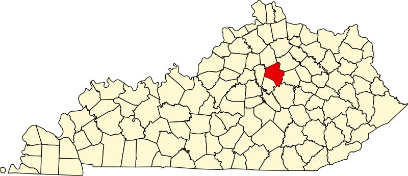
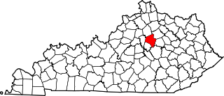
English: This is a locator map showing Fayette County in Kentucky. For more information, see Commons:United States county locator maps. |
| Date | |
| Source |
Travail personnel: English: The maps use data from nationalatlas.gov, specifically countyp020.tar.gz on the Raw Data Download page. The maps also use state outline data from statesp020.tar.gz. The Florida maps use hydrogm020.tar.gz to display Lake Okeechobee. |
| Auteur | David Benbennick |
Conditions d’utilisation[modifier]
| Moi, propriétaire des droits d’auteur sur cette œuvre, la place dans le domaine public. Ceci s'applique dans le monde entier. Dans certains pays, ceci peut ne pas être possible ; dans ce cas : J’accorde à toute personne le droit d’utiliser cette œuvre dans n’importe quel but, sans aucune condition, sauf celles requises par la loi. |
Historique du fichier
Cliquer sur une date et heure pour voir le fichier tel qu'il était à ce moment-là.
| Date et heure | Vignette | Dimensions | Utilisateur | Commentaire | |
|---|---|---|---|---|---|
| actuel | 12 février 2006 à 12:21 | | 6 770 × 2 916 (127 kio) | David Benbennick (d | contributions) | {{subst:User:Dbenbenn/clm|county=Fayette County|state=Kentucky}} |
Vous ne pouvez pas remplacer ce fichier.
Utilisations locales du fichier
Les 9 pages suivantes utilisent ce fichier :
- Category:Births in Fayette County, Kentucky
- Category:Births in Lexington, Kentucky
- Category:Deaths in Fayette County, Kentucky
- Category:Deaths in Lexington, Kentucky
- Category:Fayette County, Kentucky
- Category:Fayette County, Kentucky Image by CLight
- Category:Lexington, Kentucky
- Category:People of Fayette County, Kentucky
- Category:Sports in Lexington, Kentucky
Utilisations du fichier sur d’autres wikis
Les autres wikis suivants utilisent ce fichier :
- Utilisation sur af.wikipedia.org
- Utilisation sur ang.wikipedia.org
- Utilisation sur ar.wikipedia.org
- Utilisation sur arz.wikipedia.org
- Utilisation sur ast.wikipedia.org
- Utilisation sur bg.wikipedia.org
- Utilisation sur bpy.wikipedia.org
- Utilisation sur br.wikipedia.org
- Utilisation sur ca.wikipedia.org
- Utilisation sur cdo.wikipedia.org
- Utilisation sur ceb.wikipedia.org
- Utilisation sur ce.wikipedia.org
- Utilisation sur cs.wikipedia.org
- Utilisation sur cy.wikipedia.org
- Utilisation sur da.wikipedia.org
- Utilisation sur de.wikipedia.org
- Utilisation sur el.wikipedia.org
- Utilisation sur en.wikipedia.org
- Lexington, Kentucky
- Fayette County, Kentucky
- Kentucky Horse Park Arboretum
- List of counties in Kentucky
- Lexington–Fayette–Richmond–Frankfort combined statistical area
- CenterCourt
- Athens, Kentucky
- National Register of Historic Places listings in Fayette County, Kentucky
- Hilton Lexington/Downtown
- Bryan Station, Lexington, Kentucky
- Bell Court, Lexington
- Fairway, Lexington
- Kenwick, Lexington
- Eastland, Lexington
- Joyland, Lexington
- Winburn, Lexington
- Highland Park, Lexington
- Garden Springs, Lexington
- Beaumont Park, Lexington
- Gardenside, Lexington
- Mount Tabor, Lexington
- Rabbit Run, Lexington
- Speigle Heights, Lexington
- Melrose Park, Lexington
- Stonewall, Lexington
- Picadome, Lexington
- Harrods Hill, Lexington
- Palomar Hills, Lexington
- Firebrook, Lexington
Voir davantage sur l’utilisation globale de ce fichier.