File:Map of Lorain County Ohio Highlighting Oberlin City.png
跳至導覽
跳至搜尋
預覽大小:294 × 599 像素。 其他解析度:118 × 240 像素 | 573 × 1,167 像素。
原始檔案 (573 × 1,167 像素,檔案大小:44 KB,MIME 類型:image/png)
說明
說明
添加單行說明來描述出檔案所代表的內容
| 描述 |
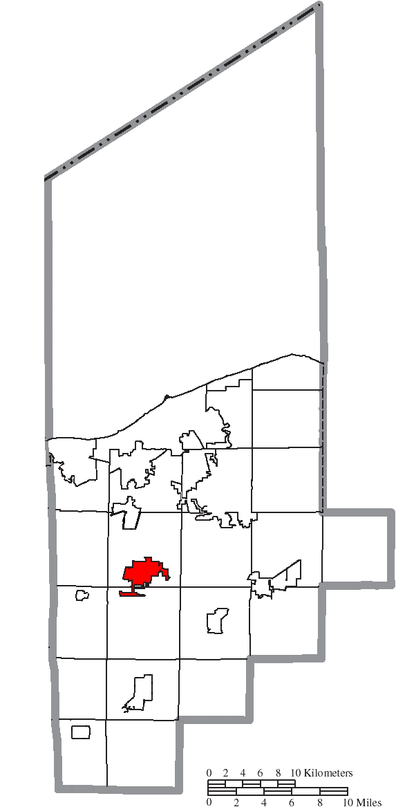
English: Map of the municipal and township boundaries of Lorain County, Ohio, United States, as of the 2000 census, with the location of Oberlin highlighted. Township borders are shown only in unincorporated areas in order to differentiate incorporated and unincorporated areas more clearly. |
||
| 日期 | |||
| 來源 | File:Map of Lorain County Ohio With Municipal and Township Labels.PNG | ||
| 作者 | Ruhrfisch and Nyttend | ||
| 授權許可 (重用此檔案) |
此檔案採用創用CC 姓名標示-相同方式分享 3.0 未在地化版本授權條款。
|
||
| 其他版本 |
|

檔案歷史
點選日期/時間以檢視該時間的檔案版本。
| 日期/時間 | 縮圖 | 尺寸 | 使用者 | 備註 | |
|---|---|---|---|---|---|
| 目前 | 2015年8月17日 (一) 00:44 | | 573 × 1,167(44 KB) | Nyttend(留言 | 貢獻) | {{Information |Description={{en|Map of the municipal and township boundaries of {{w|Lorain County, Ohio|Lorain County}}, {{w|Ohio}}, {{w|United States}}, as of the 2000 census, with the location of {{w|Oberlin, Ohio|Oberlin}} highlighted. Township bor... |
無法覆蓋此檔案。
檔案用途
沒有使用此檔案的頁面。
全域檔案使用狀況
以下其他 wiki 使用了這個檔案:
- ro.wikipedia.org 的使用狀況
- tr.wikipedia.org 的使用狀況
- zh.wikipedia.org 的使用狀況