File:Map of Maryland highlighting Prince George's County.svg
跳转到导航
跳转到搜索

此SVG文件的PNG预览的大小:800 × 418像素。 其他分辨率:320 × 167像素 | 640 × 335像素 | 1,024 × 536像素 | 1,280 × 670像素 | 2,560 × 1,339像素 | 1,929 × 1,009像素。
原始文件 (SVG文件,尺寸为1,929 × 1,009像素,文件大小:80 KB)
说明
说明
添加一行文字以描述该文件所表现的内容
摘要
[编辑]
| 描述 |
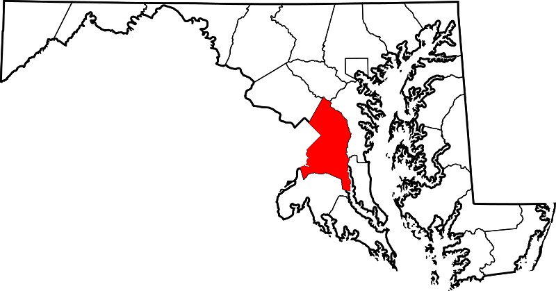
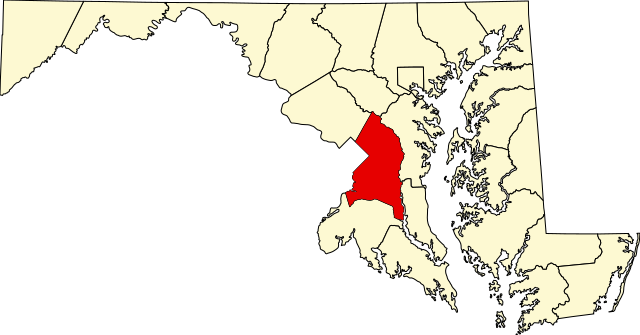
This is a locator map showing Prince George's County in Maryland. David Benbennick made this map. For more information, see Commons:United States county locator maps. |
| 日期 | 2006年2月12日 (原始上传日期) |
| 来源 | No machine-readable source provided. Own work assumed (based on copyright claims). |
| 作者 | No machine-readable author provided. David Benbennick assumed (based on copyright claims). |
许可协议
[编辑]
| 我,本作品著作权人,释出本作品至公有领域。这适用于全世界。 在一些国家这可能不合法;如果是这样的话,那么: 我无条件地授予任何人以任何目的使用本作品的权利,除非这些条件是法律规定所必需的。 |
文件历史
点击某个日期/时间查看对应时刻的文件。
| 日期/时间 | 缩略图 | 大小 | 用户 | 备注 | |
|---|---|---|---|---|---|
| 当前 | 2024年6月24日 (一) 21:42 | | 1,929 × 1,009(80 KB) | Nux(留言 | 贡献) | fix rendering (remove clipping) |
| 2006年2月12日 (日) 12:49 |  | 3,858 × 2,019(139 KB) | David Benbennick(留言 | 贡献) | {{subst:User:Dbenbenn/clm|county=Prince George's County|state=Maryland|type=county}} |
您不可以覆盖此文件。
文件用途
以下14个页面使用本文件:
- Category:Births in Prince George's County, Maryland
- Category:Census-designated places in Prince George's County, Maryland
- Category:Churches in Prince George's County, Maryland
- Category:Deaths in Prince George's County, Maryland
- Category:Geography of Prince George's County, Maryland
- Category:Houses in Prince George's County, Maryland
- Category:Maps of Prince George's County, Maryland
- Category:National Register of Historic Places in Prince George's County, Maryland
- Category:People of Prince George's County, Maryland
- Category:Populated places in Prince George's County, Maryland
- Category:Prince George's County, Maryland
- Category:Roads in Prince George's County, Maryland
- Category:Schools in Prince George's County, Maryland
- Category:Unincorporated communities in Prince George's County, Maryland
全域文件用途
以下其他wiki使用此文件:
- ar.wikipedia.org上的用途
- لوريل (ميريلاند)
- مقاطعة برينس جورج (ماريلاند)
- بروين هايتس (ماريلاند)
- بلادينسبورغ (ماريلاند)
- برنتوود (ماريلاند)
- كابيتول هايتس (ماريلاند)
- تشيفيرلي (ماريلاند)
- كولمار مانور (ماريلاند)
- كوتاغ سيتي (ماريلاند)
- إيغل هاربور (ماريلاند)
- إدمونستون (ماريلاند)
- فيرمونت هايتس (ماريلاند)
- فورست هايتس (ماريلاند)
- لاندوفر هيلز (ماريلاند)
- نورث برنتوود (ماريلاند)
- ريفرديل بارك (ماريلاند)
- يونيفرسيتي بارك (ماريلاند)
- أبر مارلبورو (ماريلاند)
- فانسفيل (ماريلاند)
- باوي (ماريلاند)
- كوليج بارك
- غرينبيلت
- هايتسفيل
- نيو كارولتون
- سيت بليزانت
- منطقة هايتس
- غليناردين
- ماونت رينيير
- قائمة مقاطعات ماريلاند
- لاندوفر (مريلاند)
- ساوث لوريل (ماريلند)
- لانغلي بارك (ماريلند)
- ووكر ميل (ماريلند)
- كامب سبرينغز (ماريلند)
- تمبل هيلز (ماريلند)
- كورال هيلز (ماريلند)
- إيست ريفرديل (ماريلند)
- ويست لوريل (ماريلند)
- فورستفيل (ماريلند)
- كلينتون (ماريلند)
- برانديواين (ماريلند)
- كيترينج (ماريلند)
- فريندلي (ماريلند)
- فورت واشنطن (ماريلند)
- غلين دالي (ماريلند)
- أدلفي (ماريلند)
- قالب:مقاطعة برينس جورج (ماريلاند)
- bpy.wikipedia.org上的用途
- ca.wikipedia.org上的用途
查看此文件的更多全域用途。