File:Map of Maryland highlighting Somerset County.svg
跳去導覽
跳去搵嘢

呢個「SVG」檔案嘅呢個「PNG」預覽嘅大細:800 × 419 像素。 第啲解像度:320 × 167 像素 | 640 × 335 像素 | 1,024 × 536 像素 | 1,280 × 670 像素 | 2,560 × 1,340 像素 | 3,858 × 2,019 像素。
原本檔案 (SVG檔案,表面大細: 3,858 × 2,019 像素,檔案大細:139 KB)
Captions
Captions
Add a one-line explanation of what this file represents
摘要[編輯]
| 描述 |
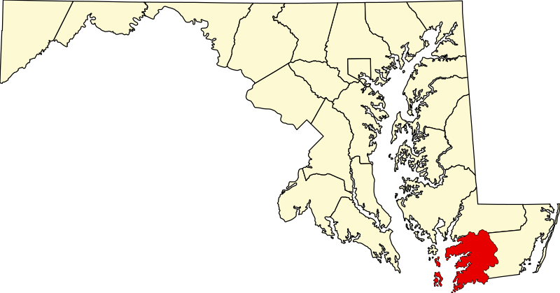
English: This is a locator map showing Somerset County in Maryland. For more information, see Commons:United States county locator maps. |
| 日期 | |
| 來源 |
自己作品: English: The maps use data from nationalatlas.gov, specifically countyp020.tar.gz on the Raw Data Download page. The maps also use state outline data from statesp020.tar.gz. The Florida maps use hydrogm020.tar.gz to display Lake Okeechobee. |
| 作者 | David Benbennick |
協議[編輯]
| I, the copyright holder of this work, release this work into the public domain. This applies worldwide. In some countries this may not be legally possible; if so: I grant anyone the right to use this work for any purpose, without any conditions, unless such conditions are required by law. |
檔案歷史
撳個日期/時間去睇響嗰個時間出現過嘅檔案。
| 日期/時間 | 縮圖 | 尺寸 | 用戶 | 註解 | |
|---|---|---|---|---|---|
| 現時 | 2006年2月12號 (日) 12:49 | | 3,858 × 2,019(139 KB) | David Benbennick(傾偈 | 貢獻) | {{subst:User:Dbenbenn/clm|county=Somerset County|state=Maryland|type=county}} |
你無得衾咗個檔案。
檔案用途
以下嘅7版用到呢個檔:
- Category:Geography of Somerset County, Maryland
- Category:Maps of Somerset County, Maryland
- Category:People of Somerset County, Maryland
- Category:Populated places in Somerset County, Maryland
- Category:Roads in Somerset County, Maryland
- Category:Somerset County, Maryland
- Category:Transport in Somerset County, Maryland
全域檔案使用情況
下面嘅維基都用緊呢個檔案:
- ar.wikipedia.org嘅使用情況
- bpy.wikipedia.org嘅使用情況
- ca.wikipedia.org嘅使用情況
- cdo.wikipedia.org嘅使用情況
- ceb.wikipedia.org嘅使用情況
- ce.wikipedia.org嘅使用情況
- cy.wikipedia.org嘅使用情況
- de.wikipedia.org嘅使用情況
- en.wikipedia.org嘅使用情況
- Somerset County, Maryland
- List of counties in Maryland
- Chance, Maryland
- Crisfield, Maryland
- Dames Quarter, Maryland
- Deal Island, Maryland
- Eden, Maryland
- Fairmount, Maryland
- Frenchtown-Rumbly, Maryland
- Mount Vernon, Maryland
- Princess Anne, Maryland
- Smith Island, Maryland
- West Pocomoke, Maryland
- Template:Somerset County, Maryland
- User:Nyttend/County templates/MD
- National Register of Historic Places listings in Somerset County, Maryland
- Shelltown, Maryland
- Ewell, Maryland
- Tylerton, Maryland
- Rhodes Point, Maryland
- Upper Fairmount, Maryland
- Kingston, Maryland
- Manokin, Maryland
- Marion Station, Maryland
- Oriole, Maryland
- Rehobeth, Maryland
睇呢個檔案嘅更多全域使用情況。