File:Map of Montana highlighting Stillwater County.svg
跳至導覽
跳至搜尋

此 SVG 檔案的 PNG 預覽的大小:800 × 461 像素。 其他解析度:320 × 185 像素 | 640 × 369 像素 | 1,024 × 591 像素 | 1,280 × 738 像素 | 2,560 × 1,477 像素 | 9,194 × 5,303 像素。
原始檔案 (SVG 檔案,表面大小:9,194 × 5,303 像素,檔案大小:122 KB)
說明
說明
添加單行說明來描述出檔案所代表的內容
摘要[編輯]
| 描述 |
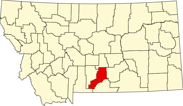
English: This is a locator map showing Stillwater County in Montana. |
| 來源 | 自己的作品 |
| 作者 | David Benbennick made this map. For more information, see Commons:United States county locator maps. |
| 我,此作品的版權所有人,釋出此作品至公共領域。此授權條款在全世界均適用。 這可能在某些國家不合法,如果是的話: 我授予任何人有權利使用此作品於任何用途,除受法律約束外,不受任何限制。 |
檔案歷史
點選日期/時間以檢視該時間的檔案版本。
| 日期/時間 | 縮圖 | 尺寸 | 用戶 | 備註 | |
|---|---|---|---|---|---|
| 目前 | 2006年2月12日 (日) 13:31 | | 9,194 × 5,303(122 KB) | David Benbennick(對話 | 貢獻) | {{subst:User:Dbenbenn/clm|county=Stillwater County|state=Montana|type=county}} |
無法覆蓋此檔案。
檔案用途
下列4個頁面有用到此檔案:
全域檔案使用狀況
以下其他 wiki 使用了這個檔案:
- ar.wikipedia.org 的使用狀況
- bg.wikipedia.org 的使用狀況
- bpy.wikipedia.org 的使用狀況
- cdo.wikipedia.org 的使用狀況
- ceb.wikipedia.org 的使用狀況
- cy.wikipedia.org 的使用狀況
- de.wikipedia.org 的使用狀況
- en.wikipedia.org 的使用狀況
- List of counties in Montana
- Stillwater County, Montana
- Absarokee, Montana
- Columbus, Montana
- Park City, Montana
- Reed Point, Montana
- Nye, Montana
- Rapelje, Montana
- Fishtail, Montana
- User:Nyttend/County templates/MT
- Template:Stillwater County, Montana
- List of lakes of Stillwater County, Montana
- List of mountains in Stillwater County, Montana
- Category:Populated places in Stillwater County, Montana
- Talk:Absarokee, Montana/sandbox
- Limestone, Montana
- Springtime, Montana
- Beehive, Montana
- Molt, Montana
- Dean, Montana
- Wheat Basin, Montana
- National Register of Historic Places listings in Stillwater County, Montana
- User:Dsetay/sandbox
- es.wikipedia.org 的使用狀況
- eu.wikipedia.org 的使用狀況
- fa.wikipedia.org 的使用狀況
- frr.wikipedia.org 的使用狀況
檢視此檔案的更多全域使用狀況。