File:Map of New York highlighting Genesee County.svg
Here nagîvasyonê
Here lêgerînê

Size of this PNG preview of this SVG file: 787 × 600 pîksel. Resolusyonên din: 315 × 240 pîksel | 630 × 480 pîksel | 1008 × 768 pîksel | 1280 × 976 pîksel | 2560 × 1951 pîksel | 6599 × 5030 pîksel.
Dosyeya orjînal (Daneya SVG, mezinbûna rast: 6599 × 5030 pixel; mezinbûna daneyê: 112 KB)
Captions
Captions
Add a one-line explanation of what this file represents
Danasîn[biguhêre]
| Danasîn |
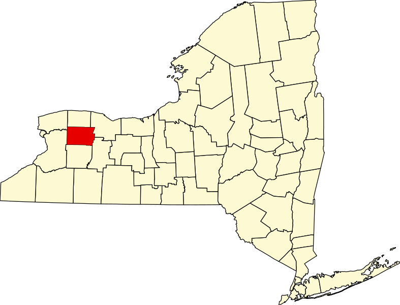
English: This is a locator map showing Genesee County in New York. For more information, see Commons:United States county locator maps. |
| Dîrok | |
| Çavkanî |
Min çêkir: English: The maps use data from nationalatlas.gov, specifically countyp020.tar.gz on the Raw Data Download page. The maps also use state outline data from statesp020.tar.gz. The Florida maps use hydrogm020.tar.gz to display Lake Okeechobee. |
| Xwedî | David Benbennick |
Lîsans[biguhêre]
| I, the copyright holder of this work, release this work into the public domain. This applies worldwide. In some countries this may not be legally possible; if so: I grant anyone the right to use this work for any purpose, without any conditions, unless such conditions are required by law. |
Dîroka daneyê
Ji bo dîtina guhartoya wê demê bişkoka dîrokê bitikîne.
| Dîrok/Katjimêr | Wêneyê biçûk | Mezinahî | Bikarhêner | Şirove | |
|---|---|---|---|---|---|
| niha | 15:32, 12 sibat 2006 | | 6599 x 5030 (112 KB) | David Benbennick (gotûbêj | beşdarî) | {{subst:User:Dbenbenn/clm|county=Genesee County|state=New York|type=county}} |
Tu nikarî cardin li ser vê dosyeyê binivîsînî.
Bikaranîna pelê
Ev 9 rûpel li jêr vê dosyeyê bi kar tînin:
- Category:Cemeteries in Genesee County, New York
- Category:Genesee County, New York
- Category:Geography of Genesee County, New York
- Category:Maps of Genesee County, New York
- Category:New York State Register of Historic Places in Genesee County
- Category:People of Genesee County, New York
- Category:Towns in Genesee County, New York
- Category:Views of Genesee County, New York
- Category:Villages in Genesee County, New York
Bikaranîna gerdûnî ya pelê
Ev wîkiyên di rêzê de vê pelê bi kar tînin:
- Bikaranîna di ar.wikipedia.org de
- Bikaranîna di bg.wikipedia.org de
- Bikaranîna di bpy.wikipedia.org de
- Bikaranîna di cdo.wikipedia.org de
- Bikaranîna di ceb.wikipedia.org de
- Bikaranîna di ce.wikipedia.org de
- Bikaranîna di cs.wikipedia.org de
- Bikaranîna di cy.wikipedia.org de
- Bikaranîna di de.wikipedia.org de
- Bikaranîna di en.wikipedia.org de
- Genesee County, New York
- List of counties in New York
- Alabama, New York
- Bethany, New York
- Byron, New York
- Corfu, New York
- Darien, New York
- Pavilion, New York
- Pembroke, New York
- Stafford, New York
- Tonawanda Reservation
- Alexander (village), New York
- Alexander, New York
- Batavia (town), New York
- Bergen (village), New York
- Bergen, New York
- Elba (village), New York
- Elba, New York
- Le Roy (village), New York
- Le Roy, New York
- Oakfield (village), New York
- Oakfield, New York
- Attica (village), New York
- Darien Lakes State Park
- Indian Falls, New York
- National Register of Historic Places listings in Genesee County, New York
- Template:Genesee County, New York
- Fossil Coral Reef
- Template:GeneseeCountyNY-geo-stub
- East Bethany, New York
- User:Nyttend/County templates/NY/1
- North Bergen, New York
- Black Creek (Genesee River tributary)
- Category:Populated places in Genesee County, New York
Zêdetir bikaranîna global a vê pelê bibîne.