File:Map of North Dakota highlighting Mercer County.svg
Salta a la navegació
Salta a la cerca

Mida d'aquesta previsualització PNG del fitxer SVG: 800 × 476 píxels. Altres resolucions: 320 × 191 píxels | 640 × 381 píxels | 1.024 × 610 píxels | 1.280 × 762 píxels | 2.560 × 1.524 píxels | 5.804 × 3.456 píxels.
Fitxer original (fitxer SVG, nominalment 5.804 × 3.456 píxels, mida del fitxer: 56 Ko)
Llegendes
Llegendes
Afegeix una explicació d'una línia del que representa aquest fitxer
Resum[modifica]
| Descripció |
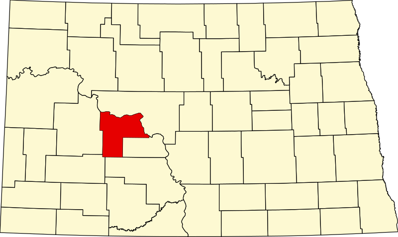
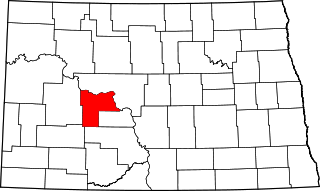
English: This is a locator map showing Mercer County in North Dakota. For more information, see Commons:United States county locator maps. |
| Data | |
| Font |
Treball propi: English: The maps use data from nationalatlas.gov, specifically countyp020.tar.gz on the Raw Data Download page. The maps also use state outline data from statesp020.tar.gz. The Florida maps use hydrogm020.tar.gz to display Lake Okeechobee. |
| Autor | David Benbennick |
Llicència[modifica]
| Jo, el titular del copyright d'aquesta obra, l'allibero al domini públic. Això s'aplica a tot el món. En alguns països això pot no ser legalment possible, en tal cas: Jo faig concessió a tothom del dret d'usar aquesta obra per a qualsevol propòsit, sense cap condició llevat d'aquelles requerides per la llei. |
Historial del fitxer
Cliqueu una data/hora per veure el fitxer tal com era aleshores.
| Data/hora | Miniatura | Dimensions | Usuari/a | Comentari | |
|---|---|---|---|---|---|
| actual | 16:04, 12 feb 2006 | | 5.804 × 3.456 (56 Ko) | David Benbennick (discussió | contribucions) | {{subst:User:Dbenbenn/clm|county=Mercer County|state=North Dakota|type=county}} |
No podeu sobreescriure aquest fitxer.
Ús del fitxer
Les 2 pàgines següents utilitzen aquest fitxer:
Ús global del fitxer
Utilització d'aquest fitxer en altres wikis:
- Utilització a ar.wikipedia.org
- Utilització a bg.wikipedia.org
- Utilització a bpy.wikipedia.org
- Utilització a ca.wikipedia.org
- Utilització a cdo.wikipedia.org
- Utilització a ceb.wikipedia.org
- Utilització a cy.wikipedia.org
- Utilització a de.wikipedia.org
- Utilització a en.wikipedia.org
- List of counties in North Dakota
- Mercer County, North Dakota
- Beulah, North Dakota
- Golden Valley, North Dakota
- Hazen, North Dakota
- Pick City, North Dakota
- Stanton, North Dakota
- Zap, North Dakota
- Knife River Indian Villages National Historic Site
- Fort Berthold Indian Reservation
- Fort Clark Trading Post State Historic Site
- Big Hidatsa Village Site
- Hazen High School (North Dakota)
- Template:Mercer County, North Dakota
- User:Nyttend/County templates/ND
- Category:Populated places in Mercer County, North Dakota
- Knife River Bridge
- Beulah School
- Fred Krause House
- St. Paul's Lutheran Church (Hazen, North Dakota)
- High Butte Effigy and Village Site
- Template:NRHP in Mercer County, North Dakota
- Utilització a eo.wikipedia.org
Vegeu més usos globals d'aquest fitxer.