File:Map of Oudomxai Province, Laos.jpg

Faylın orijinalı (1.195 × 931 piksel, fayl həcmi: 724 KB, MIME növü: image/jpeg)
Captions
Captions
Xülasə[redaktə]
| İzah |
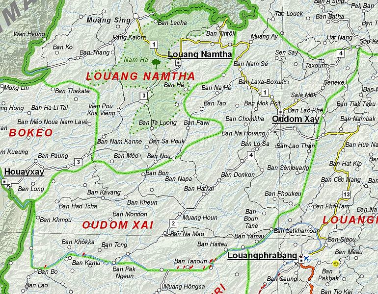
English: Map of Oudomxai Province, Laos. |
| Tarix | |
| Mənbə | Based on File:UNOSAT Laos Base Map.jpg |
| Müəllif | UNOSAT, United Nations, modified by Dr. Blofeld |
| İcazə (Faylın təkrar istifadəsi) |
The original file is marked with the UN symbol which means that it is a public domain resource. |
Lisenziya[redaktə]
| This image is a map derived from a United Nations map.
Unless stated otherwise, UN maps are to be considered in the public domain. This applies worldwide. UN maps are, in principle, open source material and you can use them in your work or for making your own map. UN requests however that you delete the UN name, logo and reference number upon any modification to the map. Content of your map will be your responsibility. You can state in your publication, if you wish, something like: based on UN map … (map name, map number, revision number and date). See: Geospatial Information Section. And: Geospatial, location data for a better world. |
 |
Faylın tarixçəsi
Faylın əvvəlki versiyasını görmək üçün gün/tarix bölməsindəki tarixlərə klikləyin.
| Tarix/Vaxt | Kiçik şəkil | Ölçülər | İstifadəçi | Şərh | |
|---|---|---|---|---|---|
| indiki | 21:02, 6 dekabr 2012 | | 1.195 × 931 (724 KB) | Blofeld Dr. (müzakirə | töhfələr) | {{Information |Description ={{en|1=d}} |Source =d |Author =d |Date =d |Permission = |other_versions = }} d |
Siz bu faylı yenidən yükləyə bilməzsiniz.
Fayl keçidləri
Bu faylı istifadə edən səhifə yoxdur.
Faylın qlobal istifadəsi
Bu fayl aşağıdakı vikilərdə istifadə olunur:
- az.wikipedia.org layihəsində istifadəsi
- de.wikipedia.org layihəsində istifadəsi
- en.wikipedia.org layihəsində istifadəsi
- fa.wikipedia.org layihəsində istifadəsi
- fr.wikipedia.org layihəsində istifadəsi
- hr.wikipedia.org layihəsində istifadəsi
- id.wikipedia.org layihəsində istifadəsi
- ru.wikipedia.org layihəsində istifadəsi
- th.wikipedia.org layihəsində istifadəsi
- ur.wikipedia.org layihəsində istifadəsi
- vi.wikipedia.org layihəsində istifadəsi