File:Map of PRC with province names zh-tw.svg
跳至導覽
跳至搜尋

此 SVG 檔案的 PNG 預覽的大小:713 × 599 像素。 其他解析度:286 × 240 像素 | 571 × 480 像素 | 914 × 768 像素 | 1,218 × 1,024 像素 | 2,436 × 2,048 像素。
原始檔案 (SVG 檔案,表面大小:1,218 × 1,024 像素,檔案大小:1.02 MB)
說明
說明
添加單行說明來描述出檔案所代表的內容
摘要
[編輯]| 描述 |
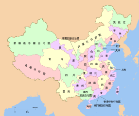
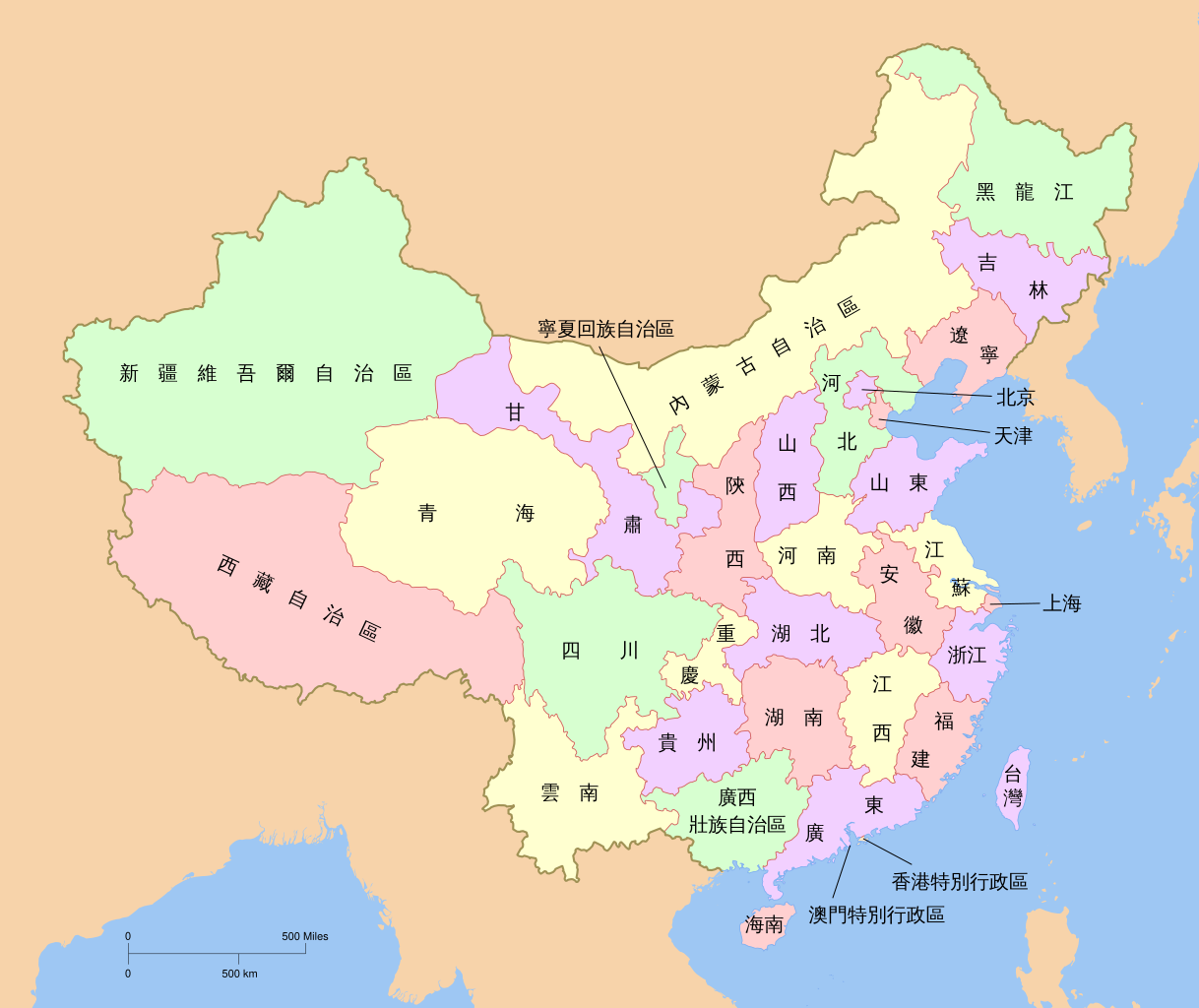
中文(中国大陆):中华人民共和国地图,显示有省级行政区名称。
English: A map of the People Republic of China, with province names. |
| 日期 | |
| 來源 | Created by User:PhiLiP, based on some bitmap files. |
| 作者 | Created by User:PhiLiP. |
| 其他版本 |
|


授權條款
[編輯]
我,本作品的著作權持有者,決定用以下授權條款發佈本作品:

|
已授權您依據自由軟體基金會發行的無固定段落、封面文字和封底文字GNU自由文件授權條款1.2版或任意後續版本,對本檔進行複製、傳播和/或修改。該協議的副本列在GNU自由文件授權條款中。 |
| 此檔案採用共享創意 姓名標示-相同方式分享 3.0 未在地化版本授權條款。 | ||
| ||
| 已新增授權條款標題至此檔案,作為GFDL授權更新的一部份。 |
檔案歷史
點選日期/時間以檢視該時間的檔案版本。
| 日期/時間 | 縮圖 | 尺寸 | 用戶 | 備註 | |
|---|---|---|---|---|---|
| 目前 | 2011年10月4日 (二) 22:34 | | 1,218 × 1,024(1.02 MB) | Ras67(對話 | 貢獻) | cropped |
| 2011年10月3日 (一) 08:48 |  | 1,223 × 1,029(1.31 MB) | McZusatz(對話 | 貢獻) | Reverted to version as of 17:33, 1 July 2010 (this versions thumbnail seems to work as well) | |
| 2011年10月3日 (一) 08:48 |  | 1,223 × 1,029(1.37 MB) | McZusatz(對話 | 貢獻) | Reverted to version as of 03:28, 27 December 2009 (thumbnail) | |
| 2010年7月1日 (四) 17:33 |  | 1,223 × 1,029(1.31 MB) | DieBucheBot(對話 | 貢獻) | Trying to fix SVG using scour | |
| 2009年12月27日 (日) 03:28 |  | 1,223 × 1,029(1.37 MB) | Πrate(對話 | 貢獻) | == {{int:filedesc}} == {{Information |Description= {{zh-cn|中华人民共和国地图,显示有省级行政区名称。}} {{en|A map of the People Republic of China, with province names. }} |Source=Created by User:PhiLiP, based on some bitmap files |
無法覆蓋此檔案。
檔案用途
下列頁面有用到此檔案:
全域檔案使用狀況
以下其他 wiki 使用了這個檔案:
- zh.wikipedia.org 的使用狀況