File:Map of Seattle–Tacoma–Bellevue MSA and Seattle–Tacoma–Olympia CSA.svg
跳至導覽
跳至搜尋

此 SVG 檔案的 PNG 預覽的大小:800 × 521 像素。 其他解析度:320 × 208 像素 | 640 × 416 像素 | 1,024 × 666 像素 | 1,280 × 833 像素 | 2,560 × 1,666 像素 | 1,781 × 1,159 像素。
原始檔案 (SVG 檔案,表面大小:1,781 × 1,159 像素,檔案大小:220 KB)
說明
說明
添加單行說明來描述出檔案所代表的內容
| 描述 |
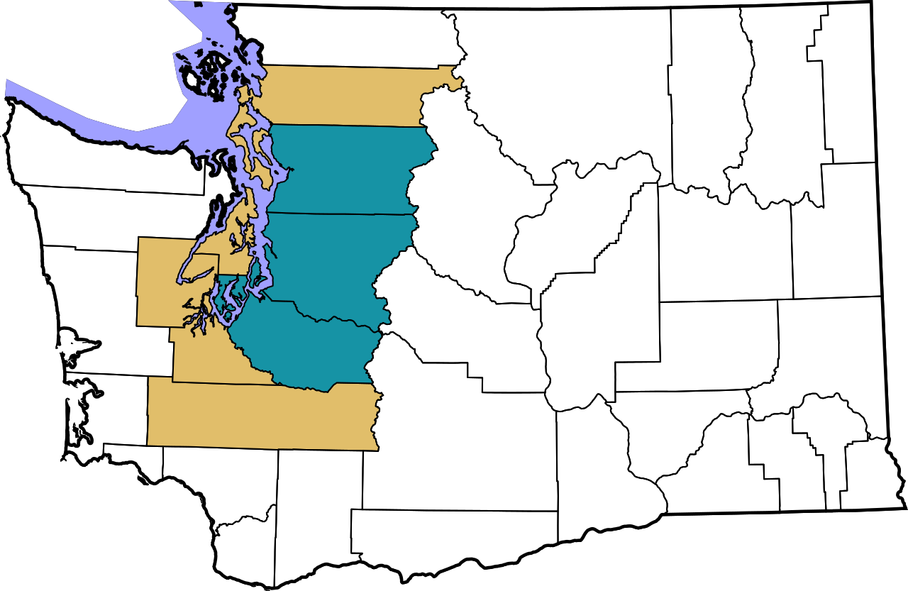
English: An outline map shading the Seattle–Tacoma–Bellevue MSA (teal) and the Seattle–Tacoma–Olympia CSA (navy)
|
||
| 日期 | (UTC) | ||
| 來源 | |||
| 作者 |
|
||
| 授權許可 (重用此檔案) |
我,本作品的著作權持有者,決定用以下授權條款發佈本作品:
|
原始上傳日誌
[編輯]
This image is a derivative work of the following images:
- File:Map_of_Washington_counties,_blank.svg licensed with PD-self
- 2006-02-14T19:06:01Z Dbenbenn 1781x1159 (219804 Bytes) by me, PD. This is a simple modification of [[:Image:Map of Washington highlighting Thurston County.svg]]
Uploaded with derivativeFX
檔案歷史
點選日期/時間以檢視該時間的檔案版本。
| 日期/時間 | 縮圖 | 尺寸 | 使用者 | 備註 | |
|---|---|---|---|---|---|
| 目前 | 2024年1月27日 (六) 05:51 | | 1,781 × 1,159(220 KB) | SounderBruce(留言 | 貢獻) | Added Lewis County to CSA, change color to be colorblind friendly and more distinct |
| 2011年2月11日 (五) 05:52 |  | 1,781 × 1,159(215 KB) | Admrboltz(留言 | 貢獻) | fix Pierce County | |
| 2011年2月11日 (五) 05:50 |  | 1,781 × 1,159(215 KB) | Admrboltz(留言 | 貢獻) | {{Information |Description={{en|An outline map shading the Seattle–Tacoma–Bellevue MSA (teal) and the Seattle–Tacoma–Olympia CSA (navy)}}{{RetouchedPicture|highlighted counties|editor=Admrboltz|orig=Map_of_Washingto |
無法覆蓋此檔案。
檔案用途
下列3個頁面有用到此檔案:
全域檔案使用狀況
以下其他 wiki 使用了這個檔案:
- cs.wikipedia.org 的使用狀況
- de.wikipedia.org 的使用狀況
- en.wikipedia.org 的使用狀況
- fa.wikipedia.org 的使用狀況
- fr.wikipedia.org 的使用狀況
- pt.wikipedia.org 的使用狀況
- ur.wikipedia.org 的使用狀況
- vi.wikipedia.org 的使用狀況
- www.wikidata.org 的使用狀況
- zh.wikipedia.org 的使用狀況