File:Map of Shanghai Pudong New District.png
跳转到导航
跳转到搜索
本预览的尺寸:509 × 599像素。 其他分辨率:204 × 240像素 | 408 × 480像素 | 652 × 768像素 | 870 × 1,024像素 | 1,600 × 1,884像素。
原始文件 (1,600 × 1,884像素,文件大小:2.43 MB,MIME类型:image/png)
说明
说明
添加一行文字以描述该文件所表现的内容
摘要[编辑]
| 描述 |
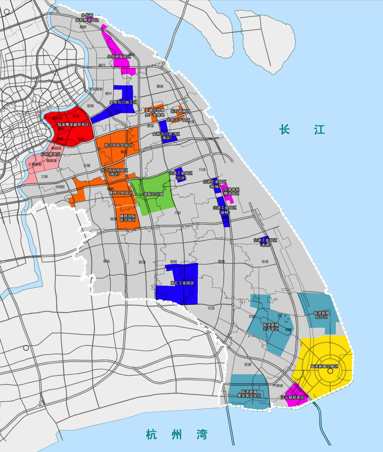
中文(中国大陆):上海市浦东新区人民政府发布的地图 English: A Chinese-language map of Pudong New Area (gray) with various neighborhoods and free trade zones in different colors: 2010 Expo Site (pink), Lujiazui (crimson), Jinqiao and Chuansha and Nanhui and Laogang (blue), Zhangjiang Hi-Tech Park (orange), Waigaoqiao and Pudong's area of Yangshan (hot pink), &c. Includes the recent Shanghai Yangtze Tunnel and Bridge to Chongming County, but Pudong's own Jiuduansha Shoals omitted. Includes proposed infrastructures projects which have not been undertaken, such as the bridge connecting Changxing and Hengsha Islands. |
| 日期 | |
| 来源 | http://gov.pudong.gov.cn/govOpenSRWJHGHSYW/Info/Detail_355191.htm |
| 作者 | 上海市浦东新区人民政府 |
许可协议[编辑]
根据《中华人民共和国著作权法》第五条,本法不适用于:
|
 | |
|
本作品属于上述条款,并在中国大陆和该法律其他的可能管辖区,属于公有领域。对于著作权过期的作品,参见{{PD-China}}、{{PD-PRC}}。 | ||
文件历史
点击某个日期/时间查看对应时刻的文件。
| 日期/时间 | 缩略图 | 大小 | 用户 | 备注 | |
|---|---|---|---|---|---|
| 当前 | 2013年7月29日 (一) 18:01 | | 1,600 × 1,884(2.43 MB) | Yhz1221(留言 | 贡献) | User created page with UploadWizard |
您不可以覆盖此文件。
文件用途
没有页面使用本文件。
全域文件用途
以下其他wiki使用此文件:
- zh.wikipedia.org上的用途