File:Map of South Dakota highlighting Hughes County.svg
Zur Navigation springen
Zur Suche springen

Größe der PNG-Vorschau dieser SVG-Datei: 800 × 492 Pixel. Weitere Auflösungen: 320 × 197 Pixel | 640 × 394 Pixel | 1.024 × 630 Pixel | 1.280 × 788 Pixel | 2.560 × 1.576 Pixel | 6.226 × 3.832 Pixel.
Originaldatei (SVG-Datei, Basisgröße: 6.226 × 3.832 Pixel, Dateigröße: 47 KB)
Bildtexte
Kurzbeschreibungen
Ergänze eine einzeilige Erklärung, was diese Datei darstellt.
Beschreibung[Bearbeiten]
| Beschreibung |
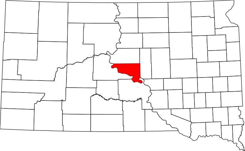
English: This is a locator map showing Hughes County in South Dakota. For more information, see Commons:United States county locator maps. |
| Datum | |
| Quelle |
Eigenes Werk: English: The maps use data from nationalatlas.gov, specifically countyp020.tar.gz on the Raw Data Download page. The maps also use state outline data from statesp020.tar.gz. The Florida maps use hydrogm020.tar.gz to display Lake Okeechobee. |
| Urheber | David Benbennick |
Lizenz[Bearbeiten]
| Ich, der Urheberrechtsinhaber dieses Werkes, veröffentliche es als gemeinfrei. Dies gilt weltweit. In manchen Staaten könnte dies rechtlich nicht möglich sein. Sofern dies der Fall ist: Ich gewähre jedem das bedingungslose Recht, dieses Werk für jedweden Zweck zu nutzen, es sei denn, Bedingungen sind gesetzlich erforderlich. |
Dateiversionen
Klicke auf einen Zeitpunkt, um diese Version zu laden.
| Version vom | Vorschaubild | Maße | Benutzer | Kommentar | |
|---|---|---|---|---|---|
| aktuell | 16:29, 12. Feb. 2006 | | 6.226 × 3.832 (47 KB) | David Benbennick (Diskussion | Beiträge) | {{subst:User:Dbenbenn/clm|county=Hughes County|state=South Dakota|type=county}} |
Du kannst diese Datei nicht überschreiben.
Dateiverwendung
Die folgenden 4 Seiten verwenden diese Datei:
Globale Dateiverwendung
Die nachfolgenden anderen Wikis verwenden diese Datei:
- Verwendung auf ar.wikipedia.org
- Verwendung auf bg.wikipedia.org
- Verwendung auf bpy.wikipedia.org
- Verwendung auf ca.wikipedia.org
- Verwendung auf cdo.wikipedia.org
- Verwendung auf ceb.wikipedia.org
- Verwendung auf ce.wikipedia.org
- Verwendung auf cy.wikipedia.org
- Verwendung auf de.wikipedia.org
- Verwendung auf en.wikipedia.org
- Pierre, South Dakota
- List of counties in South Dakota
- Hughes County, South Dakota
- Blunt, South Dakota
- Harrold, South Dakota
- Crow Creek Indian Reservation
- Template:Hughes County, South Dakota
- User:Nyttend/County templates/SD
- National Register of Historic Places listings in Hughes County, South Dakota
- Category:Populated places in Hughes County, South Dakota
- Canning, South Dakota
- De Grey, South Dakota
- Joe Creek, South Dakota
- Raber Township, Hughes County, South Dakota
- User:InverseWeiner/sandbox
- Oahe Acres, South Dakota
- Verwendung auf es.wikipedia.org
- Verwendung auf et.wikipedia.org
- Verwendung auf eu.wikipedia.org
- Verwendung auf fa.wikipedia.org
- Verwendung auf frr.wikipedia.org
- Verwendung auf fr.wikipedia.org
- Verwendung auf ga.wikipedia.org
- Verwendung auf hr.wikipedia.org
- Verwendung auf hu.wikipedia.org
- Verwendung auf hy.wikipedia.org
Weitere globale Verwendungen dieser Datei anschauen.