File:Map of USA KY.svg
ナビゲーションに移動
検索に移動

この SVG ファイルのこの PNG プレビューのサイズ: 286 × 186 ピクセル. その他の解像度: 320 × 208 ピクセル | 640 × 416 ピクセル | 1,024 × 666 ピクセル | 1,280 × 832 ピクセル | 2,560 × 1,665 ピクセル。
元のファイル (SVG ファイル、286 × 186 ピクセル、ファイルサイズ: 167キロバイト)
キャプション
キャプション
このファイルの内容を1行で記述してください
Clickable version
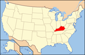
| 解説 | Map of USA with Kentucky highlighted | ||||||||
| 日付 | see file history below. | ||||||||
| 原典 | own work by uploader, based on Image:Map of USA without state names.svg | ||||||||
| 作者 |
This version: uploader Base versions this one is derived from: originally created by en:User:Wapcaplet |
||||||||
| 許可 (ファイルの再利用) |
このファイルはクリエイティブ・コモンズ 表示 2.0 一般ライセンスのもとに利用を許諾されています。
|
||||||||
| その他のバージョン | image:Map of USA with state names.svg |

ファイルの履歴
過去の版のファイルを表示するには、その版の日時をクリックしてください。
| 日付と時刻 | サムネイル | 寸法 | 利用者 | コメント | |
|---|---|---|---|---|---|
| 現在の版 | 2006年6月9日 (金) 06:38 | | 286 × 186 (167キロバイト) | Huebi~commonswiki (トーク | 投稿記録) | {{Information| |Description=Map of USA with Kentucky highlighted |other_versions=image:Map of USA with state names.svg }} Category:Maps of the United States Category:Maps of Kentucky Category:SVG maps {{GFDL-en}}{{cc-by-2.0}}{{cc-by-sa- |
このファイルは上書きできません。
ファイルの使用状況
以下の 16 ページがこのファイルを使用しています:
- Locator maps for U.S. states
- File:Map of USA KY.svg
- File:Map of USA highlighting Kentucky.png
- Category:Births in Nelson County, Kentucky
- Category:Cities in Kentucky
- Category:Deaths in Nelson County, Kentucky
- Category:Locator maps of cities in Kentucky
- Category:Locator maps of counties of Kentucky
- Category:Maps of Catholic dioceses of Kentucky
- Category:Maps of Kentucky
- Category:Maps of Marshall County, Kentucky
- Category:Marshall County, Kentucky
- Category:Nelson County, Kentucky
- Category:People of Marshall County, Kentucky
- Category:People of Nelson County, Kentucky
- Category:Videos from Kentucky
グローバルなファイル使用状況
以下に挙げる他のウィキがこの画像を使っています:
- af.wikipedia.org での使用状況
- ang.wikipedia.org での使用状況
- an.wikipedia.org での使用状況
- arz.wikipedia.org での使用状況
- ay.wikipedia.org での使用状況
- az.wiktionary.org での使用状況
- bcl.wikipedia.org での使用状況
- bi.wikipedia.org での使用状況
- bpy.wikipedia.org での使用状況
- bxr.wikipedia.org での使用状況
- ca.wikipedia.org での使用状況
- ce.wikipedia.org での使用状況
- co.wikipedia.org での使用状況
- cs.wikipedia.org での使用状況
- cv.wikipedia.org での使用状況
- da.wikipedia.org での使用状況
- de.wikipedia.org での使用状況
- Benutzer:Wolfgang1018/Wikipedia-Quiz
- Kategorie:Kentucky
- Vorwahlergebnisse der Präsidentschaftswahl in den Vereinigten Staaten 2008
- Weinbau in Kentucky
- Flaggen und Siegel der US-Bundesstaaten
- Vorwahlergebnisse der Präsidentschaftswahl in den Vereinigten Staaten 2016
- Vorwahlergebnisse der Präsidentschaftswahl in den Vereinigten Staaten 2020
- Vorwahlergebnisse der Präsidentschaftswahl in den Vereinigten Staaten 2024
- de.wiktionary.org での使用状況
- el.wikipedia.org での使用状況
- en.wikipedia.org での使用状況
- List of state and territory name etymologies of the United States
- Category:Kentucky
- Pleasant Hill, Kentucky
- Abraham Lincoln Birthplace National Historical Park
- Ashland (Henry Clay estate)
- Category:Images of Kentucky
- Kentucky School for the Deaf
- St. John the Baptist Roman Catholic Church (Wilder, Kentucky)
- Kentucky High School Athletic Association
- Episcopal Burying Ground and Chapel (Lexington, Kentucky)
- Commodore Apartment Building (Louisville, Kentucky)
- Abner Gaines House
- Kentucky wine
- User:Sesh/Democratic Party Presidential Primaries 2008
- Bank of the Commonwealth (Kentucky)
- African Cemetery No. 2 (Lexington, Kentucky)
- Lincoln County Courthouse (Kentucky)
- Union County Courthouse (Kentucky)
- Downtown Greensburg Historic District (Greensburg, Kentucky)
- Lancaster Commercial Historic District (Lancaster, Kentucky)
このファイルのグローバル使用状況を表示する。