File:Map of USA with state names 2.svg
跳至導覽
跳至搜尋

此 SVG 檔案的 PNG 預覽的大小:800 × 494 像素。 其他解析度:320 × 198 像素 | 640 × 395 像素 | 1,024 × 633 像素 | 1,280 × 791 像素 | 2,560 × 1,582 像素 | 955 × 590 像素。
原始檔案 (SVG 檔案,表面大小:955 × 590 像素,檔案大小:714 KB)
說明
說明
添加單行說明來描述出檔案所代表的內容
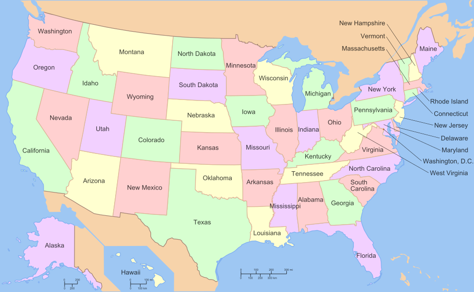
Map of all the states in U.S.
摘要[編輯]
| 描述 |
English: A map of the United States, with state names. |
| 來源 | File:Map of USA with state names.svg? |
| 作者 |
The original was edited by User:Andrew c to include Nova Scotia, PEI, Bahamas, and scale key. It was originally uploaded to the English Wikipedia with the same title by w:User:Wapcaplet:
|
| SVG開發 |
Versions[編輯]
Modifiable text (original)[編輯]

Clickable[編輯]
錯誤:在第 4 行中有不正確的座標,座標必須為數字。
授權條款[編輯]

|
已授權您依據自由軟體基金會發行的無固定段落、封面文字和封底文字GNU自由文件授權條款1.2版或任意後續版本,對本檔進行複製、傳播和/或修改。該協議的副本列在GNU自由文件授權條款中。 |
| 此檔案採用共享創意 姓名標示-相同方式分享 3.0 未在地化版本授權條款。 | ||
| ||
| 已新增授權條款標題至此檔案,作為GFDL授權更新的一部份。 |
[編輯]
Derivative works of this file:
檔案歷史
點選日期/時間以檢視該時間的檔案版本。
| 日期/時間 | 縮圖 | 尺寸 | 用戶 | 備註 | |
|---|---|---|---|---|---|
| 目前 | 2010年6月27日 (日) 04:39 | | 955 × 590(714 KB) | ZooFari(對話 | 貢獻) | Removed border, Washington, D.C. |
| 2010年1月1日 (五) 18:41 |  | 959 × 593(793 KB) | ZooFari(對話 | 貢獻) | {{validSVG}} ==Clickable version== <imagemap> Image:Map of USA with state names.svg|400px|left poly 643 371 666 452 621 458 621 473 606 468 604 374 Alabama poly 152 457 153 540 177 548 205 576 205 589 183 588 158 553 117 547 100 567 12 578 66 547 41 |
無法覆蓋此檔案。
檔案用途
下列51個頁面有用到此檔案:
- File:EstatsEUA.png
- File:Map of USA showing state names in Persian.jpg
- File:Map of USA with HPV uptake.svg
- File:Map of USA with state names.svg
- File:Map of USA with state names ar.svg
- File:Map of USA with state names as.svg
- File:Map of USA with state names bg.svg
- File:Map of USA with state names bn.svg
- File:Map of USA with state names bpy.svg
- File:Map of USA with state names bs.svg
- File:Map of USA with state names ce.svg
- File:Map of USA with state names chr.svg
- File:Map of USA with state names el.svg
- File:Map of USA with state names eo.svg
- File:Map of USA with state names es.svg
- File:Map of USA with state names et.svg
- File:Map of USA with state names eu.svg
- File:Map of USA with state names fa.svg
- File:Map of USA with state names fr.svg
- File:Map of USA with state names gl.svg
- File:Map of USA with state names grc.png
- File:Map of USA with state names haw.svg
- File:Map of USA with state names he.svg
- File:Map of USA with state names hi.png
- File:Map of USA with state names hi.svg
- File:Map of USA with state names hr.svg
- File:Map of USA with state names it.svg
- File:Map of USA with state names ka.png
- File:Map of USA with state names kk.png
- File:Map of USA with state names mk.svg
- File:Map of USA with state names mr.svg
- File:Map of USA with state names nv.svg
- File:Map of USA with state names pt.svg
- File:Map of USA with state names ru(2).svg
- File:Map of USA with state names ru.svg
- File:Map of USA with state names sco.svg
- File:Map of USA with state names sk.svg
- File:Map of USA with state names sr.svg
- File:Map of USA with state names sv.svg
- File:Map of USA with state names th.svg
- File:Map of USA with state names uk.svg
- File:Map of USA with state names ur.svg
- File:Map of USA with state names zh-hans.svg
- File:Map of USA with state names zh-hant.svg
- File:North american airline hubs map.jpg
- File:Ovtâstum staatâi uásistaatah smn.svg
- File:USA map with state names pl.svg
- File:USA map with state names szl.svg
- File:Yhdysvaltain osavaltiot.svg
- File talk:US State Name Etymologies4.png
- Template:Other versions/Map of USA with state names
.svg)
全域檔案使用狀況
以下其他 wiki 使用了這個檔案:
- azb.wikipedia.org 的使用狀況
- az.wikipedia.org 的使用狀況
- blk.wikipedia.org 的使用狀況
- br.wikipedia.org 的使用狀況
- dag.wikipedia.org 的使用狀況
- el.wikipedia.org 的使用狀況
- en.wikipedia.org 的使用狀況
- Wikipedia:WikiProject U.S. counties
- Wikipedia:WikiProject United States/Collaboration
- Wikipedia talk:WikiProject United States/Collaboration
- United States National Register of Historic Places listings
- Wikipedia:WikiProject Deletion sorting/United States of America
- User:Dogears
- Wikipedia:WikiProject United States
- Wikipedia talk:WikiProject United States
- Wikipedia:WikiProject United States/State-level WikiProjects
- Template:WikiProject United States
- Category:WikiProject United States
- Wikipedia:WikiProject United States/Assessment
- Wikipedia talk:WikiProject United States/Assessment
- Template:National Register Of Historic Places Map
- Template talk:WikiProject United States
- Wikipedia talk:WikiProject Comics/United States comics work group
- U.S. state
- Template:WikiProject United States/doc
- Wikipedia:WikiProject Film/American cinema task force
- User:Maile66
- Wikipedia:WikiProject United States/Members
- Wikipedia:WikiProject United States/To do
- Wikipedia:WikiProject United States/WikiProject embassy
- Wikipedia:WikiProject United States/Help
- Template:WikiProject United States/sandbox
- Wikipedia:WikiProject United States/Navigation
- Wikipedia:WikiProject United States/Assessment/Requests
- Wikipedia:WikiProject United States/Newsletter
- Talk:Legality of cannabis by U.S. jurisdiction
- User:Tommyboy1215
- Talk:List of states and territories of the United States
- User:Senapa
- Wikipedia:WikiProject United States/Automation
- Wikipedia:WikiProject United States/Navigation/sandbox
- User talk:AnnetteColeman
- User:Jj98/Sandbox/Wikipedia:WikiProject United States/Peer review
- Wikipedia:WikiProject United States/Outreach
- User:Waz8/sandbox
檢視此檔案的更多全域使用狀況。