File:Map of Uganda Protectorate from Harrison and Sons.jpg
跳转到导航
跳转到搜索
本预览的尺寸:607 × 600像素。 其他分辨率:243 × 240像素 | 486 × 480像素 | 827 × 817像素。
原始文件 (827 × 817像素,文件大小:121 KB,MIME类型:image/jpeg)
说明
说明
添加一行文字以描述该文件所表现的内容
摘要
[编辑]
| 描述 |
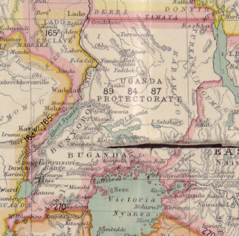
English: A clip of a map of Africa made to show detail to the Uganda Protectorate as it would appear in 1906, this map was made by Hertslet, Edward, Sir, 1824-1902, Brant, R. W. (Richard William), 1852-1934, and Sherwood, H. L. (Harry Leslie), 1863-1946 and published by Harrison and Sons in 1907. |
| 日期 | |
| 来源 | https://www.loc.gov/resource/g8200m.gct00004/?st=single&r=0.533,0.484,0.157,0.096,0 |
| 作者 |
Hertslet, Edward, Sir, 1824-1902. Brant, R. W. (Richard William), 1852-1934. Sherwood, H. L. (Harry Leslie), 1863-1946. |
许可协议
[编辑]
|
公有领域作品必须在美国以及来源国没有版权问题,才能上传至维基共享资源。如果此作品不是美国作品,这个文件必须要有一个额外的版权标记显示此文件在来源国的版权状态。
注意:此标签不应用于录音作品。 |
文件历史
点击某个日期/时间查看对应时刻的文件。
| 日期/时间 | 缩略图 | 大小 | 用户 | 备注 | |
|---|---|---|---|---|---|
| 当前 | 2023年1月21日 (六) 16:37 | | 827 × 817(121 KB) | Fidodog14(留言 | 贡献) | Uploaded a work by Hertslet, Edward, Sir, 1824-1902. Brant, R. W. (Richard William), 1852-1934. Sherwood, H. L. (Harry Leslie), 1863-1946. from https://www.loc.gov/resource/g8200m.gct00004/?st=single&r=0.533,0.484,0.157,0.096,0 with UploadWizard |
您不可以覆盖此文件。
文件用途
没有页面使用本文件。
全域文件用途
以下其他wiki使用此文件:
- en.wikipedia.org上的用途
- fi.wikipedia.org上的用途
- zh.wikipedia.org上的用途