File:Map of Utah highlighting Duchesne County.svg
Salta a la navegació
Salta a la cerca

Mida d'aquesta previsualització PNG del fitxer SVG: 480 × 599 píxels. Altres resolucions: 192 × 240 píxels | 384 × 480 píxels | 615 × 768 píxels | 820 × 1.024 píxels | 1.640 × 2.048 píxels | 4.457 × 5.566 píxels.
Fitxer original (fitxer SVG, nominalment 4.457 × 5.566 píxels, mida del fitxer: 56 Ko)
Llegendes
Llegendes
Afegeix una explicació d'una línia del que representa aquest fitxer
Resum[modifica]
| Descripció |
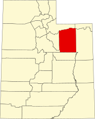
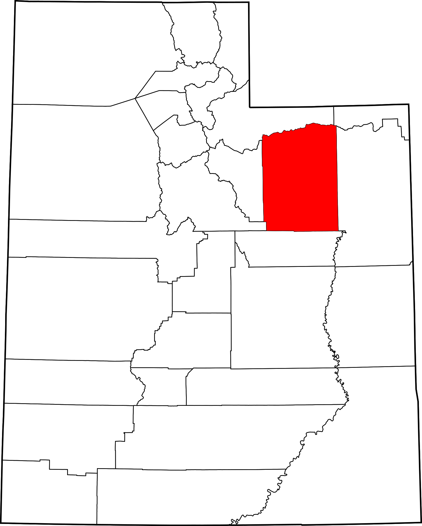
English: This is a locator map showing Duchesne County in Utah. For more information, see Commons:United States county locator maps. |
| Data | |
| Font |
Treball propi: English: The maps use data from nationalatlas.gov, specifically countyp020.tar.gz on the Raw Data Download page. The maps also use state outline data from statesp020.tar.gz. The Florida maps use hydrogm020.tar.gz to display Lake Okeechobee. |
| Autor | David Benbennick |
Llicència[modifica]
| Jo, el titular del copyright d'aquesta obra, l'allibero al domini públic. Això s'aplica a tot el món. En alguns països això pot no ser legalment possible, en tal cas: Jo faig concessió a tothom del dret d'usar aquesta obra per a qualsevol propòsit, sense cap condició llevat d'aquelles requerides per la llei. |
Historial del fitxer
Cliqueu una data/hora per veure el fitxer tal com era aleshores.
| Data/hora | Miniatura | Dimensions | Usuari/a | Comentari | |
|---|---|---|---|---|---|
| actual | 17:34, 12 feb 2006 | | 4.457 × 5.566 (56 Ko) | David Benbennick (discussió | contribucions) | {{subst:User:Dbenbenn/clm|county=Duchesne County|state=Utah|type=county}} |
No podeu sobreescriure aquest fitxer.
Ús del fitxer
Les 7 pàgines següents utilitzen aquest fitxer:
- Category:Duchesne County, Utah
- Category:Duchesne County, Utah Image by Chris Light
- Category:Education in Duchesne County, Utah
- Category:Geography of Duchesne County, Utah
- Category:Maps of Duchesne County, Utah
- Category:Populated places in Duchesne County, Utah
- Category:Transport in Duchesne County, Utah
Ús global del fitxer
Utilització d'aquest fitxer en altres wikis:
- Utilització a ar.wikipedia.org
- Utilització a be.wikipedia.org
- Utilització a bg.wikipedia.org
- Utilització a bpy.wikipedia.org
- Utilització a ca.wikipedia.org
- Utilització a cdo.wikipedia.org
- Utilització a ceb.wikipedia.org
- Utilització a cs.wikipedia.org
- Utilització a cy.wikipedia.org
- Utilització a de.wikipedia.org
- Utilització a diq.wikipedia.org
- Utilització a en.wikipedia.org
- Duchesne County, Utah
- List of counties in Utah
- Altamont, Utah
- Duchesne, Utah
- Myton, Utah
- Neola, Utah
- Roosevelt, Utah
- Tabiona, Utah
- Uintah and Ouray Indian Reservation
- Template:Duchesne County, Utah
- Harper, Utah
- Talmage, Utah
- Altonah, Utah
- Bluebell, Utah
- Fruitland, Utah
- Hanna, Utah
- Mountain Home, Utah
- User:Nyttend/County templates/UT
- Fred Hayes State Park at Starvation
- Strawberry, Utah
- National Register of Historic Places listings in Duchesne County, Utah
Vegeu més usos globals d'aquest fitxer.