File:Map of Virginia highlighting Frederick County.svg
Jump to navigation
Jump to search

Size of this PNG preview of this SVG file: 800 × 347 piksel. Klerderyow erel: 320 × 139 piksel | 640 × 278 piksel | 1,024 × 444 piksel | 1,280 × 555 piksel | 2,560 × 1,110 piksel | 7,486 × 3,247 piksel.
Restren wreydhek (Restren SVG, 7,486 × 3,247 piksel yn hanow, myns an restren: 223 KB)
Captions
Captions
Add a one-line explanation of what this file represents
Berrskrif[golegi]
| Deskrifans |
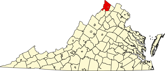
English: This is a locator map showing Frederick County in Virginia. For more information, see Commons:United States county locator maps. |
| Dedhyans | |
| Pennfenten |
Ober honan: English: The maps use data from nationalatlas.gov, specifically countyp020.tar.gz on the Raw Data Download page. The maps also use state outline data from statesp020.tar.gz. The Florida maps use hydrogm020.tar.gz to display Lake Okeechobee. |
| Awtour | David Benbennick |
| SVG genesis |
Leshyans[golegi]
| I, the copyright holder of this work, release this work into the public domain. This applies worldwide. In some countries this may not be legally possible; if so: I grant anyone the right to use this work for any purpose, without any conditions, unless such conditions are required by law. |
derivative works[golegi]
Derivative works of this file: Virginia Frederick Stephens City.png
Istori an restren
Klyckyewgh war dhedhyans/eur rag gweles an folen dell o an termyn na.
| Dedhyans/Eur | Skeusennik | Mynsow | Devnydhyer | Kampol | |
|---|---|---|---|---|---|
| a-lemmyn | 17:45, 12 Hwevrer 2006 | | 7,486 × 3,247 (223 KB) | David Benbennick (keskows | kevrohow) | {{subst:User:Dbenbenn/clm|county=Frederick County|state=Virginia|type=county}} |
Ny yllowgh gorskrifa an restren ma.
Devnydh an restren
Yma an 8 folen a syw owth usya an restren ma:
- File:Virginia Frederick Stephens City.png
- Category:Births in Frederick County, Virginia
- Category:Deaths in Frederick County, Virginia
- Category:Frederick County, Virginia
- Category:Maps of Frederick County, Virginia
- Category:People of Frederick County, Virginia
- Category:Populated places in Frederick County, Virginia
- Category:Towns in Frederick County, Virginia
Devnydh ollvysel an restren
Yma an wikis erel a syw ow tevnydhya an restren ma:
- Devnydh war ar.wikipedia.org
- Devnydh war bg.wikipedia.org
- Devnydh war bpy.wikipedia.org
- Devnydh war cdo.wikipedia.org
- Devnydh war ceb.wikipedia.org
- Devnydh war ce.wikipedia.org
- Devnydh war cy.wikipedia.org
- Devnydh war de.wikipedia.org
- Devnydh war en.wikipedia.org
- Frederick County, Virginia
- List of cities and counties in Virginia
- Winchester, Virginia
- Middletown, Virginia
- Stephens City, Virginia
- Category:Frederick County, Virginia
- Clear Brook, Virginia
- Rock Enon Springs, Virginia
- Gore, Virginia
- Round Hill, Frederick County, Virginia
- Hayfield, Frederick County, Virginia
- Gainesboro, Virginia
- Cacapon Mountain
- White Hall, Frederick County, Virginia
- Green Spring, Frederick County, Virginia
- Shockeysville, Virginia
- Bartonsville, Virginia
- Reynolds Store, Virginia
- Whitacre, Virginia
- Opequon, Virginia
- Star Tannery, Virginia
- Indian Hollow, Virginia
- De Haven, Virginia
- Jordan Springs, Virginia
- Template:Frederick County, Virginia
- Albin, Virginia
- Armel, Virginia
- Brucetown, Virginia
- Gravel Springs, Virginia
- Burnt Factory, Virginia
- Cedar Grove, Frederick County, Virginia
- Cedar Hill, Frederick County, Virginia
- Cross Junction, Virginia
- Kernstown, Virginia
- Kline's Mill, Virginia
- Leetown, Virginia
- Marlboro, Virginia
Gweles devnydh ollvysel moy a'n restren ma.