File:Map of Virginia highlighting Richmond City.svg
跳至導覽
跳至搜尋

此 SVG 檔案的 PNG 預覽的大小:800 × 347 像素。 其他解析度:320 × 139 像素 | 640 × 278 像素 | 1,024 × 444 像素 | 1,280 × 555 像素 | 2,560 × 1,110 像素 | 7,486 × 3,247 像素。
原始檔案 (SVG 檔案,表面大小:7,486 × 3,247 像素,檔案大小:232 KB)
說明
說明
添加單行說明來描述出檔案所代表的內容
摘要
[編輯]
| 描述 |
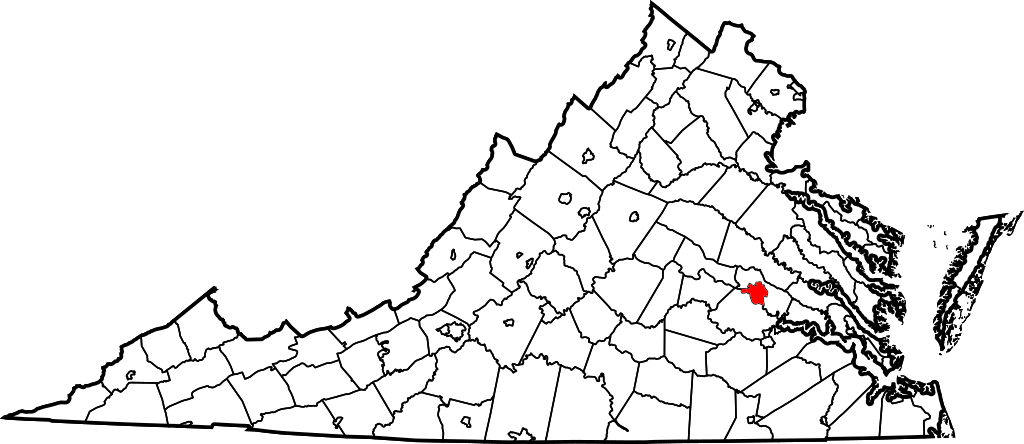
English: This is a locator map showing Richmond in Virginia. For more information, see Commons:United States county locator maps. |
| 日期 | |
| 來源 |
自己的作品: English: The maps use data from nationalatlas.gov, specifically countyp020.tar.gz on the Raw Data Download page. The maps also use state outline data from statesp020.tar.gz. The Florida maps use hydrogm020.tar.gz to display Lake Okeechobee. |
| 作者 | David Benbennick |
授權條款
[編輯]
| 我,此作品的版權所有人,釋出此作品至公共領域。此授權條款在全世界均適用。 這可能在某些國家不合法,如果是的話: 我授予任何人有權利使用此作品於任何用途,除受法律約束外,不受任何限制。 |
檔案歷史
點選日期/時間以檢視該時間的檔案版本。
| 日期/時間 | 縮圖 | 尺寸 | 使用者 | 備註 | |
|---|---|---|---|---|---|
| 目前 | 2022年3月21日 (一) 02:15 | | 7,486 × 3,247(232 KB) | Enjoymoreradio(留言 | 貢獻) | Corrected highlighted jurisdiction. Had been Richmond County, not the City of Richmond |
| 2006年2月12日 (日) 17:55 |  | 7,486 × 3,247(223 KB) | David Benbennick(留言 | 貢獻) | {{subst:User:Dbenbenn/clm|county=Richmond City|state=Virginia|type=city}} |
無法覆蓋此檔案。
檔案用途
沒有使用此檔案的頁面。
全域檔案使用狀況
以下其他 wiki 使用了這個檔案:
- af.wikipedia.org 的使用狀況
- br.wikipedia.org 的使用狀況
- en.wikipedia.org 的使用狀況
- List of cities and counties in Virginia
- National Register of Historic Places listings in Richmond, Virginia
- Exchange Hotel (Richmond, Virginia)
- Template:RichmondCityVA-geo-stub
- User:LBourne/Scratch pad
- Brookbury, Virginia
- Cherry Gardens, Virginia
- Chestnut Hill, Richmond, Virginia
- Clopton, Richmond, Virginia
- Dorchester, Virginia
- Fairway Acres, Virginia
- Huguenot Farms, Virginia
- Rio Vista, Virginia
- South Garden, Richmond, Virginia
- South Richmond, Richmond, Virginia
- Southampton, Richmond, Virginia
- Westover Gardens, Virginia
- Woodland Park, Richmond, Virginia
- Powhite Park
- Upper Shockoe Valley
- Pine Camp, Richmond, Virginia
- Washington Park, Richmond
- Chamberlayne Industrial Center
- Carver, Richmond, Virginia
- Gilpin, Richmond, Virginia
- Green Park, Richmond, Virginia
- Jahnke, Richmond, Virginia
- Three Chopt
- Carillon, Richmond, Virginia
- Old Town Manchester
- Lockgreen
- Central Office District
- Randolph, Richmond, Virginia
- Texas Beach
- User:Nyttend/Virginia NRHP/City of Richmond
- Wikipedia:Village pump (technical)/Archive 154
- Wikipedia:Graphics Lab/Map workshop/Archive/Mar 2020
- Colonial Place, Richmond
- et.wikipedia.org 的使用狀況
- fa.wikipedia.org 的使用狀況
- fi.wikipedia.org 的使用狀況
- fo.wikipedia.org 的使用狀況
- fr.wikipedia.org 的使用狀況
- fy.wikipedia.org 的使用狀況
- gd.wikipedia.org 的使用狀況
- he.wikipedia.org 的使用狀況
- hr.wikipedia.org 的使用狀況
- id.wikipedia.org 的使用狀況
檢視此檔案的更多全域使用狀況。