File:Map of the Sea People invasions in the Aegean Sea and Eastern Mediterranean at the end of the Late Bronze Age.jpg
跳转到导航
跳转到搜索

本预览的尺寸:800 × 572像素。 其他分辨率:320 × 229像素 | 640 × 458像素 | 1,024 × 733像素 | 1,280 × 916像素 | 2,067 × 1,479像素。
原始文件 (2,067 × 1,479像素,文件大小:801 KB,MIME类型:image/jpeg)
说明
说明
添加一行文字以描述该文件所表现的内容
Kursiver Text==摘要==
| 描述 |
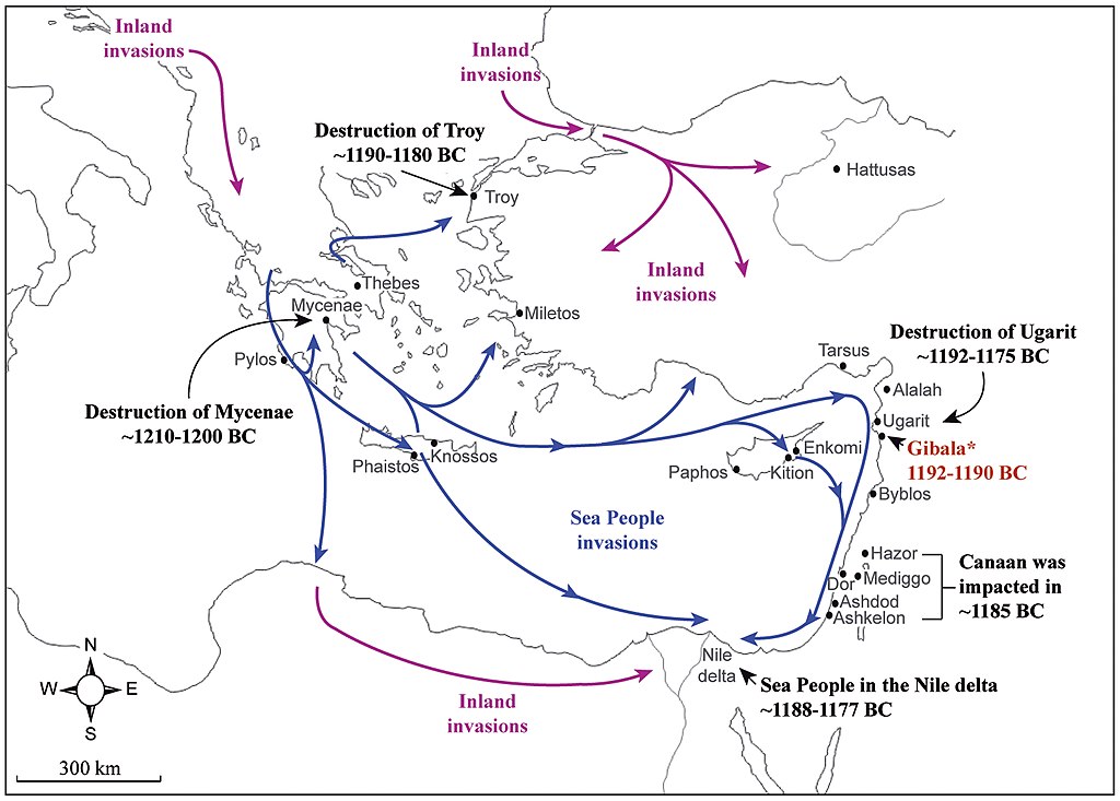
English: Map of the Sea People invasions in the Aegean Sea and Eastern Mediterranean at the end of the Late Bronze Age |
| 日期 | |
| 来源 |
The Sea Peoples, from Cuneiform Tablets to Carbon Dating |
| 作者 | David Kaniewski, Elise Van Campo, Karel Van Lerberghe, Tom Boiy, Klaas Vansteenhuyse, Greta Jans, Karin Nys, Harvey Weiss |
许可协议
[编辑]
文件历史
点击某个日期/时间查看对应时刻的文件。
| 日期/时间 | 缩略图 | 大小 | 用户 | 备注 | |
|---|---|---|---|---|---|
| 当前 | 2019年5月11日 (六) 08:01 | | 2,067 × 1,479(801 KB) | पाटलिपुत्र(留言 | 贡献) | User created page with UploadWizard |
您不可以覆盖此文件。
文件用途
没有页面使用本文件。
全域文件用途
以下其他wiki使用此文件:
- ar.wikipedia.org上的用途
- cs.wikipedia.org上的用途
- de.wikipedia.org上的用途
- en.wikipedia.org上的用途
- fr.wikipedia.org上的用途
- he.wikipedia.org上的用途
- id.wikipedia.org上的用途
- it.wikipedia.org上的用途
- ru.wikipedia.org上的用途
- zh.wikipedia.org上的用途