File:Map of the Western Coast of Taiwan, Tayouan and Points North, c. 1636.jpg
跳至導覽
跳至搜尋
預覽大小:800 × 529 像素。 其他解析度:320 × 212 像素 | 640 × 423 像素 | 1,000 × 661 像素。
原始檔案 (1,000 × 661 像素,檔案大小:265 KB,MIME 類型:image/jpeg)
說明
說明
添加單行說明來描述出檔案所代表的內容
摘要
[編輯]
| 描述 |
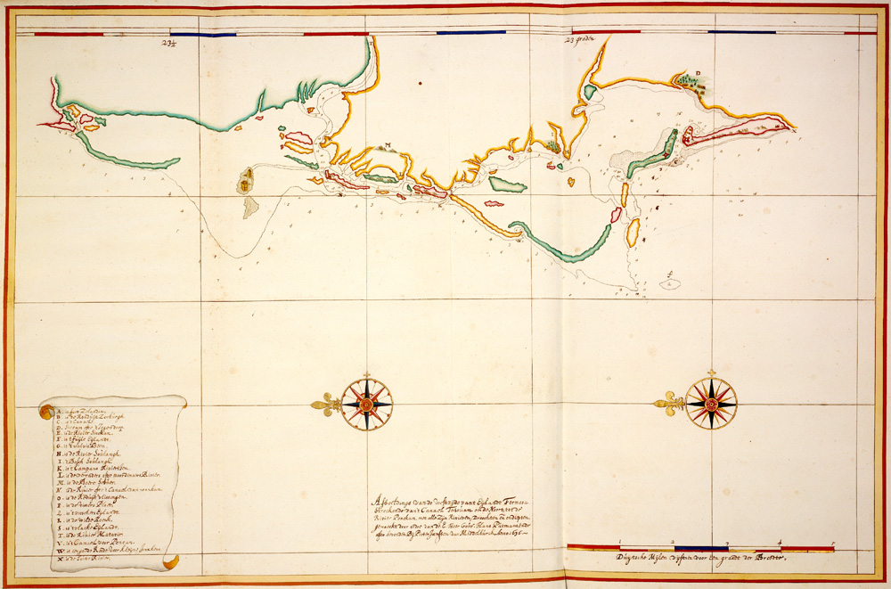
English: This detailed navigation chart shows the coastline of Taiwan from the Bay of Tayouan northward (left is north). Used by permission of the Austrian National Library (finding aid: Atlas Van der Hem, V. XLI, sheet 4-2). |
| 日期 | |
| 來源 | Austrian National Library, Atlas Van der Hem, V. XLI, sheet 4-2 |
| 作者 |
Credit: Pieter Janszoon van Middelburch
授權條款
[編輯]
|
此為如實地拍攝平面藝術品的相片複製本。原作位於公有領域,是因下列原因:
維基媒體基金會的官方立場認為:「針對平面公有領域的藝術作品進行忠實重製,其重製後的照片也屬於公有領域。」
因此,可認定本重製照片屬於公有領域。在其他司法管轄區,再利用此照片可能會被限制;參見再利用PD-Art照片以獲得進一步資訊。 | ||||
檔案歷史
點選日期/時間以檢視該時間的檔案版本。
| 日期/時間 | 縮圖 | 尺寸 | 用戶 | 備註 | |
|---|---|---|---|---|---|
| 目前 | 2014年5月7日 (三) 13:24 | | 1,000 × 661(265 KB) | Hst0129(對話 | 貢獻) | User created page with UploadWizard |
無法覆蓋此檔案。
檔案用途
沒有使用此檔案的頁面。