File:Map showing Doolittle Raid targets and landing fields.jpg
跳转到导航
跳转到搜索

本预览的尺寸:763 × 599像素。 其他分辨率:306 × 240像素 | 611 × 480像素 | 978 × 768像素 | 1,280 × 1,006像素 | 1,800 × 1,414像素。
原始文件 (1,800 × 1,414像素,文件大小:782 KB,MIME类型:image/jpeg)
说明
说明
添加一行文字以描述该文件所表现的内容
地圖顯示空襲目標和著陸場
摘要
[编辑]
| 描述 |
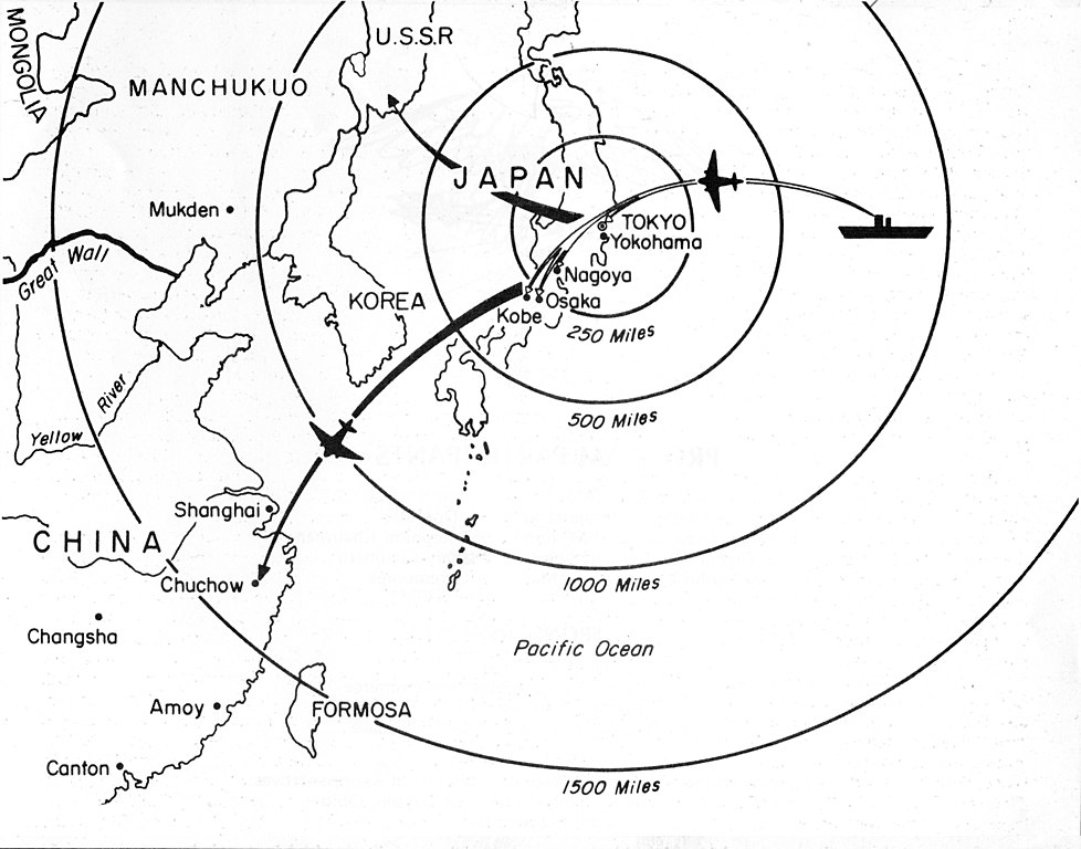
English: Map showing Doolittle Raid targets and landing fields. Doolittle Raid was an air raid by bombers from an American carrier on Tokyo and other places in Japan on 18 April 1942 , four months after Japanese Attack on Pearl Harbor. |
| 日期 | |
| 来源 | https://www.nationalmuseum.af.mil/Upcoming/Photos/igphoto/2000484315/ |
| 作者 | 匿名 |
许可协议
[编辑]
此作品在美国属于公有领域,因为其是由美国政府的官员或雇员,基于其个人公务目的制作的作品,参考美国法典第17篇第1章第105条。
注意︰本模板仅适用于美国联邦政府的原创作品,不适用于任何美国州、属地、联邦个体、县、市或任何次级政府的作品。本模板也不适用于1978年以后由美国邮政署出版的邮票图案(参看美国版权局实践纲领第313.6(C)(1)条)。也不适用于部分美国硬币;参看美国铸币局使用条款。 |
 | |
| 本文件已被确认为免除已知的著作权法限制(包括所有相关权利)。 | ||
文件历史
点击某个日期/时间查看对应时刻的文件。
| 日期/时间 | 缩略图 | 大小 | 用户 | 备注 | |
|---|---|---|---|---|---|
| 当前 | 2021年5月31日 (一) 23:46 | | 1,800 × 1,414(782 KB) | Happyseeu(留言 | 贡献) | Uploaded a work by {{anonymous}} from https://www.nationalmuseum.af.mil/Upcoming/Photos/igphoto/2000484315/ with UploadWizard |
您不可以覆盖此文件。
文件用途
全域文件用途
以下其他wiki使用此文件:
- en.wikipedia.org上的用途
- es.wikipedia.org上的用途
- zh.wikipedia.org上的用途