File:Map showing the Départements of Algeria from 1962-1968 and 1968-1974.svg
跳至導覽
跳至搜尋

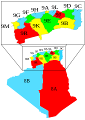
此 SVG 檔案的 PNG 預覽的大小:424 × 600 像素。 其他解析度:170 × 240 像素 | 339 × 480 像素 | 543 × 768 像素 | 724 × 1,024 像素 | 1,448 × 2,048 像素 | 744 × 1,052 像素。
原始檔案 (SVG 檔案,表面大小:744 × 1,052 像素,檔案大小:77 KB)
說明
說明
添加單行說明來描述出檔案所代表的內容
摘要
[編輯]
| 描述 |
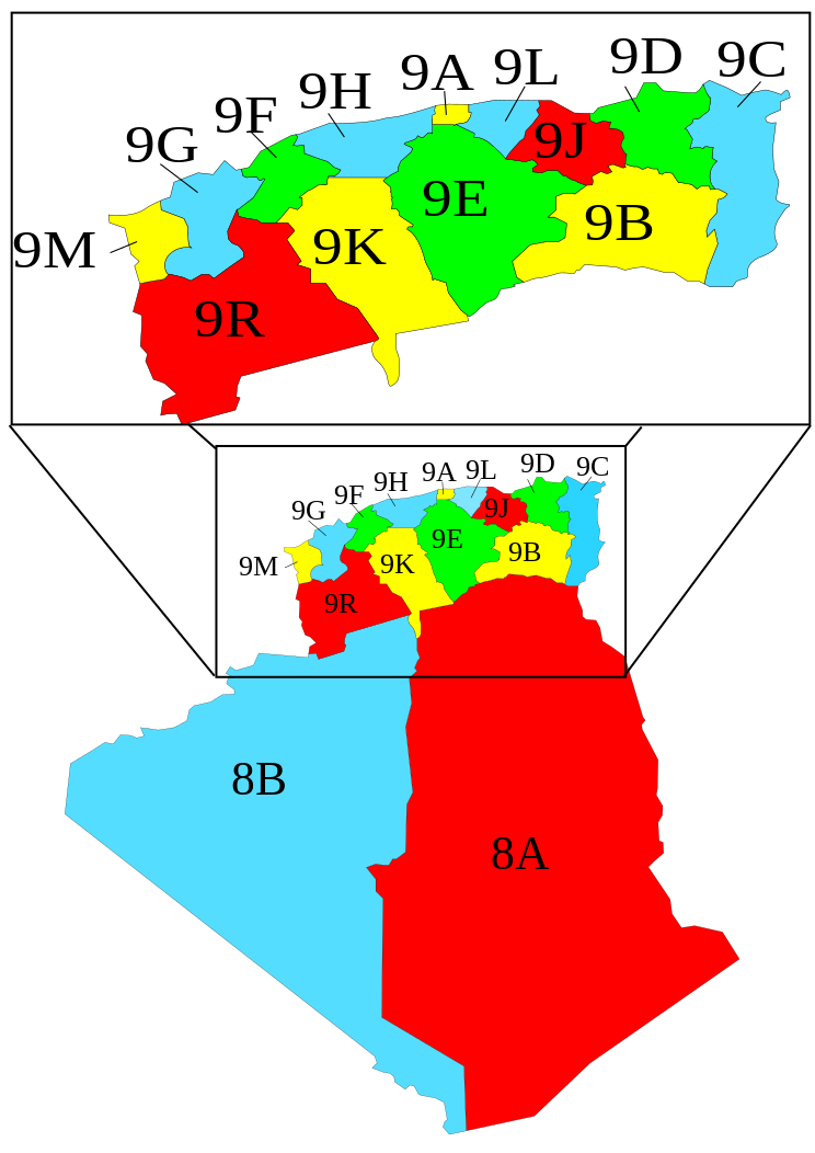
English: A map showing the Départements of Algeria from 1962-1968 and 1968-1974 when they where called "provinces".
Français : Carte des départements français d'Algérie (1957-1962), devenus les départements algériens (1962-1968), renommés wilayas en 1968. |
| 日期 | |
| 來源 | Image:Algeria_elections_91_by_province.svg by Chabacano |
| 作者 | Escondites |
Légende
[編輯]
- 8A : Département des Oasis
- 8B : Département de la Saoura
- 9A : Département d'Alger
- 9B : Département de Batna
- 9C : Département de Bône
- 9D : Département de Constantine
- 9E : Département de Médéa
- 9F : Département de Mostaganem
- 9G : Département d'Oran
- 9H : Département d'Orléansville
- 9J : Département de Sétif
- 9K : Département de Tiaret
- 9L : Département de Tizi-Ouzou
- 9M : Département de Tlemcen
- 9R : Département de Saïda
授權條款
[編輯]
Mustafaa at the English Wikipedia,此作品的版權所有人,決定用以下授權條款發佈本作品:

|
已授權您依據自由軟體基金會發行的無固定段落、封面文字和封底文字GNU自由文件授權條款1.2版或任意後續版本,對本檔進行複製、傳播和/或修改。該協議的副本列在GNU自由文件授權條款中。 |
| 此檔案採用共享創意 姓名標示-相同方式分享 3.0 未在地化版本授權條款。 | ||
| 姓名標示: Mustafaa at the English Wikipedia | ||
| ||
| 已新增授權條款標題至此檔案,作為GFDL授權更新的一部份。 |
檔案歷史
點選日期/時間以檢視該時間的檔案版本。
| 日期/時間 | 縮圖 | 尺寸 | 用戶 | 備註 | |
|---|---|---|---|---|---|
| 目前 | 2007年11月7日 (三) 11:02 | | 744 × 1,052(77 KB) | Escondites(對話 | 貢獻) | == Summary == {{Information |Description= A map showing the Départements, Algeria from 1962-1968 and 1968-1974 when they where called "provinces". |Source= Image:Algeria_elections_91_by_province.svg by {{u|Ch |
無法覆蓋此檔案。
檔案用途
下列3個頁面有用到此檔案:
全域檔案使用狀況
以下其他 wiki 使用了這個檔案:
- ar.wikipedia.org 的使用狀況
- ast.wikipedia.org 的使用狀況
- ca.wikipedia.org 的使用狀況
- de.wikipedia.org 的使用狀況
- el.wikipedia.org 的使用狀況
- en.wikipedia.org 的使用狀況
- es.wikipedia.org 的使用狀況
- et.wikipedia.org 的使用狀況
- fa.wikipedia.org 的使用狀況
- fi.wikipedia.org 的使用狀況
- fr.wikipedia.org 的使用狀況
- hu.wikipedia.org 的使用狀況
- it.wikipedia.org 的使用狀況
- ja.wikipedia.org 的使用狀況
- ps.wikipedia.org 的使用狀況
- pt.wikipedia.org 的使用狀況
- sco.wikipedia.org 的使用狀況
- vi.wikipedia.org 的使用狀況
- zh.wikipedia.org 的使用狀況