File:March of Lusatia locator map (1004).svg
ナビゲーションに移動
検索に移動

この SVG ファイルのこの PNG プレビューのサイズ: 465 × 599 ピクセル. その他の解像度: 186 × 240 ピクセル | 373 × 480 ピクセル | 596 × 768 ピクセル | 795 × 1,024 ピクセル | 1,590 × 2,048 ピクセル | 1,390 × 1,790 ピクセル。
元のファイル (SVG ファイル、1,390 × 1,790 ピクセル、ファイルサイズ: 2.47メガバイト)
キャプション
キャプション
このファイルの内容を1行で記述してください
概要[編集]
| 解説 |
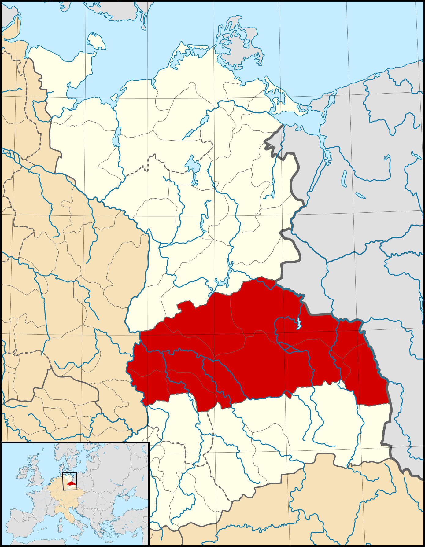
English: A map of the March of Lusatia (German: Mark Lausitz) around 1004 CE.
The map is derived from a vectorised version of one found in Professor G. Droysens Allgemeiner Historischer Handatlas, which was published in 1886 by R. Andrée Plate, and is now in the public domain. Note that while it uses the same scheme as standard location/locator maps, this map technically does not conform to the standard, as it is not in equirectangular projection. Therefore grid lines for latitude and longitude are included on the map. |
| 日付 | |
| 原典 |
Main map file: own work Data: Droysens-22-23.jpg Sub-map file: Blank map of Europe 1004.svg own work (by Alphathon), which is a derivative work of Blank map of Europe.svg by maix¿? et al. |
| 作者 | Alphathon /ˈæɫfə.θɒn/ (talk) |
| その他のバージョン |
|
.svg)
.svg)
.svg)
.svg)
.svg)

.svg)
.svg)
.svg&action=edit§ion=1)
ライセンス[編集]
.svg&action=edit§ion=2)
このファイルはクリエイティブ・コモンズ 表示-継承 4.0 国際ライセンスのもとに利用を許諾されています。
- あなたは以下の条件に従う場合に限り、自由に
- 共有 – 本作品を複製、頒布、展示、実演できます。
- 再構成 – 二次的著作物を作成できます。
- あなたの従うべき条件は以下の通りです。
- 表示 – あなたは適切なクレジットを表示し、ライセンスへのリンクを提供し、変更があったらその旨を示さなければなりません。これらは合理的であればどのような方法で行っても構いませんが、許諾者があなたやあなたの利用行為を支持していると示唆するような方法は除きます。
- 継承 – もしあなたがこの作品をリミックスしたり、改変したり、加工した場合には、あなたはあなたの貢献部分を元の作品とこれと同一または互換性があるライセンスの下に頒布しなければなりません。
ファイルの履歴
過去の版のファイルを表示するには、その版の日時をクリックしてください。
| 日付と時刻 | サムネイル | 寸法 | 利用者 | コメント | |
|---|---|---|---|---|---|
| 現在の版 | 2016年12月10日 (土) 17:37 | | 1,390 × 1,790 (2.47メガバイト) | Alphathon (トーク | 投稿記録) | == {{int:filedesc}} == {{Inkscape}} {{Information |Description={{en|A map of the en:March of Lusatia (German: ''Mark Lausitz'') around 1004 CE. The map is derived from a vectorised version of one found in Professor G. Droysens Allgemeine... |
このファイルは上書きできません。
ファイルの使用状況
以下の 6 ページがこのファイルを使用しています:
グローバルなファイル使用状況
以下に挙げる他のウィキがこの画像を使っています:
- cs.wikipedia.org での使用状況
- en.wikipedia.org での使用状況
- es.wikipedia.org での使用状況
- et.wikipedia.org での使用状況
- fr.wikipedia.org での使用状況
- it.wikipedia.org での使用状況
- ja.wikipedia.org での使用状況
- ru.wikipedia.org での使用状況
- uk.wikipedia.org での使用状況
- www.wikidata.org での使用状況
.svg&oldid=478535628)