File:Maug caldera bathymetry.jpg
Aller à la navigation
Aller à la recherche

Taille de cet aperçu : 800 × 487 pixels. Autres résolutions : 320 × 195 pixels | 640 × 390 pixels | 1 024 × 624 pixels | 1 280 × 780 pixels | 2 560 × 1 560 pixels | 3 693 × 2 250 pixels.
Fichier d’origine (3 693 × 2 250 pixels, taille du fichier : 673 kio, type MIME : image/jpeg)
Légendes
Légendes
Ajoutez en une ligne la description de ce que représente ce fichier
Description
[modifier]
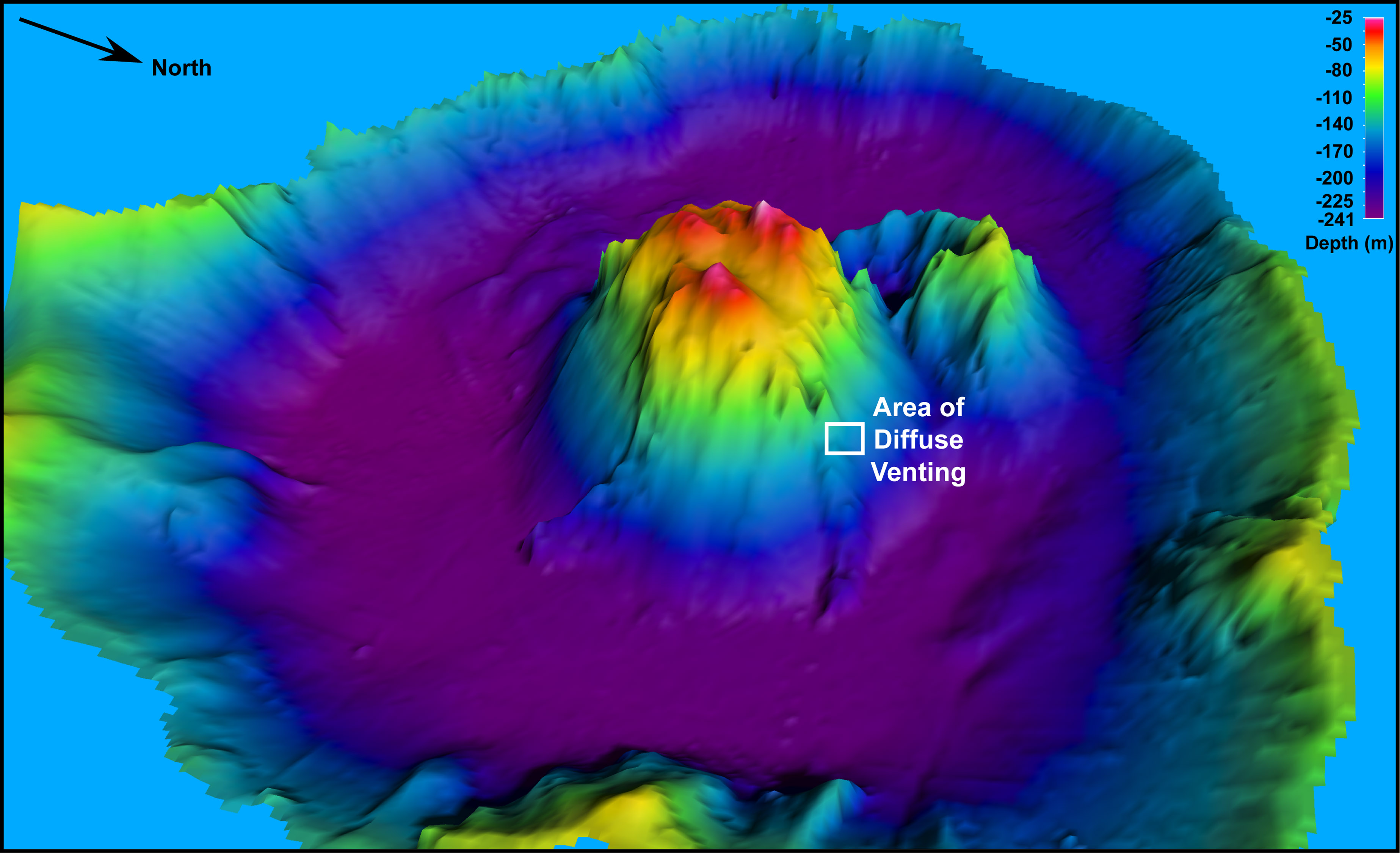
| Description | 3-D perspective view of the bathymetry within Maug caldera. |
| Date | |
| Source | Image and its description. |
| Auteur | NOAA |
| Autorisation (Réutilisation de ce fichier) |
Public domain - original work of NOAA |
Conditions d’utilisation
[modifier]
Cette image est dans le domaine public car son contenu provient de la
National Oceanic and Atmospheric Administration , réalisé par un employé dans le cadre de ses activités professionnelles.
|
Historique du fichier
Cliquer sur une date et heure pour voir le fichier tel qu'il était à ce moment-là.
| Date et heure | Vignette | Dimensions | Utilisateur | Commentaire | |
|---|---|---|---|---|---|
| actuel | 9 janvier 2008 à 12:39 | | 3 693 × 2 250 (673 kio) | Avenue (d | contributions) | {{Information| |Description=3-D perspective view of the bathymetry within Maug caldera. |Source=[http://oceanexplorer.noaa.gov/explorations/04fire/logs/hirez/maug_hirez.jpg Image] and its [http://oceanexplorer.noaa.gov/explorations/04fire/logs/april09/med |
Vous ne pouvez pas remplacer ce fichier.
Utilisations locales du fichier
La page suivante utilise ce fichier :
Utilisations du fichier sur d’autres wikis
Les autres wikis suivants utilisent ce fichier :
- Utilisation sur de.wikipedia.org
- Utilisation sur en.wikipedia.org
- Utilisation sur fa.wikipedia.org
- Utilisation sur fr.wikipedia.org
- Utilisation sur sk.wikipedia.org
- Utilisation sur vi.wikipedia.org
- Utilisation sur www.wikidata.org
Métadonnées
Catégories :
- Maug Islands
- Maps of the Northern Mariana Islands
- Bathymetric maps
- Stratovolcanoes
- Bathymetric maps of volcanoes
- Maps of submarine volcanoes in the Pacific Ocean
- Maps of calderas
- Partially submerged calderas
- Partially submarine volcanoes in the United States
- Bathymetric maps of the Pacific Ocean
- Submarine calderas in the Pacific Ocean