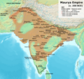
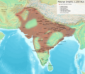
File:Maurya Empire, c.250 BCE.png

原始檔案 (1,200 × 1,121 像素,檔案大小:2.3 MB,MIME 類型:image/png)
說明
說明
摘要
| 描述Maurya Empire, c.250 BCE.png |
This is based on the map provided on p. 69 of Kulke, H.; Rothermund, D. (2004), A History of India, 4th, Routledge, ISBN 978-0-415-32920-0.
|
| 日期 | |
| 來源 | 自己的作品 |
| 作者 | Avantiputra7 |
授權條款
- 您可以自由:
- 分享 – 複製、發佈和傳播本作品
- 重新修改 – 創作演繹作品
- 惟需遵照下列條件:
- 姓名標示 – 您必須指名出正確的製作者,和提供授權條款的連結,以及表示是否有對內容上做出變更。您可以用任何合理的方式來行動,但不得以任何方式表明授權條款是對您許可或是由您所使用。
- 相同方式分享 – 如果您利用本素材進行再混合、轉換或創作,您必須基於如同原先的相同或兼容的條款,來分布您的貢獻成品。
檔案歷史
點選日期/時間以檢視該時間的檔案版本。
| 日期/時間 | 縮圖 | 尺寸 | 用戶 | 備註 | |
|---|---|---|---|---|---|
| 目前 | 2024年1月29日 (一) 02:15 |  | 1,200 × 1,121(2.3 MB) | Avantiputra7(對話 | 貢獻) | as per discussions added labelling of provinces |
| 2023年11月22日 (三) 06:40 |  | 1,200 × 1,121(2.06 MB) | Avantiputra7(對話 | 貢獻) | Reverted to version as of 05:59, 22 November 2023 (UTC) no justification for changing to less legible version of exactly the same map | |
| 2023年11月22日 (三) 06:14 |  | 1,500 × 1,309(2.93 MB) | Indo12122(對話 | 貢獻) | Reverted to version as of 05:34, 22 November 2023 (UTC) Stop hijacking. | |
| 2023年11月22日 (三) 05:59 |  | 1,200 × 1,121(2.06 MB) | Avantiputra7(對話 | 貢獻) | Reverted to version as of 05:06, 22 November 2023 (UTC) | |
| 2023年11月22日 (三) 05:34 |  | 1,500 × 1,309(2.93 MB) | Indo12122(對話 | 貢獻) | Reverted to version as of 19:00, 21 November 2023 (UTC) | |
| 2023年11月22日 (三) 05:06 |  | 1,200 × 1,121(2.06 MB) | Avantiputra7(對話 | 貢獻) | Reverted to version as of 18:13, 21 November 2023 (UTC) rv vandalism | |
| 2023年11月21日 (二) 19:00 |  | 1,500 × 1,309(2.93 MB) | Indo12122(對話 | 貢獻) | Reverted to version as of 17:53, 21 November 2023 (UTC) Adding Gedrosia .Ray, Himanshu Prabha (2003). The Archaeology of Seafaring in Ancient South Asia. Cambridge University Press. ISBN 978-0-521-01109-9. In spite of the vagueness of the historical texts, the consensus among scholars is that the treaty concluded between Candragupta Maurya and Seleucus acknowledged Indian control of territories to the west of the Indus. These included Gedrosia, Paropamisadae (the region of Kabul and Begram) a... | |
| 2023年11月21日 (二) 18:13 |  | 1,200 × 1,121(2.06 MB) | Avantiputra7(對話 | 貢獻) | Reverted to version as of 17:07, 21 November 2023 (UTC) no justification for changing to less legible version of exactly the same map | |
| 2023年11月21日 (二) 17:53 |  | 1,500 × 1,309(2.93 MB) | Indo12122(對話 | 貢獻) | Reverted to version as of 16:58, 21 November 2023 (UTC) | |
| 2023年11月21日 (二) 17:07 |  | 1,200 × 1,121(2.06 MB) | Avantiputra7(對話 | 貢獻) | Reverted to version as of 16:36, 21 November 2023 (UTC) |
無法覆蓋此檔案。
檔案用途
下列7個頁面有用到此檔案:
- User:MdsShakil/Bangladesh/2023 November 21-30
- User:MdsShakil/Bangladesh/2023 October 21-31
- User:MdsShakil/Bangladesh/2023 September 1-10
- User:MdsShakil/Bangladesh/2024 January 21-31
- File:Maurya Empire, c.250 BCE 2.png
- File:Maurya Empire synthetic map 250 BCE.png
- File:Maurya Empire with autonomou and free tribes.png
全域檔案使用狀況
以下其他 wiki 使用了這個檔案:
- bh.wikipedia.org 的使用狀況
- en.wikipedia.org 的使用狀況
- en.wiktionary.org 的使用狀況
- hy.wikipedia.org 的使用狀況
- ko.wikipedia.org 的使用狀況
- si.wikipedia.org 的使用狀況
- sv.wikipedia.org 的使用狀況
- ta.wikipedia.org 的使用狀況
- zh.wikipedia.org 的使用狀況
詮釋資料
此檔案中包含其他資訊,這些資訊可能是由數位相機或掃描器在建立或數位化過程中所新增的。若檔案自原始狀態已被修改,一些詳細資料可能無法完整反映出已修改的檔案。
| 水平解析度 | 28.35 dpc |
|---|---|
| 垂直解析度 | 28.35 dpc |