File:Mexico Governors Map.svg
跳转到导航
跳转到搜索

此SVG文件的PNG预览的大小:800 × 511像素。 其他分辨率:320 × 205像素 | 640 × 409像素 | 1,024 × 654像素 | 1,280 × 818像素 | 2,560 × 1,636像素 | 1,150 × 735像素。
原始文件 (SVG文件,尺寸为1,150 × 735像素,文件大小:238 KB)
说明
说明
添加一行文字以描述该文件所表现的内容
Cambiar el color del estado de México
摘要
[编辑]
| 描述 |
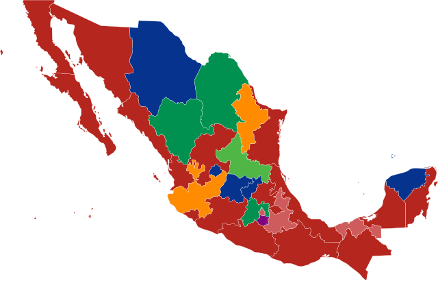
Español: Entidad federativa por partido político de su gobernante:
|
| 日期 | 15 July 2009 (last update: 08 December 2022) |
| 来源 | 自己的作品 |
| 作者 | PuebloUnited |
许可协议
[编辑]
我,本作品著作权人,特此采用以下许可协议发表本作品:
本文件采用知识共享署名 3.0 未本地化版本许可协议授权。
- 您可以自由地:
- 共享 – 复制、发行并传播本作品
- 修改 – 改编作品
- 惟须遵守下列条件:
- 署名 – 您必须对作品进行署名,提供授权条款的链接,并说明是否对原始内容进行了更改。您可以用任何合理的方式来署名,但不得以任何方式表明许可人认可您或您的使用。
文件历史
点击某个日期/时间查看对应时刻的文件。
| 日期/时间 | 缩略图 | 大小 | 用户 | 备注 | |
|---|---|---|---|---|---|
| 当前 | 2023年6月18日 (日) 17:01 | | 1,150 × 735(238 KB) | AntoFran(留言 | 贡献) | Ciudad de México |
| 2022年12月15日 (四) 16:19 |  | 1,150 × 735(238 KB) | AntoFran(留言 | 贡献) | Oaxaca y Puebla | |
| 2022年10月1日 (六) 13:29 |  | 1,150 × 735(238 KB) | AntoFran(留言 | 贡献) | Cambio de gobierno de Tamaulipas y Aguascalientes | |
| 2022年9月25日 (日) 15:04 |  | 1,150 × 735(238 KB) | AntoFran(留言 | 贡献) | Cambio de gobierno en Quintana Roo | |
| 2022年9月15日 (四) 03:00 |  | 1,150 × 735(238 KB) | Alberto0617(留言 | 贡献) | Durango actualizado | |
| 2021年11月3日 (三) 02:14 |  | 1,150 × 736(203 KB) | Malachy(留言 | 贡献) | Reverted to version as of 18:00, 1 November 2021 (UTC) | |
| 2021年11月2日 (二) 01:44 |  | 1,150 × 736(205 KB) | Alberto0617(留言 | 贡献) | Quintana Roo corregido | |
| 2021年11月1日 (一) 18:00 |  | 1,150 × 736(203 KB) | The Sammirs(留言 | 贡献) | ¡Faltó Colima! | |
| 2021年11月1日 (一) 08:51 |  | 1,150 × 736(205 KB) | Alberto0617(留言 | 贡献) | Sinaloa actualizado. | |
| 2021年10月15日 (五) 13:12 |  | 1,150 × 736(203 KB) | The Sammirs(留言 | 贡献) | Hoy asume Evelyn Salgado |
您不可以覆盖此文件。
文件用途
以下20个页面使用本文件:
- Atlas of Mexico
- User:Magog the Ogre/Political maps/2016 April 1-10
- User:Magog the Ogre/Political maps/2016 June 1-10
- User:Magog the Ogre/Political maps/2017 December 11-20
- User:Magog the Ogre/Political maps/2017 October 21-31
- User:Magog the Ogre/Political maps/2018 December 1-10
- User:Magog the Ogre/Political maps/2018 July 11-20
- User:Magog the Ogre/Political maps/2018 October 1-10
- User:Magog the Ogre/Political maps/2019 January 1-10
- User:Magog the Ogre/Political maps/2019 January 21-31
- User:Magog the Ogre/Political maps/2019 June 11-20
- User:Magog the Ogre/Political maps/2019 November 1-10
- User:Magog the Ogre/Political maps/2019 September 1-10
- User:Magog the Ogre/Political maps/2020 July 21-31
- User:Magog the Ogre/Political maps/2021 November 1-10
- User:Magog the Ogre/Political maps/2022 December 11-20
- User:Magog the Ogre/Political maps/2022 October 1-10
- User:Magog the Ogre/Political maps/2022 September 11-20
- User:Magog the Ogre/Political maps/2022 September 21-30
- User:Magog the Ogre/Political maps/2023 June 11-20
全域文件用途
以下其他wiki使用此文件:
- ast.wikipedia.org上的用途
- ca.wikipedia.org上的用途
- it.wikipedia.org上的用途
- ja.wikipedia.org上的用途
- nl.wikipedia.org上的用途
- sr.wikipedia.org上的用途
- zh.wikipedia.org上的用途