File:Montenegro Map.png

Πρωτότυπο αρχείο (2.427 × 1.807 εικονοστοιχεία, μέγεθος αρχείου: 1,03 MB, τύπος MIME: image/png)
Λεζάντες
Λεζάντες
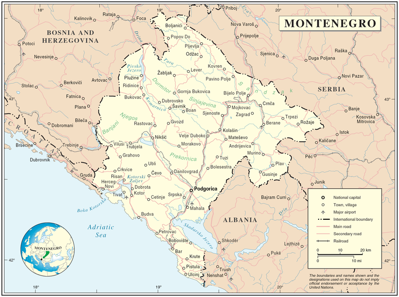
Map of Montenegro
| Περιγραφή | Map of Montenegro | |||
| Ημερομηνία | ||||
| Πηγή | The Cartographic Section of the United Nations (CSUN) | |||
| Δημιουργός | Cartographer of the United Nations | |||
| Άδεια (Επαναχρησιμοποίηση αυτού του αρχείου) |
|

Ιστορικό αρχείου
Πατήστε σε μια ημερομηνία/ώρα για να δείτε το αρχείο όπως εμφανιζόταν εκείνη την χρονική στιγμή.
| Ημερομηνία/Ώρα | Μικρογραφία | Διαστάσεις | Χρήστης | Σχόλιο | |
|---|---|---|---|---|---|
| τρέχον | 17:03, 10 Μαρτίου 2007 | | 2.427 × 1.807 (1,03 MB) | Minestrone (συζήτηση | Συνεισφορά) | Map of Montenegro {{Information |Description=Map of Montenegro |Source=The Cartographic Section of the United Nations (CSUN) |Date=2007-03-10 |Author=Cartographer of the United Nations |Permission={{Template:UN map}} and the cartographer of the UN [ |
Δεν μπορείτε να αντικαταστήσετε αυτό το αρχείο.
Χρήση αρχείου
Δεν υπάρχουν σελίδες που χρησιμοποιούν αυτό το αρχείο.
Καθολική χρήση αρχείου
Τα ακόλουθα άλλα wiki χρησιμοποιούν αυτό το αρχείο:
- Χρήση σε als.wikipedia.org
- Χρήση σε ar.wikipedia.org
- Χρήση σε avk.wikipedia.org
- Χρήση σε be-tarask.wikipedia.org
- Χρήση σε bg.wikipedia.org
- Χρήση σε cs.wikipedia.org
- Χρήση σε cy.wikipedia.org
- Χρήση σε de.wikipedia.org
- Χρήση σε el.wikipedia.org
- Χρήση σε en.wikipedia.org
- Χρήση σε fa.wikipedia.org
- Χρήση σε fr.wikipedia.org
- Χρήση σε gag.wikipedia.org
- Χρήση σε gd.wikipedia.org
- Χρήση σε hr.wiktionary.org
- Χρήση σε ia.wikipedia.org
- Χρήση σε incubator.wikimedia.org
- Χρήση σε io.wikipedia.org
- Χρήση σε ka.wikipedia.org
- Χρήση σε la.wikipedia.org
- Χρήση σε ms.wikipedia.org
- Χρήση σε nl.wikipedia.org
- Χρήση σε pl.wikipedia.org
- Χρήση σε pl.wiktionary.org
- Χρήση σε pnb.wikipedia.org
- Χρήση σε ps.wikipedia.org
- Χρήση σε rm.wikipedia.org
- Χρήση σε roa-tara.wikipedia.org
- Χρήση σε ro.wikipedia.org
- Χρήση σε ro.wikivoyage.org
- Χρήση σε ru.wikipedia.org
Δείτε περισσότερη καθολική χρήση αυτού του αρχείου.