File:Morris Canal Plane 7 West from HABS.tiff
跳至導覽
跳至搜尋

此 TIF 檔案的 JPG 預覽的大小:750 × 599 像素。 其他解析度:300 × 240 像素 | 601 × 480 像素 | 961 × 768 像素 | 1,280 × 1,023 像素 | 2,560 × 2,046 像素 | 5,000 × 3,996 像素。
原始檔案 (5,000 × 3,996 像素,檔案大小:19.06 MB,MIME 類型:image/tiff)
說明
說明
添加單行說明來描述出檔案所代表的內容
| 描述 |
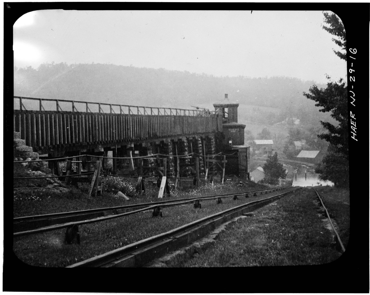
English: Inclined Plane 7 West near Bowerstown, showing flume that carries water to penstock, machinery tower in the middle to control winding machinery. |
||||
| 來源 |
|
||||
| 作者 | Historic American Buildings Survey | ||||
| 授權許可 (重用此檔案) |
|
||||
| 其他版本 |


檔案歷史
點選日期/時間以檢視該時間的檔案版本。
| 日期/時間 | 縮圖 | 尺寸 | 使用者 | 備註 | |
|---|---|---|---|---|---|
| 目前 | 2014年2月19日 (三) 00:57 |  | 5,000 × 3,996(19.06 MB) | Bonnachoven(留言 | 貢獻) | {{Information |Description ={{en|1=Inclined Plane 7 West near Bowerstown, showing flume that carries water to penstock, machinery tower in the middle to control winding machinery.}} |Source =http://www.loc.gov/pictures/item/nj0903.photos.110... |
無法覆蓋此檔案。
檔案用途
全域檔案使用狀況
以下其他 wiki 使用了這個檔案:
- ja.wikipedia.org 的使用狀況
- zh.wikipedia.org 的使用狀況