File:NASA Mando-Koresand.png
Spring til navigation
Spring til søgning
Størrelse af denne forhåndsvisning: 612 × 599 pixels. Andre opløsninger: 245 × 240 pixels | 620 × 607 pixels.
Oprindelig fil (620 × 607 billedpunkter, filstørrelse: 962 KB, MIME-type: image/png)
Captions
Captions
Tilføj en kort forklaring på en enkelt linje om hvad filen viser
Beskrivelse[redigér]
| Beskrivelse |
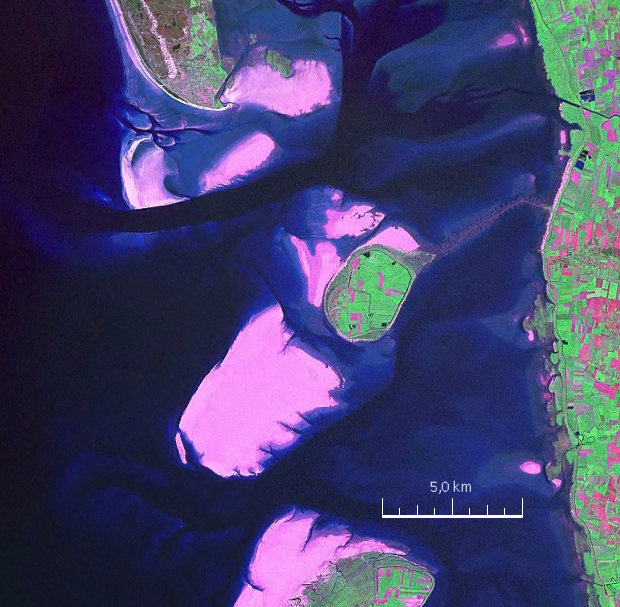
English: Mandø, the Danish Wadden Island, with Koresand close southwest, Fanø to the north, Romø to the south and the Jutland mainland coast to the east |
| Dato | |
| Kilde | NASA World Wind Screen Shot |
| Forfatter | NASA |
Licensering[redigér]
| This image is in the public domain because it is a screenshot from NASA’s globe software World Wind using a public domain layer, such as Blue Marble, MODIS, Landsat, SRTM, USGS or GLOBE.
|
 |
| Annotations | This image is annotated: View the annotations at Commons |
Filhistorik
Klik på en dato/tid for at se filen som den så ud på det tidspunkt.
| Dato/tid | Miniaturebillede | Dimensioner | Bruger | Kommentar | |
|---|---|---|---|---|---|
| nuværende | 19. aug. 2009, 17:57 | | 620 × 607 (962 KB) | Ratzer (diskussion | bidrag) | {{Information |Description={{en|1=Mandø, the Danish Wadden Island, with Koresand close southwest, Fanø to the north, Romø to the south and the Jutland mainland coast to the east}} |Source=NASA World Wind Screen Shot |Author=NASA |Date=2000 |Permission= |
Du kan ikke overskrive denne fil.
Filanvendelse
Der er ingen sider der bruger denne fil.
Global filanvendelse
Følgende andre wikier anvender denne fil:
- Anvendelser på da.wikipedia.org
- Anvendelser på de.wikipedia.org
- Anvendelser på frr.wikipedia.org
- Anvendelser på fr.wikipedia.org
- Anvendelser på fy.wikipedia.org
- Anvendelser på hu.wikipedia.org
- Anvendelser på no.wikipedia.org
- Anvendelser på sv.wikipedia.org