File:NASA Wahiba Sands.jpg
跳转到导航
跳转到搜索
本预览的尺寸:800 × 600像素。 其他分辨率:320 × 240像素 | 640 × 480像素 | 1,024 × 768像素。
原始文件 (1,024 × 768像素,文件大小:581 KB,MIME类型:image/jpeg)
说明
说明
添加一行文字以描述该文件所表现的内容
摘要
[编辑]
| 描述 |
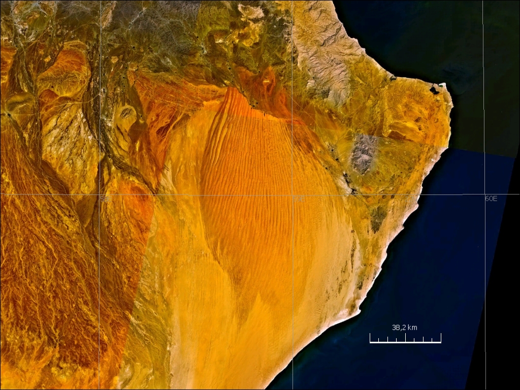
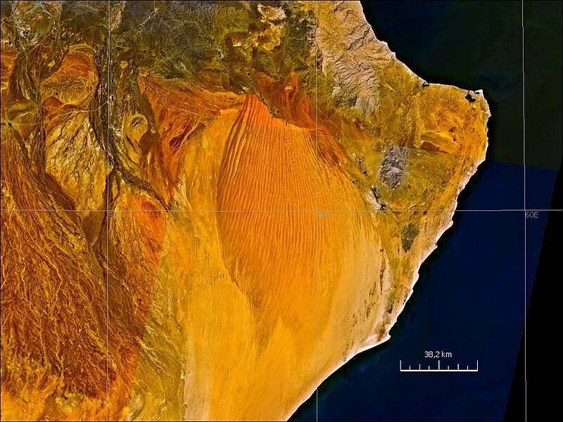
English: satellite image of Wahiba Sands, eastern Oman |
| 日期 | 2000年代 |
| 来源 | NASA World Wind screen shopt |
| 作者 | NASA |
许可协议
[编辑]
| 本图像属于 w:公有领域 ,因其为 NASA 的 World Wind 卫星地图浏览器的一张截图,且使用了公有领域图层,如 Blue Marble、MODIS、Landsat、SRTM、USGS、GLOBE 等。
|
 |
文件历史
点击某个日期/时间查看对应时刻的文件。
| 日期/时间 | 缩略图 | 大小 | 用户 | 备注 | |
|---|---|---|---|---|---|
| 当前 | 2010年8月24日 (二) 20:56 | | 1,024 × 768(581 KB) | Ratzer(留言 | 贡献) | {{Information |Description={{en|1=satellite image of Wahiba Sands, eastern Oman}} |Source=NASA World Wind screen shopt |Author=NASA |Date=2000s |Permission= |other_versions= }} Category:Satellite pictures of Oman Category:Dunes [[Category:Deserts |
您不可以覆盖此文件。
文件用途
没有页面使用本文件。
全域文件用途
以下其他wiki使用此文件:
- de.wikipedia.org上的用途
- el.wikipedia.org上的用途
- en.wikipedia.org上的用途
- it.wikipedia.org上的用途
- it.wikivoyage.org上的用途
- nn.wikipedia.org上的用途
- pt.wikipedia.org上的用途
- sl.wikipedia.org上的用途
- sv.wikipedia.org上的用途
- uk.wikipedia.org上的用途
- zh.wikipedia.org上的用途