File:New Zealand relief map.jpg
Salta a la navegació
Salta a la cerca

Mida d'aquesta previsualització: 475 × 599 píxels. Altres resolucions: 190 × 240 píxels | 380 × 480 píxels | 609 × 768 píxels | 1.200 × 1.514 píxels.
Fitxer original (1.200 × 1.514 píxels, mida del fitxer: 185 Ko, tipus MIME: image/jpeg)
Llegendes
Llegendes
Afegeix una explicació d'una línia del que representa aquest fitxer
Resum
[modifica]
| Descripció |
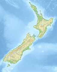
Deutsch: Positionskarte von Neuseeland
Quadratische Plattkarte, N-S-Streckung 120 %. Geographische Begrenzung der Karte: * N: 34.0° S * S: 48.3° S * W: 165.8° O * O: 179.4° O English: Location map of New Zealand
Equirectangular projection, N/S stretching 120 %. Geographic limits of the map: * N: 34.0° S * S: 48.3° S * W: 165.8° E * E: 179.4° E |
| Data | (UTC) |
| Font |
|
| Autor |
|
| Altres versions |
Derivative works of this file: |
| Això és una imatge retocada, cosa que vol dir que ha estat alterada digitalment de la seva versió original. Modificacions: {{{1}}}. L'original es pot veure a: New Zealand location map.svg:
|
Llicència
[modifica]
Jo, el titular dels drets d'autor d'aquest treball, el public sota les següents llicències:
Aquest fitxer està subjecte a la llicència de Creative Commons Reconeixement i Compartir Igual 3.0 No adaptada.
- Sou lliure de:
- compartir – copiar, distribuir i comunicar públicament l'obra
- adaptar – fer-ne obres derivades
- Amb les condicions següents:
- reconeixement – Heu de donar la informació adequada sobre l'autor, proporcionar un enllaç a la llicència i indicar si s'han realitzat canvis. Podeu fer-ho amb qualsevol mitjà raonable, però de cap manera no suggereixi que l'autor us dóna suport o aprova l'ús que en feu.
- compartir igual – Si modifiqueu, transformeu, o generareu amb el material, haureu de distribuir les vostres contribucions sota una llicència similar o una de compatible com l'original

|
S'autoritza la còpia, la distribució i la modificació d'aquest document sota els termes de la llicència de documentació lliure GNU versió 1.2 o qualsevol altra versió posterior que publiqui la Free Software Foundation; sense seccions invariants, ni textos de portada, ni textos de contraportada. S'inclou una còpia d'aquesta llicència en la secció titulada GNU Free Documentation License. |
Podeu seleccionar la llicència que vulgueu.
Registre original de càrregues
[modifica]
This image is a derivative work of the following images:
- File:New_Zealand_location_map.svg licensed with Cc-by-sa-3.0, GFDL
- 2009-08-13T17:15:46Z NordNordWest 1928x2432 (385078 Bytes) '
- 2008-09-02T20:22:10Z NordNordWest 1928x2432 (385116 Bytes) {{Information |Description= {{de|Positionskarte von [[:de:Neuseeland|Neuseeland]]}} Quadratische Plattkarte, N-S-Streckung 120 %. Geographische Begrenzung der Karte: * N: 34.0° S * S: 48.3° S * W: 165.8° O * O: 179.4° O {
Uploaded with derivativeFX
Historial del fitxer
Cliqueu una data/hora per veure el fitxer tal com era aleshores.
| Data/hora | Miniatura | Dimensions | Usuari/a | Comentari | |
|---|---|---|---|---|---|
| actual | 13:45, 20 oct 2010 | | 1.200 × 1.514 (185 Ko) | Виктор В (discussió | contribucions) | {{Information |Description={{de|Positionskarte von Neuseeland}} Quadratische Plattkarte, N-S-Streckung 120 %. Geographische Begrenzung der Karte: * N: 34.0° S * S: 48.3° S * W: 165.8° O * O: 179.4° O {{en|Location map of [[:en:New |
No podeu sobreescriure aquest fitxer.
Ús del fitxer
Les 4 pàgines següents utilitzen aquest fitxer:
Ús global del fitxer
Utilització d'aquest fitxer en altres wikis:
- Utilització a als.wikipedia.org
- Utilització a an.wikipedia.org
- Aoraki
- Tititea
- Kawarau
- Rahotu
- Glaciar Franz Josef
- Glaciar Fox
- Maungawhau
- Owairaka
- Maungakiekie
- Pico Walter (Nueva Zelanda)
- Mirror Lakes
- Crown Range
- Kā Kamu-a-Hakitekura
- Pico Cecil
- Caldera de Rotorua
- Río Kawarau
- Río Shotover
- Río Arrow
- Río Cleddau
- Río Hollyford
- Río Eglinton
- Opuke
- Te Tapu-nui
- Double Cone
- Mont Tarawera
- Mont Tongariro
- Te-taumata-o-Hakitekura
- Pico Coronet
- Utilització a ar.wikipedia.org
- Utilització a ast.wikipedia.org
- Utilització a as.wikipedia.org
- Utilització a az.wikipedia.org
- Şablon:Yer xəritəsi Yeni Zelandiya
- Taumatafakatanqihanqakoauauotamateaturipukakapikimaunqahoronukupokaifenuakitanatahu
- Celliko boğazı
- Kolvill boğazı
- Kredok boğazı
- Kuk boğazı
- Frenc-Pass boğazı
- Pitt boğazı
- Fovo boğazı
- Tamaki boğazı
- Rangitoto boğazı
- Aupouri
- Rakiura Milli Parkı
- Şimal adası (Yeni Zelandiya)
- Cənub adası (Yeni Zelandiya)
- Stüart adası
- Kraysterçdə zəlzələ (2016)
- Ranqipo
Vegeu més usos globals d'aquest fitxer.