File:Nord-Pas-de-Calais region location map.svg
跳至導覽
跳至搜尋

此 SVG 檔案的 PNG 預覽的大小:800 × 543 像素。 其他解析度:320 × 217 像素 | 640 × 434 像素 | 1,024 × 695 像素 | 1,280 × 868 像素 | 2,560 × 1,736 像素 | 1,576 × 1,069 像素。
原始檔案 (SVG 檔案,表面大小:1,576 × 1,069 像素,檔案大小:515 KB)
說明
說明
添加單行說明來描述出檔案所代表的內容
摘要[編輯]
| 拍攝地點 | | 位於此地的本圖片與其他圖片: OpenStreetMap |
|---|
| 描述 |
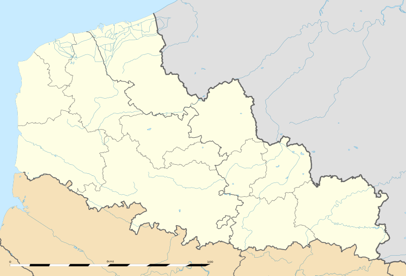
English: Blank administrative map of the region of Nord-Pas-de-Calais, France, as in January 2007, for geo-location purpose, with distinct boundaries for regions, departments and arrondissements.
Français : Carte administrative vierge de la région Nord-Pas-de-Calais, France, telle qu'en janvier 2007, destinée à la géolocalisation, avec limite distincte des régions, départements et arrondissements.
Español: Antigua región de Francia que, con su fusión con la región de Picardía, forma, desde el 1 de enero de 2016, la región de Alta Francia. Estimated scale: 1:520,000 (precision: 130 m)
Geographic limits of the map:
|
||
| 日期 | |||
| 來源 |
自己的作品 |
||
| 作者 | Eric Gaba (Sting - fr:Sting) | ||
| 授權許可 (重用此檔案) |
|
||
| 其他版本 |
|

授權條款[編輯]
Eric Gaba, Wikimedia Commons user Sting,此作品的版權所有人,決定用以下授權條款發佈本作品:
此檔案採用共享創意 姓名標示-相同方式分享 3.0 未在地化版本授權條款。
姓名標示: Eric Gaba, Wikimedia Commons user Sting
- 您可以自由:
- 分享 – 複製、發佈和傳播本作品
- 重新修改 – 創作演繹作品
- 惟需遵照下列條件:
- 姓名標示 – 您必須指名出正確的製作者,和提供授權條款的連結,以及表示是否有對內容上做出變更。您可以用任何合理的方式來行動,但不得以任何方式表明授權條款是對您許可或是由您所使用。
- 相同方式分享 – 如果您利用本素材進行再混合、轉換或創作,您必須基於如同原先的相同或兼容的條款,來分布您的貢獻成品。
檔案歷史
點選日期/時間以檢視該時間的檔案版本。
| 日期/時間 | 縮圖 | 尺寸 | 用戶 | 備註 | |
|---|---|---|---|---|---|
| 目前 | 2011年8月2日 (二) 22:06 | | 1,576 × 1,069(515 KB) | Sting(對話 | 貢獻) | == {{int:filedesc}} == {{Location|50|31|30|N|02|54|00|E|scale:500000}} {{Information |Description={{en|Blank administrative map of the region of Nord-Pas-de-Calais, France, as in January 2007, for geo-location purpose, with dist |
無法覆蓋此檔案。
檔案用途
下列7個頁面有用到此檔案:
- Location maps of regions of France
- User:Sting/Gallery: Location and locator maps
- User:Wikisoft*/Localisation cartes des regions de France
- File:Lille RER map-fr.svg
- File:Nord, Pas-de-Calais & Somme relief location map.png
- File:Nord-Pas-de-Calais region relief location map.jpg
- File:Vimy (Pas-de-Calais) and its surroundings - ru.svg
_and_its_surroundings_-_ru.svg)
全域檔案使用狀況
以下其他 wiki 使用了這個檔案:
- ar.wikipedia.org 的使用狀況
- be.wikipedia.org 的使用狀況
- bg.wikipedia.org 的使用狀況
- ceb.wikipedia.org 的使用狀況
- de.wikipedia.org 的使用狀況
- el.wikipedia.org 的使用狀況
- en.wikipedia.org 的使用狀況
- eo.wikipedia.org 的使用狀況
- es.wikipedia.org 的使用狀況
- Bosque de Arenberg
- Carrefour de l'Arbre
- Mons-en-Pévèle (sector de pavé)
- Sinagoga de Lille
- Plantilla:Mapa de localización de Norte-Paso de Calais
- Basílica de Nuestra Señora de la Inmaculada Concepción de Boulogne-sur-Mer
- Beffroi de Dunkerque
- Basílica catedral de Nuestra Señora y San Vaast (Arrás)
- Tramo de Roubaix
- fa.wikipedia.org 的使用狀況
- fo.wikipedia.org 的使用狀況
- fr.wikipedia.org 的使用狀況
- Université du Littoral-Côte-d'Opale
- Racing Club de Lens
- Catastrophe de Courrières
- Stade Grimonprez-Jooris
- Stade Bollaert-Delelis
- Stade Henri-Jooris
- Stadium Lille Métropole
- Salle du Hainaut
- Quatre Jours de Dunkerque 2006
- Stade Nungesser
- Stades de Flandres
- Liste des commanderies templières dans le Nord-Pas-de-Calais
- Stade Marcel-Tribut
- Championnat de France de football de deuxième division 1937-1938
- Hippodrome de la Canche
- Hippodrome des Hauts-Blancs-Monts
- Stade Pierre-Mauroy
- Stade Julien-Denis
檢視此檔案的更多全域使用狀況。