File:Norden satellite.jpg
跳至導覽
跳至搜尋
預覽大小:750 × 600 像素。 其他解析度:300 × 240 像素 | 601 × 480 像素 | 961 × 768 像素 | 1,280 × 1,023 像素 | 1,436 × 1,148 像素。
原始檔案 (1,436 × 1,148 像素,檔案大小:977 KB,MIME 類型:image/jpeg)
說明
說明
添加單行說明來描述出檔案所代表的內容
摘要[編輯]
| 描述 |
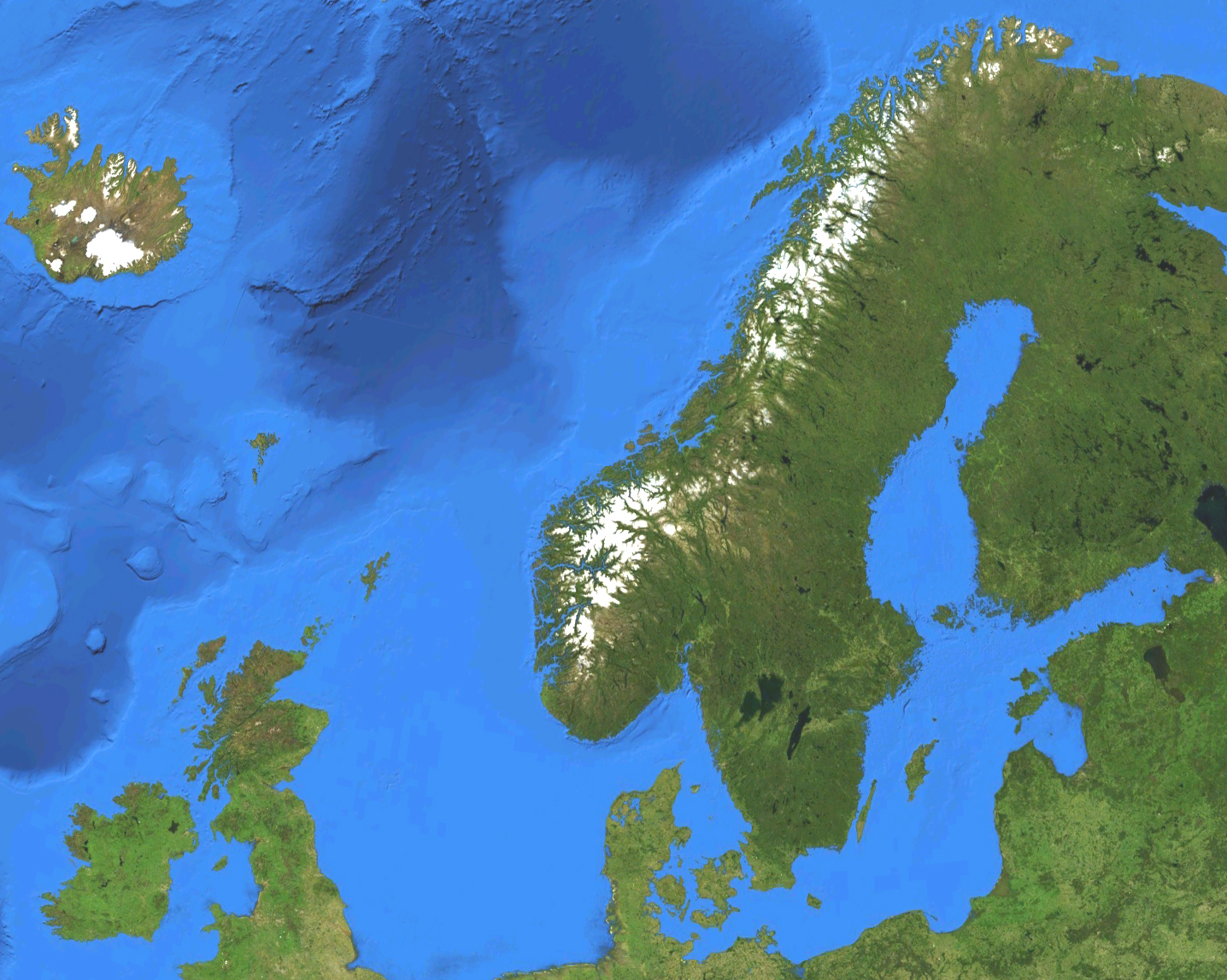
English: Satellite map of European part of the Nordic countries, except for Jan Mayen and Svalbard. Terrain and ocean topography.
Svenska: Satellitkarta över den europeiska delen av Norden, förutom Jan Mayen och Svalbard. Terräng och havstopografi. |
| 日期 | |
| 來源 | Own work by uploader, made with NASA World Wind. |
| 作者 | Koyos |
授權條款[編輯]
| 我,此作品的版權所有人,釋出此作品至公共領域。此授權條款在全世界均適用。 這可能在某些國家不合法,如果是的話: 我授予任何人有權利使用此作品於任何用途,除受法律約束外,不受任何限制。 |
檔案歷史
點選日期/時間以檢視該時間的檔案版本。
| 日期/時間 | 縮圖 | 尺寸 | 使用者 | 備註 | |
|---|---|---|---|---|---|
| 目前 | 2009年3月15日 (日) 03:47 | | 1,436 × 1,148(977 KB) | Koyos(留言 | 貢獻) | colors |
| 2009年3月15日 (日) 03:30 |  | 1,444 × 1,156(1,019 KB) | Koyos(留言 | 貢獻) | {{Information |Description={{en|1=Satellite map of the Nordic countries. Terrain and ocean topography.}} {{sv|1=Satellitkarta över Norden. Terräng och havstopografi.}} |Source=Own work by uploader, made with NASA World Wind. |Author=Koyos |
無法覆蓋此檔案。
檔案用途
下列頁面有用到此檔案:
全域檔案使用狀況
以下其他 wiki 使用了這個檔案:
- cs.wikipedia.org 的使用狀況
- el.wikipedia.org 的使用狀況
- en.wikipedia.org 的使用狀況
- eo.wikipedia.org 的使用狀況
- eo.wiktionary.org 的使用狀況
- fa.wikipedia.org 的使用狀況
- fr.wikipedia.org 的使用狀況
- he.wikipedia.org 的使用狀況
- he.wikiquote.org 的使用狀況
- id.wikipedia.org 的使用狀況
- is.wikipedia.org 的使用狀況
- lv.wikipedia.org 的使用狀況
- pl.wiktionary.org 的使用狀況
- pt.wikipedia.org 的使用狀況
- rm.wikipedia.org 的使用狀況
- sv.wikipedia.org 的使用狀況
- uk.wikipedia.org 的使用狀況
- zh.wikipedia.org 的使用狀況