File:North and South Luconia Shoals.jpg
跳转到导航
跳转到搜索
本预览的尺寸:331 × 600像素。 其他分辨率:132 × 240像素 | 265 × 480像素 | 423 × 768像素 | 565 × 1,024像素 | 1,280 × 2,320像素。
原始文件 (1,280 × 2,320像素,文件大小:478 KB,MIME类型:image/jpeg)
说明
说明
添加一行文字以描述该文件所表现的内容
摘要
[编辑]
| 描述 |
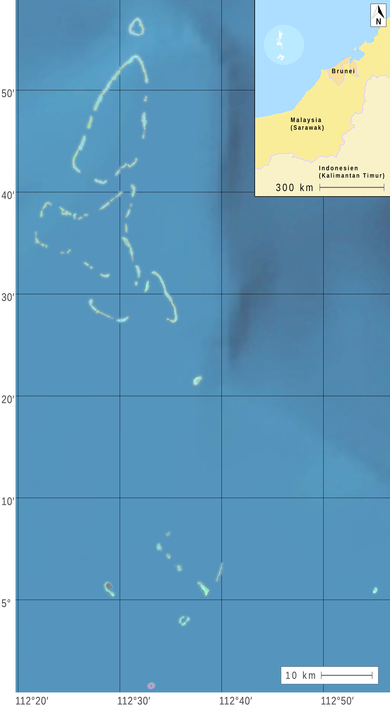
Deutsch: Nördliche und Südliche Luconia-Untiefen (oder -Riffe, englisch Luconia Shoals) im Südchinesische Meer südwestlich der Spratly-Inseln auf dem Festlandsockel vor dem malaysischen Bundesstaat Sarawak. (Nach Satellitenbildern der Landsat 7 und weiteren Quellen.) English: Northern and Southern Luconia Shoals (or reefs) in the South China Sea southwest of the Spratly Islands to the continental shelf in front of the Malaysian state of Sarawak. (According to satellite images of Landsat 7 and other sources.) Français : Les bancs Luconia nord et sud (ou récifs, en anglais Luçon Shoals) dans la mer de Chine méridionale sud-ouest des îles Spratly sur le plateau continental en face de l'État malais du Sarawak. (Selon des images satellite Landsat 7 et d'autres sources.) |
| 日期 | |
| 来源 |
1) satellite images on oceandots.com |
| 作者 |
|
| 这是一张修改过的图片,这意味着它已在原版本的基础上通过软件进行了编辑,改动内容: Deutsch: Teile der angegebenen Quellen wurden zu einem neuen Bild zusammengestellt. English: Parts of the indicated sources were combined to form a new image. Français : Parties des sources indiquées ont été combinées pour former une nouvelle image. 。修改者:MagentaGreen。
|
许可协议
[编辑]
| 本文件完全由NASA创作,在美国属于公有领域。根据NASA的版权方针,NASA的材料除非另有声明否则不受版权保护。(参见Template:PD-USGov/zh、NASA版权方针页面或JPL图片使用方针。) | ||
 |
警告:
|
(1, 2)
(3, 4)
| 注解 | 该图片含有注解:在维基媒体共享资源上查看注解 |
文件历史
点击某个日期/时间查看对应时刻的文件。
| 日期/时间 | 缩略图 | 大小 | 用户 | 备注 | |
|---|---|---|---|---|---|
| 当前 | 2015年6月5日 (五) 10:31 | | 1,280 × 2,320(478 KB) | MagentaGreen(留言 | 贡献) | Längen- und Breitengrade |
| 2015年5月28日 (四) 15:37 |  | 1,232 × 2,112(326 KB) | MagentaGreen(留言 | 贡献) | =={{int:filedesc}}== {{Information |description={{de|1=Nördliche und Südliche Luconia-Untiefen (oder -Riffe, englisch Luconia Shoals) im Südchinesische Meer südwestlich der Spratly-Inseln auf dem Festlandsockel vor dem malaysischen Bundesstaat Sara... |
您不可以覆盖此文件。
文件用途
没有页面使用本文件。
全域文件用途
以下其他wiki使用此文件:
- de.wikipedia.org上的用途
- en.wikipedia.org上的用途
- id.wikipedia.org上的用途
- ja.wikipedia.org上的用途
- ms.wikipedia.org上的用途
- sv.wikipedia.org上的用途
- zh.wikipedia.org上的用途