File:Northlasv.jpg
Jump to navigation
Jump to search
Myns an ragwel ma: 800 × 292 piksel. Klerderyow erel: 320 × 117 piksel | 1,011 × 369 piksel.
Restren wreydhek (1,011 × 369 piksel, myns an restren: 123 KB, eghen MIME: image/jpeg)
Captions
Captions
Add a one-line explanation of what this file represents
Berrskrif[golegi]
| Deskrifans |
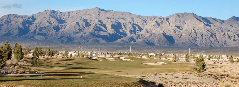
English: The southern section of the Las Vegas Range, and the Aliante Golf Club in the Las Vegas Valley — in Clark County, southern Nevada.
|
| Pennfenten | Ober honan |
| Awtour | Meridethmyers |
Leshyans[golegi]
| I, the copyright holder of this work, release this work into the public domain. This applies worldwide. In some countries this may not be legally possible; if so: I grant anyone the right to use this work for any purpose, without any conditions, unless such conditions are required by law. |
Istori an restren
Klyckyewgh war dhedhyans/eur rag gweles an folen dell o an termyn na.
| Dedhyans/Eur | Skeusennik | Mynsow | Devnydhyer | Kampol | |
|---|---|---|---|---|---|
| a-lemmyn | 22:04, 3 Me 2008 | 1,011 × 369 (123 KB) | Meridethmyers~commonswiki (keskows | kevrohow) | {{Information |Description= |Source=self-made |Date= |Author= Meridethmyers |Permission= |other_versions= }} |
Ny yllowgh gorskrifa an restren ma.
Devnydh an restren
Yma an 2 folen a syw owth usya an restren ma:
Devnydh ollvysel an restren
Yma an wikis erel a syw ow tevnydhya an restren ma:
- Devnydh war ar.wikipedia.org
- Devnydh war arz.wikipedia.org
- Devnydh war azb.wikipedia.org
- Devnydh war be-tarask.wikipedia.org
- Devnydh war br.wikipedia.org
- Devnydh war bs.wikipedia.org
- Devnydh war ceb.wikipedia.org
- Devnydh war de.wikipedia.org
- Devnydh war en.wikipedia.org
- Devnydh war en.wikivoyage.org
- Devnydh war eo.wikipedia.org
- Devnydh war es.wikipedia.org
- Devnydh war fa.wikipedia.org
- Devnydh war fi.wikipedia.org
- Devnydh war fr.wikipedia.org
- Devnydh war id.wikipedia.org
- Devnydh war ja.wikipedia.org
- Devnydh war kw.wikipedia.org
- Devnydh war no.wikipedia.org
- Devnydh war pms.wikipedia.org
- Devnydh war pt.wikipedia.org
- Devnydh war ru.wikipedia.org
- Devnydh war simple.wikipedia.org
- Devnydh war sw.wikipedia.org
- Devnydh war tl.wikipedia.org
- Devnydh war tr.wikipedia.org
- Devnydh war uk.wikipedia.org
- Devnydh war uz.wikipedia.org
- Devnydh war war.wikipedia.org
- Devnydh war www.wikidata.org
- Devnydh war zh.wikipedia.org