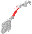
File:Norway Counties Nordland Position.svg
出自Wikimedia Commons
跳至導覽
跳至搜尋

此 SVG 檔案的 PNG 預覽的大小:562 × 600 像素。 其他解析度:225 × 240 像素 | 450 × 480 像素 | 719 × 768 像素 | 959 × 1,024 像素 | 1,918 × 2,048 像素 | 740 × 790 像素。
原始檔案 (SVG 檔案,表面大小:740 × 790 像素,檔案大小:54 KB)
檔案資訊
結構化資料
說明
說明
添加單行說明來描述出檔案所代表的內容
| 描述Norway Counties Nordland Position.svg | Autogenerated locator map of norwegian county as named in filename. |
| 日期 | |
| 來源 | Based on Image:Norway counties blank.svg |
| 作者 | Marmelad |
| 授權許可 (重用此檔案) |
Own work, share alike, attribution required (Creative Commons CC-BY-SA-2.5) |
| 其他版本 | Derivative works of this file: Nordland.svg |
我,本作品的著作權持有者,決定用以下授權條款發佈本作品:
此檔案採用創用CC 姓名標示-相同方式分享 2.5 通用版授權條款。
- 您可以自由:
- 分享 – 複製、發佈和傳播本作品
- 重新修改 – 創作演繹作品
- 惟需遵照下列條件:
- 姓名標示 – 您必須指名出正確的製作者,和提供授權條款的連結,以及表示是否有對內容上做出變更。您可以用任何合理的方式來行動,但不得以任何方式表明授權條款是對您許可或是由您所使用。
- 相同方式分享 – 如果您利用本素材進行再混合、轉換或創作,您必須基於如同原先的相同或兼容的條款,來分布您的貢獻成品。
檔案歷史
點選日期/時間以檢視該時間的檔案版本。
| 日期/時間 | 縮圖 | 尺寸 | 用戶 | 備註 | |
|---|---|---|---|---|---|
| 目前 | 2024年1月2日 (二) 00:48 |  | 740 × 790(54 KB) | Jay1279(對話 | 貢獻) | update county borders for 2024 |
| 2020年1月1日 (三) 22:44 |  | 740 × 790(50 KB) | Bjarkan(對話 | 貢獻) | Border update for 2020. | |
| 2019年1月27日 (日) 08:26 |  | 740 × 790(67 KB) | Bjarkan(對話 | 貢獻) | Border update (Rindal). | |
| 2017年12月17日 (日) 03:01 |  | 740 × 790(67 KB) | Bjarkan(對話 | 貢獻) | Improved version. | |
| 2016年1月24日 (日) 11:46 |  | 740 × 790(81 KB) | Fleinn(對話 | 貢獻) | Reverted to version as of 12:53, 16 August 2010 (UTC) | |
| 2016年1月19日 (二) 02:03 |  | 512 × 512(82 KB) | Kingsocarso(對話 | 貢獻) | Reverted to version as of 21:28, 21 September 2007 (UTC) | |
| 2010年8月16日 (一) 12:53 |  | 740 × 790(81 KB) | Fleinn(對話 | 貢獻) | Added gradient. | |
| 2007年9月21日 (五) 21:28 |  | 512 × 512(82 KB) | Marmelad(對話 | 貢獻) | {{Information |Description=Autogenerated locator map of norwegian county as named in filename. |Source=Based on Image:Norway counties blank.svg |Date=2007-09-21 |Author=Marmelad |Permission=Own work, share alike, attribution require |
無法覆蓋此檔案。
檔案用途
下列10個頁面有用到此檔案:
全域檔案使用狀況
以下其他 wiki 使用了這個檔案:
- af.wikipedia.org 的使用狀況
- ast.wikipedia.org 的使用狀況
- azb.wikipedia.org 的使用狀況
- bjn.wikipedia.org 的使用狀況
- bpy.wikipedia.org 的使用狀況
- br.wikipedia.org 的使用狀況
- bs.wikipedia.org 的使用狀況
- da.wikipedia.org 的使用狀況
- de.wikipedia.org 的使用狀況
- en.wikipedia.org 的使用狀況
- Nordland
- Bodø Municipality
- Narvik Municipality
- Bindal Municipality
- Sømna Municipality
- Brønnøy Municipality
- Vega Municipality
- Vevelstad Municipality
- Herøy Municipality (Nordland)
- Alstahaug Municipality
- Leirfjord Municipality
- Vefsn Municipality
- Grane Municipality
- Hattfjelldal Municipality
- Dønna Municipality
- Nesna Municipality
- Hemnes Municipality
- Lurøy Municipality
- Træna Municipality
- Rødøy Municipality
- Meløy Municipality
- Gildeskål Municipality
- Beiarn Municipality
- Saltdal Municipality
- Fauske Municipality
- Sørfold Municipality
- Steigen Municipality
- Hamarøy Municipality
- Tysfjord Municipality
- Lødingen Municipality
- Evenes Municipality
- Ballangen Municipality
- Røst Municipality
- Værøy Municipality
- Flakstad Municipality
- Vestvågøy Municipality
- Vågan Municipality
- Hadsel Municipality
檢視此檔案的更多全域使用狀況。
詮釋資料
此檔案中包含其他資訊,這些資訊可能是由數位相機或掃描器在建立或數位化過程中所新增的。若檔案自原始狀態已被修改,一些詳細資料可能無法完整反映出已修改的檔案。
| 寬度 | 740 |
|---|---|
| 高度 | 790 |