File:Obcine Slovenija 2006 Cerklje na Gorenjskem.svg
ナビゲーションに移動
検索に移動

この SVG ファイルのこの PNG プレビューのサイズ: 800 × 522 ピクセル. その他の解像度: 320 × 209 ピクセル | 640 × 418 ピクセル | 1,024 × 668 ピクセル | 1,280 × 835 ピクセル | 2,560 × 1,670 ピクセル | 2,613 × 1,705 ピクセル。
元のファイル (SVG ファイル、2,613 × 1,705 ピクセル、ファイルサイズ: 2.36メガバイト)
キャプション
キャプション
このファイルの内容を1行で記述してください
概要[編集]
| 解説 |
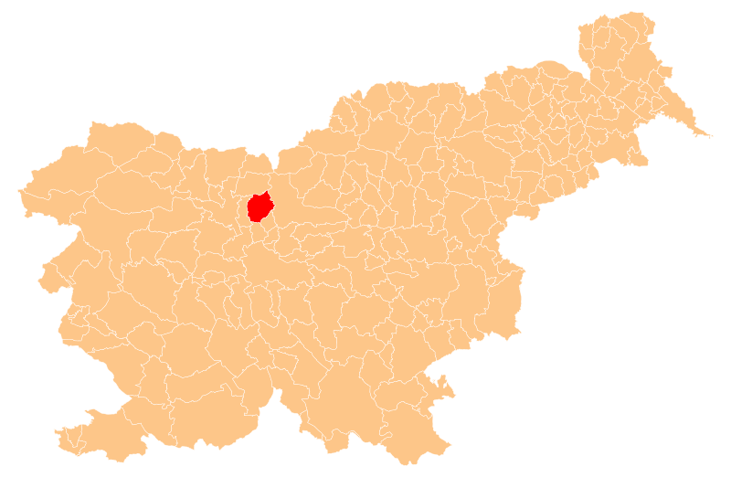
English: Občina Cerklje na Gorenjskem (marked red) on map of the municipalities (občine) of the Republic of Slovenia, as since May 2006 (210 units). |
| 日付 | |
| 原典 | Manipulated Image:Obcine Slovenija 2006.svg in text editor. |
| 作者 | Source of the public data is GURS (Geodetska uprava Republike Slovenije or Surveying and Mapping Authority of the Republic of Slovenia). Converted from Shapefile to SVG with shp2svg and prepared for Wikipedia by romanm (talk). |
| 許可 (ファイルの再利用) |
Public domain. See Image:Obcine Slovenija 2006.svg for an explanation. |
ライセンス[編集]
| この著作物の著作権者である私は、この著作物における権利を放棄しパブリックドメインとします。これは全世界で適用されます。 一部の国では、これが法的に可能ではない場合があります。その場合は、次のように宣言します。 私は、あらゆる人に対して、法により必要とされている条件を除き、如何なる条件も課すことなく、あらゆる目的のためにこの著作物を使用する権利を与えます。 |
ファイルの履歴
過去の版のファイルを表示するには、その版の日時をクリックしてください。
| 日付と時刻 | サムネイル | 寸法 | 利用者 | コメント | |
|---|---|---|---|---|---|
| 現在の版 | 2009年5月31日 (日) 22:41 | | 2,613 × 1,705 (2.36メガバイト) | Romanm (トーク | 投稿記録) | {{Information |Description={{en|1=''Občina Cerklje na Gorenjskem'' (marked red) on map of the municipalities (''občine'') of the Republic of Slovenia, as since May 2006 (210 units).}} |Source=Manipulated Image:Obcine Slovenija 2006.svg in text edit |
このファイルは上書きできません。
ファイルの使用状況
以下の 2 ページがこのファイルを使用しています:
グローバルなファイル使用状況
以下に挙げる他のウィキがこの画像を使っています:
- cs.wikipedia.org での使用状況
- en.wikipedia.org での使用状況
- eo.wikipedia.org での使用状況
- fi.wikipedia.org での使用状況
- id.wikipedia.org での使用状況
- it.wikipedia.org での使用状況
- ja.wikipedia.org での使用状況
- lmo.wikipedia.org での使用状況
- mk.wikipedia.org での使用状況
- pl.wikipedia.org での使用状況
- ro.wikipedia.org での使用状況
- Cerklje na Gorenjskem
- Format:Cerklje na Gorenjskem
- Adergas
- Ambrož pod Krvavcem
- Apno, Cerklje na Gorenjskem
- Cerkljanska Dobrava
- Češnjevek, Cerklje na Gorenjskem
- Dvorje, Cerklje na Gorenjskem
- Glinje, Cerklje na Gorenjskem
- Grad, Cerklje na Gorenjskem
- Poženik
- Praprotna Polica
- Pšata, Cerklje na Gorenjskem
- Pšenična Polica
- Ravne, Cerklje na Gorenjskem
- Šenturška Gora
- Sidraž
- Šmartno, Cerklje na Gorenjskem
- Spodnji Brnik
- Štefanja Gora
- Stiška vas
- Sveti Lenart, Cerklje na Gorenjskem
- Lahovče
- Trata pri Velesovem
- Vašca
- Velesovo
- Viševca
- Vopovlje
- Vrhovje
- Zalog pri Cerkljah
- Zgornji Brnik
- ru.wikipedia.org での使用状況
- sco.wikipedia.org での使用状況
- sl.wikipedia.org での使用状況
このファイルのグローバル使用状況を表示する。