File:Oceanic gyres.png
Aller à la navigation
Aller à la recherche
Pas de plus haute résolution disponible.
Oceanic_gyres.png (450 × 294 pixels, taille du fichier : 225 kio, type MIME : image/png)
Légendes
Légendes
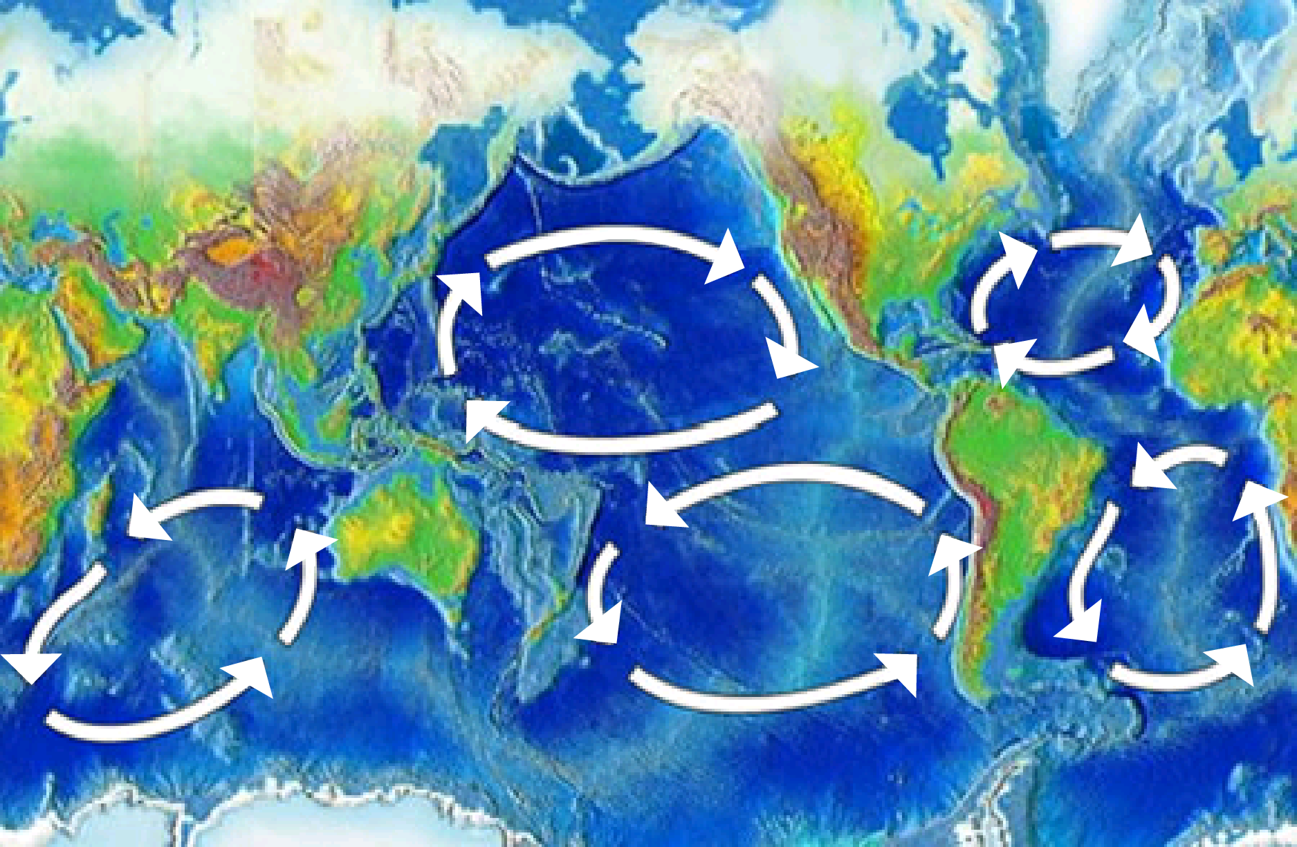
Il y a 5 grands gyres océaniques : de l'Atlantique Nord, de l'Atlantique Sud, du Pacifique Nord, du Pacifique Sud et de l'océan Indien. Chacun a un courant de frontière ouest, fort et étroit et un courant de frontière est, faible et large.
Description
[modifier]
| Description | There are five major ocean-wide gyres — the North Atlantic, South Atlantic, North Pacific, South Pacific, and Indian Ocean gyres. Each is flanked by a strong and narrow “western boundary current,” and a weak and broad “eastern boundary current”. |
| Date | |
| Source | here, img |
| Auteur | NOAA |
| Autres versions | Image:Pacific oceanic gyres.png |
Conditions d’utilisation
[modifier]
Cette image est dans le domaine public car son contenu provient de la
National Oceanic and Atmospheric Administration , réalisé par un employé dans le cadre de ses activités professionnelles.
|
Historique du fichier
Cliquer sur une date et heure pour voir le fichier tel qu'il était à ce moment-là.
| Date et heure | Vignette | Dimensions | Utilisateur | Commentaire | |
|---|---|---|---|---|---|
| actuel | 20 mai 2024 à 06:18 | | 450 × 294 (225 kio) | Sumanjyot840 (d | contributions) | Reverted to version as of 02:47, 5 April 2008 (UTC) |
| 12 décembre 2018 à 21:46 |  | 1 875 × 1 225 (328 kio) | A loose necktie (d | contributions) | Fixing surprisingly unhelopful NOAA map by adding better arrows | |
| 5 avril 2008 à 02:47 |  | 450 × 294 (225 kio) | Jrockley (d | contributions) | {{Information |Description=Gyres of the world's oceans |Source=[http://oceanservice.noaa.gov/education/kits/currents/05currents3.html here] |Date=March 25, 2008 |Author=NOAA |Permission= |other_versions= }} Category:Oceans [[Category:Mar |
Vous ne pouvez pas remplacer ce fichier.
Utilisations locales du fichier
Aucune page n’utilise ce fichier.
Utilisations du fichier sur d’autres wikis
Les autres wikis suivants utilisent ce fichier :
- Utilisation sur af.wikipedia.org
- Utilisation sur ar.wikipedia.org
- Utilisation sur bn.wikipedia.org
- Utilisation sur bs.wikipedia.org
- Utilisation sur ca.wikipedia.org
- Utilisation sur da.wikipedia.org
- Utilisation sur de.wikipedia.org
- Utilisation sur de.wikinews.org
- Utilisation sur en.wikipedia.org
- Atlantic Ocean
- History of Portugal (1415–1578)
- Downwelling
- Conquistador
- Ocean gyre
- Kuroshio Current
- Walter Munk
- Great Pacific garbage patch
- Volta do mar
- User:Epipelagic/sandbox/box3
- Wild fisheries
- Ocean
- Indian Ocean Gyre
- Indian Ocean garbage patch
- Marine habitat
- User:GarrettGissinger/sandbox
- User:Daniel Mietchen/gallery
- Beach cleaning
- Template:Oceanic gyres
- Low-nutrient, low-chlorophyll region
Voir davantage sur l’utilisation globale de ce fichier.