File:Oise department location map.svg
跳至導覽
跳至搜尋

此 SVG 檔案的 PNG 預覽的大小:780 × 599 像素。 其他解析度:313 × 240 像素 | 625 × 480 像素 | 1,000 × 768 像素 | 1,280 × 983 像素 | 2,560 × 1,967 像素 | 1,446 × 1,111 像素。
原始檔案 (SVG 檔案,表面大小:1,446 × 1,111 像素,檔案大小:425 KB)
說明
說明
添加單行說明來描述出檔案所代表的內容
摘要
[編輯]| 拍攝地點 | | 位於此地的本圖片與其他圖片: OpenStreetMap |
|---|
| 描述 |
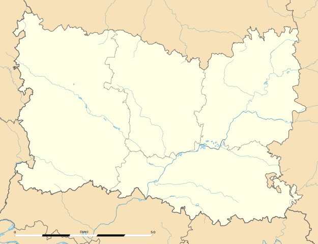
English: Blank administrative map of the department of Oise, France, as in December 2014, for geo-location purpose, with distinct boundaries for regions, departments and arrondissements.
Français : Carte administrative vierge du département de l'Oise, France, tel qu'en décembre 2014, destinée à la géolocalisation, avec limite distincte des régions, départements et arrondissements. Estimated scale: 1:320,000 (precision: 80 m)
Geographic limits of the map:
|
||
| 日期 | |||
| 來源 |
自己的作品
|
||
| 作者 | Eric Gaba (Sting - fr:Sting) | ||
| 授權許可 (重用此檔案) |
|
||
| 其他版本 |
|

授權條款
[編輯]
Eric Gaba, Wikimedia Commons user Sting,此作品的版權所有人,決定用以下授權條款發佈本作品:
此檔案採用創用CC 姓名標示-相同方式分享 3.0 未在地化版本授權條款。
姓名標示: Eric Gaba, Wikimedia Commons user Sting
- 您可以自由:
- 分享 – 複製、發佈和傳播本作品
- 重新修改 – 創作演繹作品
- 惟需遵照下列條件:
- 姓名標示 – 您必須指名出正確的製作者,和提供授權條款的連結,以及表示是否有對內容上做出變更。您可以用任何合理的方式來行動,但不得以任何方式表明授權條款是對您許可或是由您所使用。
- 相同方式分享 – 如果您利用本素材進行再混合、轉換或創作,您必須基於如同原先的相同或兼容的條款,來分布您的貢獻成品。
檔案歷史
點選日期/時間以檢視該時間的檔案版本。
| 日期/時間 | 縮圖 | 尺寸 | 使用者 | 備註 | |
|---|---|---|---|---|---|
| 目前 | 2014年12月27日 (六) 02:41 | | 1,446 × 1,111(425 KB) | Sting(留言 | 貢獻) | == {{int:filedesc}} == {{Location|49|24|00|N|02|25|30|E|scale:500000}} {{Information |Description={{en|Blank administrative map of the department of Oise, France, as in December 2014, for geo-location purpose, with distinct b... |
無法覆蓋此檔案。
檔案用途
下列3個頁面有用到此檔案:
全域檔案使用狀況
以下其他 wiki 使用了這個檔案:
- als.wikipedia.org 的使用狀況
- de.wikipedia.org 的使用狀況
- eo.wikipedia.org 的使用狀況
- Compiègne
- Beauvais
- Creil
- Noyon
- Pierrefonds
- Coye-la-Forêt
- Gouvieux
- Crépy-en-Valois
- Ormoy-Villers
- Le Plessis-Belleville
- Nanteuil-le-Haudouin
- Lavilletertre
- Liancourt-Saint-Pierre
- Chaumont-en-Vexin
- Trie-Château
- Boran-sur-Oise
- Saint-Leu-d'Esserent
- Précy-sur-Oise
- Mareuil-sur-Ourcq
- Ŝablono:Situo sur mapo Francio Oise
- Beauvais (stacidomo)
- Compiègne (stacidomo)
- Formerie (stacidomo)
- Formerie
- Abancourt (stacidomo)
- Abancourt (Oise)
- Appilly (stacidomo)
- Appilly
- Balagny-Saint-Épin (stacidomo)
- Balagny-sur-Thérain
- Avrechy (stacidomo)
- Avrechy
- Bornel - Belle-Église (stacidomo)
- Belle-Église
- Bornel
- Breteuil-Embranchement (stacidomo)
- Bacouël
- Breteuil (Oise)
- Chambly (stacidomo)
- Chambly (Oise)
- Chevrières (stacidomo)
- Chevrières (Oise)
- Saint-Just-en-Chaussée (stacidomo)
- Saint-Just-en-Chaussée
- Sérifontaine (stacidomo)
檢視此檔案的更多全域使用狀況。