File:Ordnance Survey 1-250000 - TF.jpg
Przejdź do nawigacji
Przejdź do wyszukiwania

Rozmiar podglądu – 600 × 600 pikseli. Inne rozdzielczości: 240 × 240 pikseli | 480 × 480 pikseli | 768 × 768 pikseli | 1024 × 1024 pikseli | 2048 × 2048 pikseli | 4000 × 4000 pikseli.
Rozmiar pierwotny (4000 × 4000 pikseli, rozmiar pliku: 6,07 MB, typ MIME: image/jpeg)
Podpisy
Podpisy
Dodaj jednolinijkowe objaśnienie tego, co ten plik pokazuje
Opis[edytuj]
| Opis |
Español: Un mapa de la Ordnance Survey de la zona TF del sistema de referencia británico, en una escala de 1:250.000. Français : Une carte de l'Ordnance Survey de la zone TF dans le système de référence britanique, à l'échelle 1:250.000. Italiano: Una carta della Ordnance Survey della zona TF nella sistema di referenza britannica, con la scala 1:250.000.     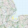     |
| Data | 6 czerwca 2010 (data przesłania) |
| Źródło | Ordnance Survey OpenData 1:250 000 Scale Colour Raster. Converted from File:Ordnance Survey 1-250000 - TF.tif to jpg |
| Autor | Ordnance Survey |
Licencja[edytuj]
This file is licensed by the Ordnance Survey of the United Kingdom under their OS OpenData License
In short: you are free to distribute and modify the file as long as you attribute (including year), the Ordnance Survey. Uznanie autorstwa: Contains Ordnance Survey data © Crown copyright and database right (year) Note: Derivative works can be licensed under any Creative Commons Attribution 3.0 Licence. |
_(St_Edwards_Crown).svg)
|
This file is licensed under the United Kingdom Open Government Licence v3.0. |
See also: Meta for information on usage on Wikimedia wikis.
|
Historia pliku
Kliknij na odpowiedniej dacie/czasie, aby zobaczyć wersję pliku z tamtego okresu.
| Data/czas | Miniatura | Wymiary | Użytkownik | Opis | |
|---|---|---|---|---|---|
| aktualny | 19:49, 6 cze 2010 | | 4000 × 4000 (6,07 MB) | OrdnanceSurveyBot (dyskusja | edycje) | {{subst:Commons:Batch uploading/Ordnance Survey/Template |subst=subst: |square=TF |scale=250.000 |sourcename=1:250 000 Scale Colour Raster |basefilename=Ordnance Survey 1-250000 - |extension=jpg |nw_square=SE |n_square=TA |ne_square= |w_square=SK |e_squa |
Nie możesz nadpisać tego pliku.
Lokalne wykorzystanie pliku
Następujące strony korzystają z tego pliku:
- Ordnance Survey 1:250 000 Scale Colour Raster map
- File:National Grid square TF at 1 in 250 000 scale.png
- File:Ordnance Survey 1-250000 - SE.jpg
- File:Ordnance Survey 1-250000 - SE.tif
- File:Ordnance Survey 1-250000 - SK.jpg
- File:Ordnance Survey 1-250000 - SK.tif
- File:Ordnance Survey 1-250000 - SP.jpg
- File:Ordnance Survey 1-250000 - SP.tif
- File:Ordnance Survey 1-250000 - TA.jpg
- File:Ordnance Survey 1-250000 - TA.tif
- File:Ordnance Survey 1-250000 - TF.jpg
- File:Ordnance Survey 1-250000 - TF.tif
- File:Ordnance Survey 1-250000 - TG.jpg
- File:Ordnance Survey 1-250000 - TG.tif
- File:Ordnance Survey 1-250000 - TL.jpg
- File:Ordnance Survey 1-250000 - TL.tif
- File:Ordnance Survey 1-250000 - TM.jpg
- File:Ordnance Survey 1-250000 - TM.tif
Globalne wykorzystanie pliku
Ten plik jest wykorzystywany także w innych projektach wiki:
- Wykorzystanie na cy.wikipedia.org
- Wykorzystanie na en.wikipedia.org
- Ordnance Survey National Grid
- Metrication in the United Kingdom
- Ordnance Survey
- Wikipedia:Featured picture candidates/April-2010
- Wikipedia:Featured picture candidates/National Grid square TF at 1 in 250 000 scale.jpg
- User:Cmglee/Ordnance Survey 1:250 000 Scale Colour Raster map
- User:Peter Mercator/Draft for OS national grid
- Wykorzystanie na fr.wikipedia.org
- Wykorzystanie na id.wikipedia.org
- Wykorzystanie na nl.wikipedia.org
- Wykorzystanie na pl.wikipedia.org