File:Osprey Reef map.png
跳转到导航
跳转到搜索
本预览的尺寸:800 × 481像素。 其他分辨率:320 × 192像素 | 640 × 385像素 | 1,024 × 615像素 | 1,280 × 769像素 | 2,067 × 1,242像素。
原始文件 (2,067 × 1,242像素,文件大小:897 KB,MIME类型:image/png)
说明
说明
添加一行文字以描述该文件所表现的内容
| 描述 |
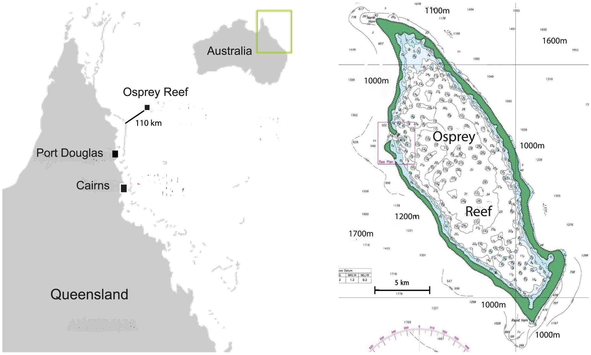
Original caption: "Location map of Osprey Reef, Coral Sea, Australia. Osprey Reef is located 100 km from the outer edge of the northern Great Barrier Reef, rising from around 2000 m depths to just below the surface in an almost vertical reef wall." |
| 日期 | |
| 来源 | Dunstan A, Bradshaw CJA, Marshall J (2011) Nautilus at risk – estimating population size and demography of Nautilus pompilius. PLoS ONE 6(2): e16716. doi:10.1371/journal.pone.0016716 |
| 作者 | Dunstan AJ, Ward PD, Marshall NJ |
文件历史
点击某个日期/时间查看对应时刻的文件。
| 日期/时间 | 缩略图 | 大小 | 用户 | 备注 | |
|---|---|---|---|---|---|
| 当前 | 2012年4月2日 (一) 01:17 | | 2,067 × 1,242(897 KB) | Mgiganteus(留言 | 贡献) | {{Information |Description=Original caption: "Location map of Osprey Reef, Coral Sea, Australia. Osprey Reef is located 100 km from the outer edge of the northern Great Barrier Reef, rising from around 2000 m depths to just below the surface in an alm... |
您不可以覆盖此文件。
文件用途
没有页面使用本文件。
全域文件用途
以下其他wiki使用此文件:
- de.wikipedia.org上的用途
- en.wikipedia.org上的用途
- zh.wikipedia.org上的用途