File:Overview of West Lancaster.jpg
跳至導覽
跳至搜尋

預覽大小:800 × 596 像素。 其他解析度:320 × 239 像素 | 640 × 477 像素 | 1,024 × 763 像素 | 1,280 × 954 像素 | 2,576 × 1,920 像素。
原始檔案 (2,576 × 1,920 像素,檔案大小:2.02 MB,MIME 類型:image/jpeg)
說明
說明
添加單行說明來描述出檔案所代表的內容
| 描述 |
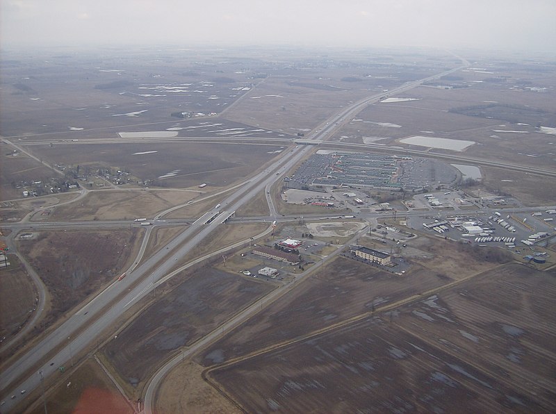
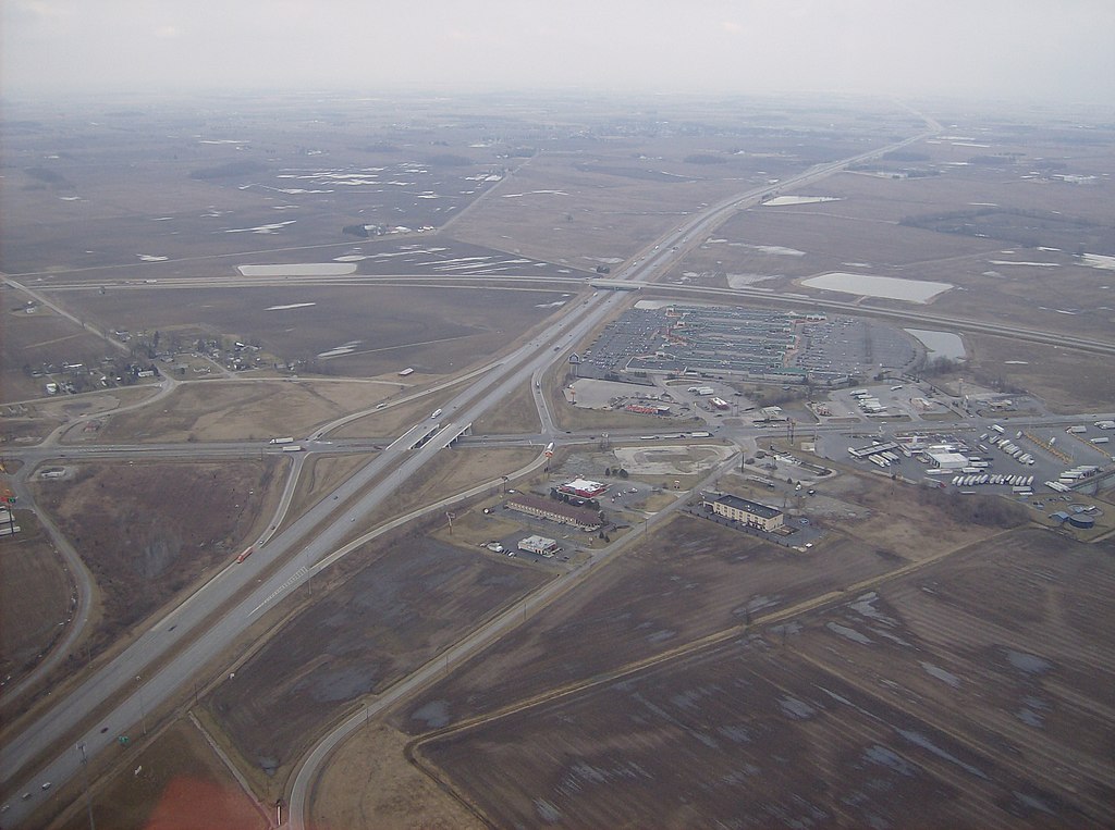
English: Aerial view of West Lancaster, a community in southern Jefferson Township, Fayette County, Ohio, United States. The village of Octa lies primarily just off the bottom edge of the picture, although its village limits extend along the road that appears from the picture's bottom edge. Picture taken from a Diamond Eclipse light airplane at an altitude of 2,500 feet MSL at an bearing of approximately 5º. The interchange is Interstate 71 over State Route 435, and the divided highway's overpass in the background is U.S. Route 35 passing over the interstate. |
||
| 日期 | 攝於2008年三月6日 | ||
| 來源 | 自己的作品 | ||
| 作者 | Nyttend | ||
| 授權許可 (重用此檔案) |
|
| 註解 | 該圖片含有註解:在維基媒體共享資源上查看註解 |
檔案歷史
點選日期/時間以檢視該時間的檔案版本。
| 日期/時間 | 縮圖 | 尺寸 | 用戶 | 備註 | |
|---|---|---|---|---|---|
| 目前 | 2008年5月26日 (一) 03:42 | | 2,576 × 1,920(2.02 MB) | Nyttend(對話 | 貢獻) | {{Information |Description=Aerial view of {{w|West Lancaster, Ohio|West Lancaster}}, a community in southern {{w|Jefferson Township, Fayette County, Ohio|Jefferson Township}}, {{w|Fayette County, Ohio|Fayette County}}, {{w|Ohio}}, {{w|United States}}. Pi |
無法覆蓋此檔案。
檔案用途
下列2個頁面有用到此檔案:
全域檔案使用狀況
以下其他 wiki 使用了這個檔案:
- ar.wikipedia.org 的使用狀況
- arz.wikipedia.org 的使用狀況
- ca.wikipedia.org 的使用狀況
- en.wikipedia.org 的使用狀況
- es.wikipedia.org 的使用狀況
- eu.wikipedia.org 的使用狀況
- fr.wikipedia.org 的使用狀況
- ht.wikipedia.org 的使用狀況
- it.wikipedia.org 的使用狀況
- ja.wikipedia.org 的使用狀況
- lld.wikipedia.org 的使用狀況
- pl.wikipedia.org 的使用狀況
- pt.wikipedia.org 的使用狀況
- sh.wikipedia.org 的使用狀況
- sr.wikipedia.org 的使用狀況
- uk.wikipedia.org 的使用狀況
- vi.wikipedia.org 的使用狀況
- www.wikidata.org 的使用狀況
- zh-min-nan.wikipedia.org 的使用狀況
- zh.wikipedia.org 的使用狀況
詮釋資料
分類:
- Aerial photographs of Ohio
- Divided highways in the United States
- Diamond interchanges
- Interchanges in Ohio
- Aerial photographs of interchanges in the United States
- Interstate 71 in Ohio
- Jefferson Township, Fayette County, Ohio
- Octa, Ohio
- Shopping malls in Ohio
- Bridges on U.S. Route 35
- U.S. Route 35 in Ohio
- Ohio State Route 435
- 2008 in Ohio