File:PIA18883-MarsCuriosityRover-PahrumpHills-Sand-20141113.jpg

原始檔案 (1,024 × 1,024 像素,檔案大小:175 KB,MIME 類型:image/jpeg)
說明
說明
摘要
[編輯]
| 描述 |
English: November 18, 2014
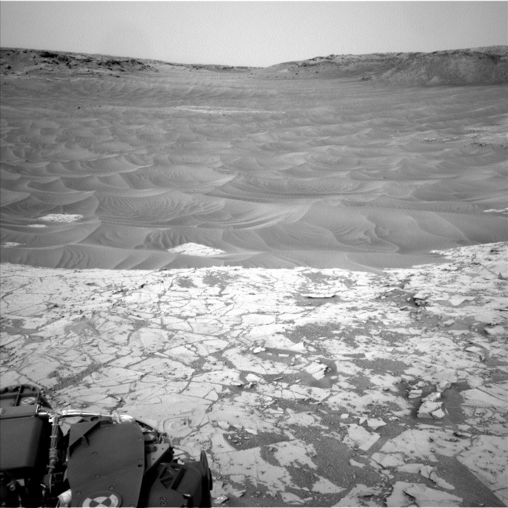
Ripples Beside 'Pahrump Hills' Outcrop at Base of Mount Sharp http://www.jpl.nasa.gov/spaceimages/details.php?id=pia18883 This northeast-facing view from the lower edge of the pale "Pahrump Hills" outcrop at the base of Mount Sharp includes wind-sculpted ripples of sand and dust in the middle ground. It was taken by the Navigation Camera (Navcam) of NASA's Curiosity Mars rover on Nov. 13, 2014, the 807th Martian day, or sol, of Curiosity's work on Mars. NASA's Jet Propulsion Laboratory, a division of the California Institute of Technology, Pasadena, manages the Mars Science Laboratory Project for NASA's Science Mission Directorate, Washington. JPL designed and built the project's Curiosity rover and the rover's Navcam. More information about Curiosity is online at http://www.nasa.gov/msl and http://mars.jpl.nasa.gov/msl/. |
| 日期 | |
| 來源 | http://photojournal.jpl.nasa.gov/jpeg/PIA18883.jpg |
| 作者 | NASA/JPL-Caltech |
授權條款
[編輯]
| 本作品由NASA創作,屬於公有領域。根據NASA的版權政策:“NASA的創作除非另有聲明否則不受版權保護。”(參見:Template:PD-USGov/zh,NASA版權政策或JPL圖像使用政策) | ||
 |
警告:
|
檔案歷史
點選日期/時間以檢視該時間的檔案版本。
| 日期/時間 | 縮圖 | 尺寸 | 使用者 | 備註 | |
|---|---|---|---|---|---|
| 目前 | 2014年11月23日 (日) 14:20 | | 1,024 × 1,024(175 KB) | Drbogdan(留言 | 貢獻) | User created page with UploadWizard |
無法覆蓋此檔案。
檔案用途
沒有使用此檔案的頁面。
全域檔案使用狀況
以下其他 wiki 使用了這個檔案:
- en.wikipedia.org 的使用狀況
- tr.wikipedia.org 的使用狀況
- uk.wikipedia.org 的使用狀況
- zh.wikipedia.org 的使用狀況