File:PIA20014-Ceres-SurveyAtlas-Overall-June2015.jpg

元のファイル (874 × 477 ピクセル、ファイルサイズ: 90キロバイト、MIME タイプ: image/jpeg)
キャプション
キャプション
概要[編集]
| 解説 |
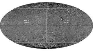
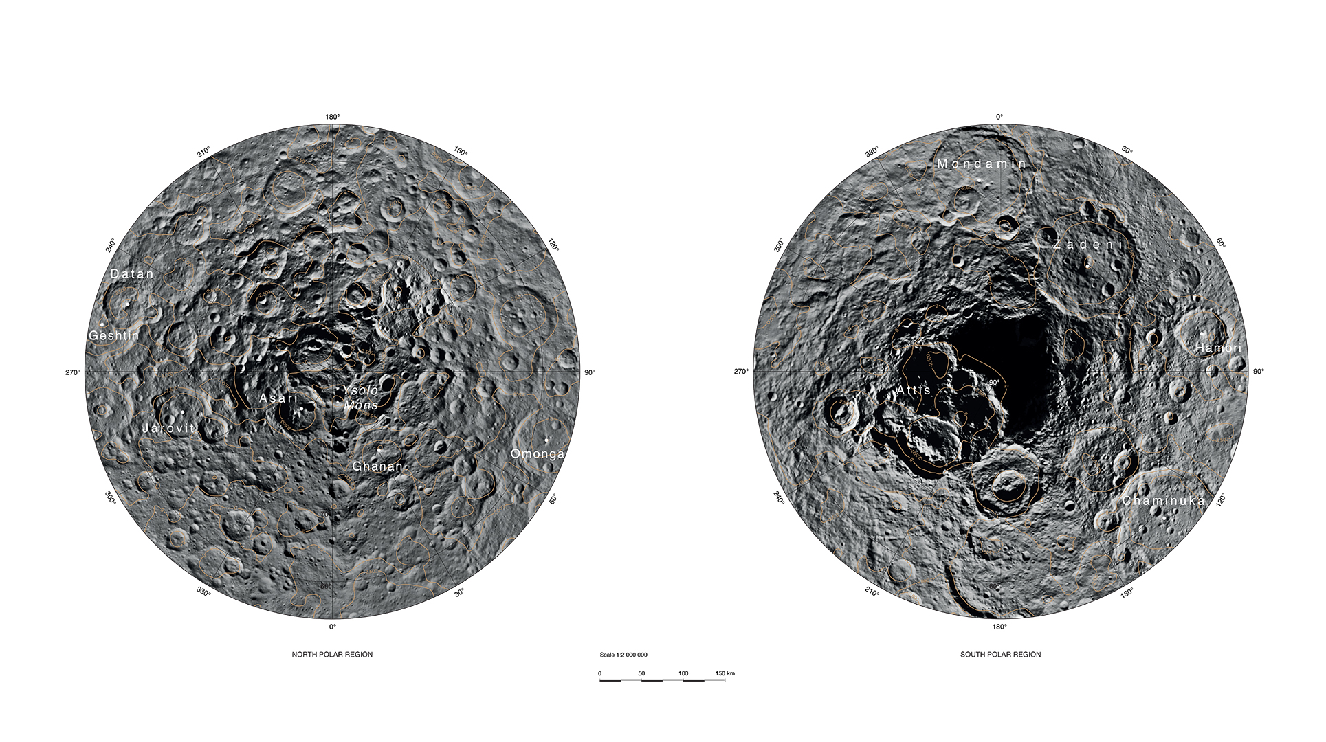
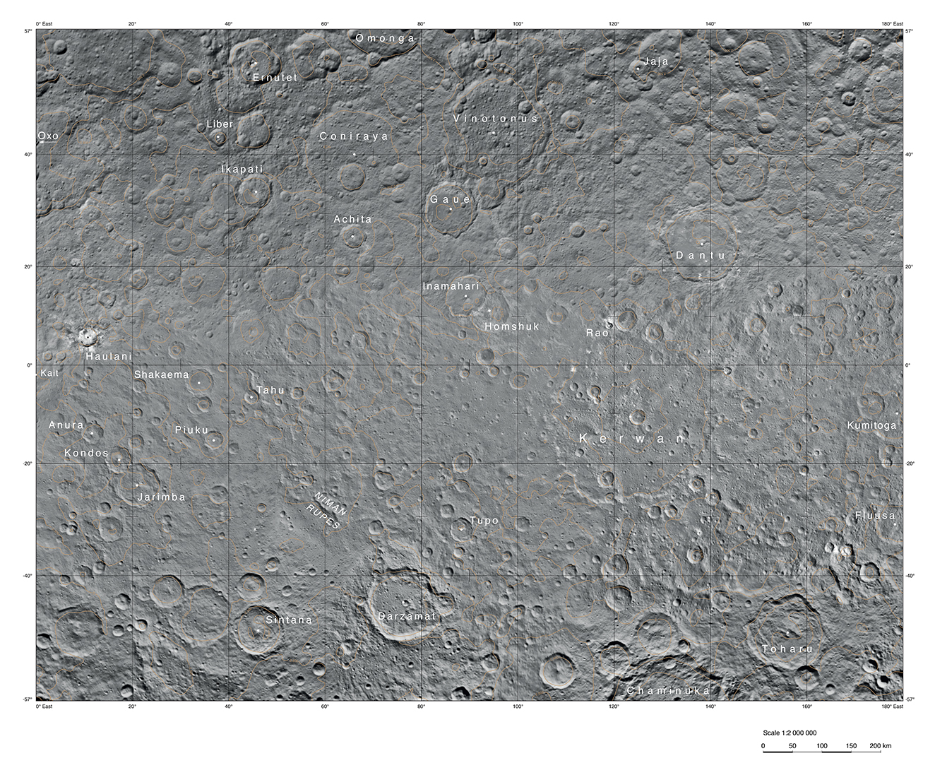
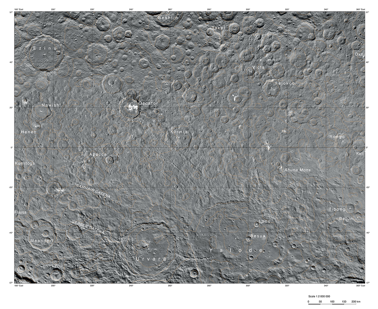
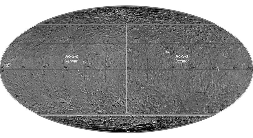
English: PIA20014: Ceres Survey Atlas - June 2015
http://photojournal.jpl.nasa.gov/catalog/PIA20014 This atlas of Ceres was created using images taken by NASA's Dawn spacecraft in June 2015. Researchers used 12,000 points on Ceres to construct a terrain model, which served as the basis for these maps. Kait crater was chosen as the reference point for longitude 0. The German Aerospace Center (DLR) constructed this atlas using data from Dawn's Survey orbit, when the spacecraft was at an altitude of about 2,700 miles (4,400 kilometers) above Ceres. The resolution is approximately 1,400 feet (410 meters) per pixel in the full-resolution PDF. The Kerwan map section is centered on 0 degrees latitude, 90 east longitude. The Occator map section is centered on 0 degrees latitude, 270 east longitude. The Asari-Zadeni map section is centered above Ceres' north and south polar regions.
|
| 日付 | |
| 原典 | http://photojournal.jpl.nasa.gov/jpeg/PIA20014.jpg |
| 作者 | NASA/JPL-Caltech/UCLA/MPS/DLR/IDA |
ライセンス[編集]
| このファイルはアメリカ航空宇宙局(NASA)によって作成されたものです。NASAの著作権の方針では、特記事項が無い場合、NASAの資料はパブリックドメインとなります。 (詳しくはTemplate:PD-USGov、NASAの著作権の方針について(英語)又はジェット推進研究所(JPL)の画像使用に関するガイドライン(英語)をご覧ください。) |
||
 |
注意事項:
|
ファイルの履歴
過去の版のファイルを表示するには、その版の日時をクリックしてください。
| 日付と時刻 | サムネイル | 寸法 | 利用者 | コメント | |
|---|---|---|---|---|---|
| 現在の版 | 2015年12月1日 (火) 21:03 | | 874 × 477 (90キロバイト) | Drbogdan (トーク | 投稿記録) | User created page with UploadWizard |
このファイルは上書きできません。
ファイルの使用状況
このファイルを使用しているページはありません。
グローバルなファイル使用状況
以下に挙げる他のウィキがこの画像を使っています:
- en.wikipedia.org での使用状況
- fa.wikipedia.org での使用状況
- ja.wikipedia.org での使用状況
- kk.wikipedia.org での使用状況
- pt.wikipedia.org での使用状況
- vi.wikipedia.org での使用状況
- zh.wikipedia.org での使用状況