File:PIA20014-Ceres-SurveyAtlas-Overall-June2015.jpg

原始文件 (874 × 477像素,文件大小:90 KB,MIME类型:image/jpeg)
说明
说明
摘要
[编辑]
| 描述 |
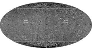
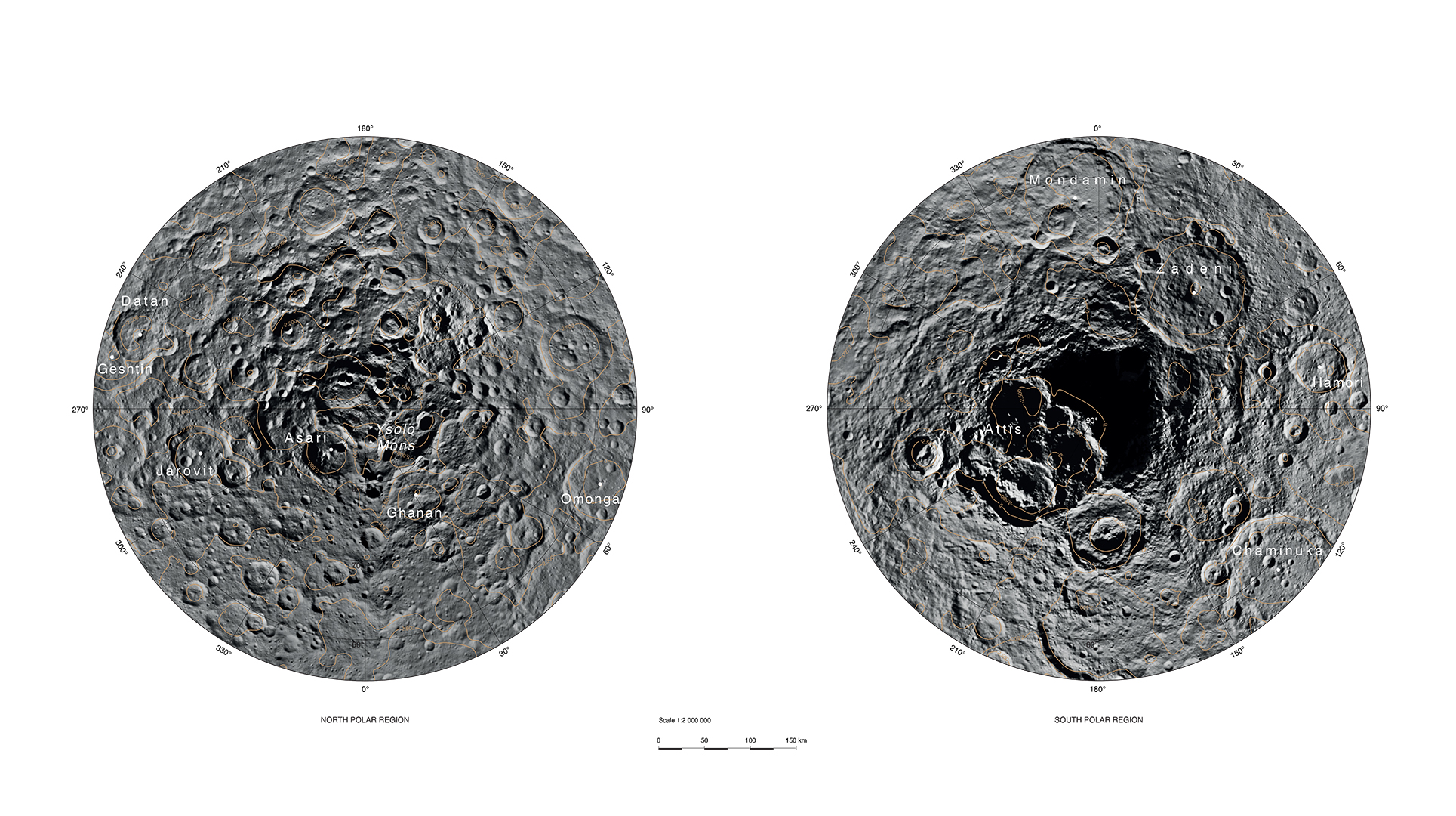
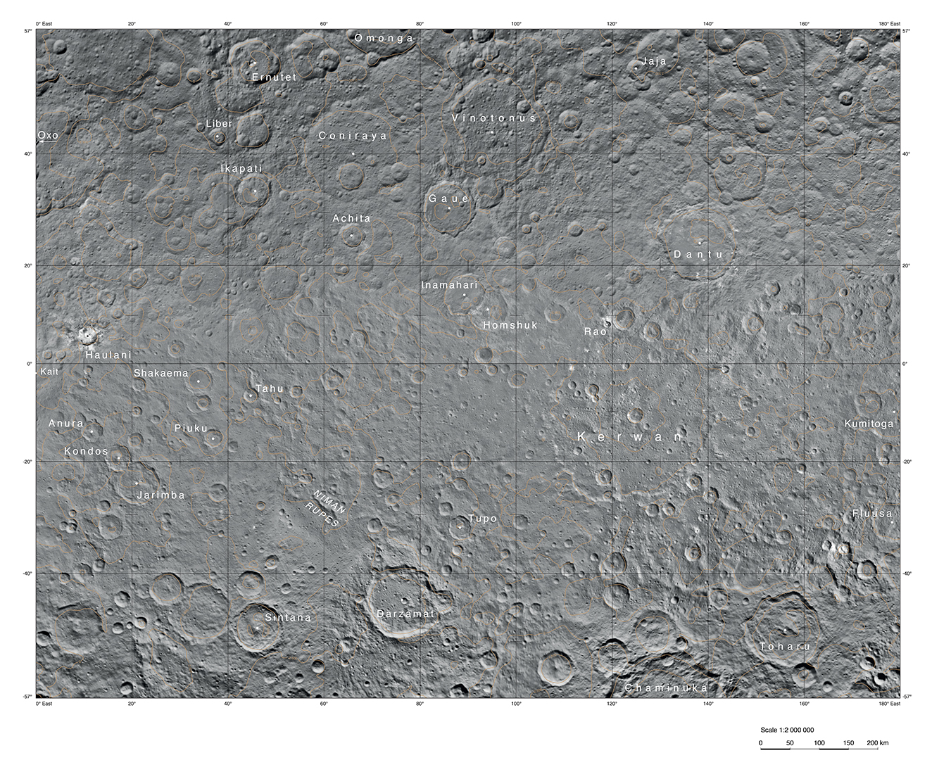
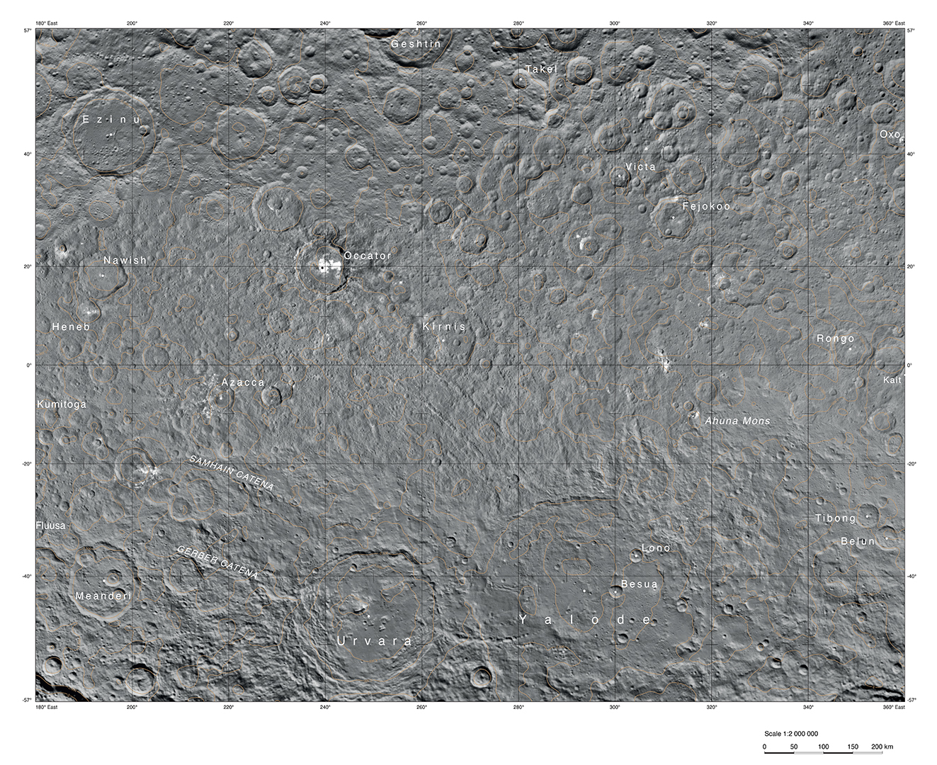
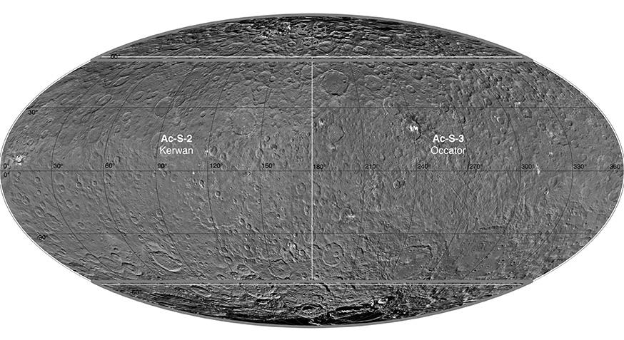
English: PIA20014: Ceres Survey Atlas - June 2015
http://photojournal.jpl.nasa.gov/catalog/PIA20014 This atlas of Ceres was created using images taken by NASA's Dawn spacecraft in June 2015. Researchers used 12,000 points on Ceres to construct a terrain model, which served as the basis for these maps. Kait crater was chosen as the reference point for longitude 0. The German Aerospace Center (DLR) constructed this atlas using data from Dawn's Survey orbit, when the spacecraft was at an altitude of about 2,700 miles (4,400 kilometers) above Ceres. The resolution is approximately 1,400 feet (410 meters) per pixel in the full-resolution PDF. The Kerwan map section is centered on 0 degrees latitude, 90 east longitude. The Occator map section is centered on 0 degrees latitude, 270 east longitude. The Asari-Zadeni map section is centered above Ceres' north and south polar regions.
|
| 日期 | |
| 来源 | http://photojournal.jpl.nasa.gov/jpeg/PIA20014.jpg |
| 作者 | NASA/JPL-Caltech/UCLA/MPS/DLR/IDA |
许可协议
[编辑]
| 本文件完全由NASA创作,在美国属于公有领域。根据NASA的版权方针,NASA的材料除非另有声明否则不受版权保护。(参见Template:PD-USGov/zh、NASA版权方针页面或JPL图片使用方针。) | ||
 |
警告:
|
文件历史
点击某个日期/时间查看对应时刻的文件。
| 日期/时间 | 缩略图 | 大小 | 用户 | 备注 | |
|---|---|---|---|---|---|
| 当前 | 2015年12月1日 (二) 21:03 | | 874 × 477(90 KB) | Drbogdan(留言 | 贡献) | User created page with UploadWizard |
您不可以覆盖此文件。
文件用途
没有页面使用本文件。
全域文件用途
以下其他wiki使用此文件:
- en.wikipedia.org上的用途
- fa.wikipedia.org上的用途
- ja.wikipedia.org上的用途
- kk.wikipedia.org上的用途
- pt.wikipedia.org上的用途
- vi.wikipedia.org上的用途
- zh.wikipedia.org上的用途