File:Pacific Area - The Imperial Powers 1939 - Map-it.svg
Spring til navigation
Spring til søgning

Size of this PNG preview of this SVG file: 765 × 599 pixels. Andre opløsninger: 306 × 240 pixels | 613 × 480 pixels | 980 × 768 pixels | 1.280 × 1.003 pixels | 2.560 × 2.006 pixels | 1.039 × 814 pixels.
Oprindelig fil (SVG fil, basisstørrelse 1.039 × 814 pixels, filstørrelse: 2,25 MB)
Captions
Captions
Tilføj en kort forklaring på en enkelt linje om hvad filen viser
Beskrivelse[redigér]
| Beskrivelse |
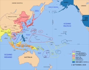
Italiano: Mappa delle potenze imperiali nel Pacifico (1939) |
| Dato | |
| Kilde | File:Pacific Area - The Imperial Powers 1939 - Map.svg |
| Forfatter | Emok, derivative by User:Fulvio314 |
| Andre versioner |
[]
|


Licensering[redigér]
Jeg, dette værks ophavsretsindehaver, udgiver hermed værket under den følgende licens:
Denne fil er udgivet under Creative Commons Kreditering-Del på samme vilkår 3.0 Ikke-porteret-licensen.
- Du må frit:
- at dele – at kopiere, distribuere og overføre værket
- at remixe – at tilpasse værket
- Under følgende vilkår:
- kreditering – Du skal give passende kreditering, angive et link til licensen, og oplyse om der er foretaget ændringer. Du må gøre det på enhver fornuftig måde, men ikke på en måde der antyder at licensgiveren godkender dig eller din anvendelse.
- deling på samme vilkår – Hvis du bearbejder, ændrer eller bygger videre på dette værk, skal du distribuere dine bidrag under den samme eller en kompatibel licens som originalen.

|
Tilladelse er givet til at kopiere, distribuere og/eller ændre dette dokument under betingelserne i GNU Free Documentation License', Version 1.2 eller enhver senere version udgivet af Free Software Foundation; uden et invariant afsnit, ingen forsidetekster, og ingen bagsidetekst. En kopi af licensen er inkluderet i afsnittet GNU Free Documentation License. |
Du kan vælge den licens du foretrækker.
Filhistorik
Klik på en dato/tid for at se filen som den så ud på det tidspunkt.
| Dato/tid | Miniaturebillede | Dimensioner | Bruger | Kommentar | |
|---|---|---|---|---|---|
| nuværende | 7. okt. 2015, 18:59 | | 1.039 × 814 (2,25 MB) | Fulvio314 (diskussion | bidrag) | fixing border |
| 7. okt. 2015, 18:49 |  | 1.039 × 814 (2,25 MB) | Fulvio314 (diskussion | bidrag) | stati uniti D'AMERICA | |
| 3. okt. 2015, 07:10 |  | 1.039 × 814 (2,24 MB) | Fulvio314 (diskussion | bidrag) | - Tannu Tuva | |
| 1. okt. 2015, 08:17 |  | 1.039 × 814 (2,24 MB) | Fulvio314 (diskussion | bidrag) | User created page with UploadWizard |
Du kan ikke overskrive denne fil.
Filanvendelse
De følgende 9 sider bruger denne fil:
- User:Magog the Ogre/Maps of conflicts/2015 October
- File:Kolonialmächte im Pazifikraum, 1939.svg
- File:Pacific Area - Imperial Powers 1939 - Map.svg
- File:Pacific Area - The Imperial Powers 1939 - Map-es.svg
- File:Pacific Area - The Imperial Powers 1939 - Map-hu.svg
- File:Pacific Area - The Imperial Powers 1939 - Map-it.svg
- File:Pacific Area - The Imperial Powers 1939 - Map.svg
- File:Pacific Area - The Imperial Powers 1939 - Map mk.svg
- Template:Other versions/Pacific Area - The Imperial Powers 1939
Global filanvendelse
Følgende andre wikier anvender denne fil:
- Anvendelser på it.wikipedia.org
Metadata
Kategorier:
- Maps of the history of Oceania
- Maps showing the history of colonies
- Maps of World War II in the Pacific
- Maps of the Empire of Japan
- Maps of former colonies of the United Kingdom in Oceania
- Maps of former colonies of the United Kingdom in Asia
- Maps of former colonies of Portugal in Asia
- 1939 maps of Oceania
- Italian-language SVG maps showing history
- 20th-century maps of the Pacific Ocean