File:Ph locator region 7.png
Salta a la navegació
Salta a la cerca
No hi ha cap versió amb una resolució més gran.
Ph_locator_region_7.png (300 × 440 píxels, mida del fitxer: 17 Ko, tipus MIME: image/png)
Llegendes
Llegendes
Afegeix una explicació d'una línia del que representa aquest fitxer
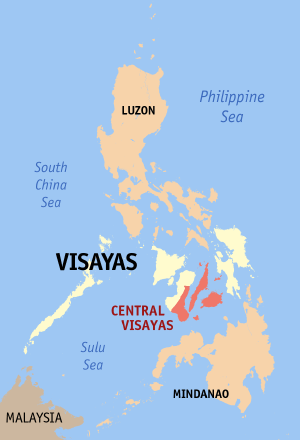
Map of the Philippines showing the location of Central Visayas.
Created and copyright (2003) by seav. Released under the GFDL.
Source: English Wikipedia
seav from en.wikipedia.org, el titular dels drets d'autor d'aquest treball, el public sota la següent llicència:

|
S'autoritza la còpia, la distribució i la modificació d'aquest document sota els termes de la llicència de documentació lliure GNU versió 1.2 o qualsevol altra versió posterior que publiqui la Free Software Foundation; sense seccions invariants, ni textos de portada, ni textos de contraportada. S'inclou una còpia d'aquesta llicència en la secció titulada GNU Free Documentation License. |
| Aquest fitxer està subjecte a la llicència de Creative Commons Reconeixement i Compartir Igual 3.0 No adaptada. | ||
| Reconeixement: seav | ||
| ||
| Aquest avís de llicència s'ha afegit a aquest fitxer d'acord amb l'actualització de la llicència GFDL. |
Historial del fitxer
Cliqueu una data/hora per veure el fitxer tal com era aleshores.
| Data/hora | Miniatura | Dimensions | Usuari/a | Comentari | |
|---|---|---|---|---|---|
| actual | 02:31, 15 ago 2017 | | 300 × 440 (17 Ko) | Nikbert16 (discussió | contribucions) | Reverted to version as of 23:38, 27 February 2006 (UTC) Negros Island Region abolish. Reverting Negros Oriental back into Central Visayas. |
| 05:31, 6 juny 2015 |  | 300 × 440 (31 Ko) | Hariboneagle927 (discussió | contribucions) | Negros Island Region created | |
| 23:38, 27 feb 2006 |  | 300 × 440 (17 Ko) | Magalhães (discussió | contribucions) | ||
| 20:03, 14 set 2005 |  | 300 × 450 (11 Ko) | Magalhães (discussió | contribucions) | Map of the Philippines showing the location of Central Visayas. Created and copyright (2003) by seav. Released under the GNU FDL. Source: [http://en.wikipedia.org/wiki/Image:Ph_locator_region_7.png English Wikipedia] {{GFDL}} [[Category:Maps of the Phi |
No podeu sobreescriure aquest fitxer.
Ús del fitxer
La pàgina següent utilitza aquest fitxer:
Ús global del fitxer
Utilització d'aquest fitxer en altres wikis:
- Utilització a ceb.wikipedia.org
- Utilització a da.wikipedia.org
- Utilització a en.wikipedia.org
- Utilització a fi.wikipedia.org
- Utilització a he.wikipedia.org
- Utilització a hi.wikipedia.org
- Utilització a hr.wikipedia.org
- Utilització a id.wikipedia.org
- Utilització a ilo.wikipedia.org
- Utilització a incubator.wikimedia.org
- Utilització a it.wikipedia.org
- Utilització a it.wikivoyage.org
- Utilització a ja.wikipedia.org
- Utilització a ko.wikipedia.org
- Utilització a la.wikipedia.org
- Utilització a lt.wikipedia.org
- Utilització a mk.wikipedia.org
- Utilització a pam.wikipedia.org
- Utilització a pl.wikipedia.org
- Utilització a pt.wikipedia.org
- Utilització a ru.wikipedia.org
- Utilització a sco.wikipedia.org
- Utilització a sv.wikipedia.org
- Utilització a ta.wikipedia.org
- Utilització a th.wikipedia.org
- Utilització a tr.wikipedia.org
- Utilització a uk.wikipedia.org
- Utilització a ur.wikipedia.org
- Utilització a vec.wikipedia.org
- Utilització a vi.wikipedia.org
- Utilització a war.wikipedia.org
- Utilització a zh-yue.wikipedia.org
- Utilització a zh.wikipedia.org