File:Piri Reis map interpretation RG.jpg
Salta a la navegació
Salta a la cerca

Mida d'aquesta previsualització: 744 × 600 píxels. Altres resolucions: 298 × 240 píxels | 595 × 480 píxels.
Fitxer original (800 × 645 píxels, mida del fitxer: 187 Ko, tipus MIME: image/jpeg)
Llegendes
Llegendes
Afegeix una explicació d'una línia del que representa aquest fitxer
Resum[modifica]
| Descripció |
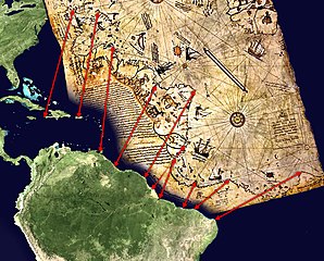
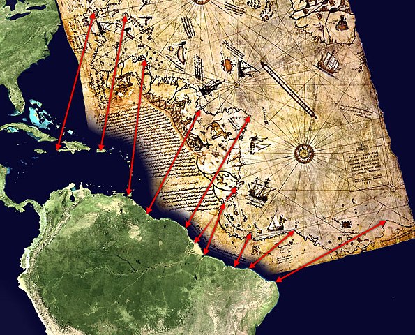
English: Possible interpretation of the Piri Reis map. Middle and south america on the left, north africa in the upper right, south atlantic ocean in the middle.
An alternate (and more likely) interpretation of those ancient map can be found here: File:Piri Reis map interpretation.jpg |
| Data | |
| Font | Treball propi, based on de:Datei:Karte des piri reis.jpg and File:Whole world - land and oceans.jpg. Both sources are public domain. |
| Autor | TMg, based on an image by Segantini. |
| Altres versions |
|

Llicència[modifica]
| Jo, el titular del copyright d'aquesta obra, l'allibero al domini públic. Això s'aplica a tot el món. En alguns països això pot no ser legalment possible, en tal cas: Jo faig concessió a tothom del dret d'usar aquesta obra per a qualsevol propòsit, sense cap condició llevat d'aquelles requerides per la llei. |
Historial del fitxer
Cliqueu una data/hora per veure el fitxer tal com era aleshores.
| Data/hora | Miniatura | Dimensions | Usuari/a | Comentari | |
|---|---|---|---|---|---|
| actual | 20:32, 29 març 2006 | | 800 × 645 (187 Ko) | TMg (discussió | contribucions) | == Beschreibung == {{Information| |Description = Possible interpretation of the Piri Reis map. Middle and south america on the left, north africa in the upper right, south [[w |
No podeu sobreescriure aquest fitxer.
Ús del fitxer
La pàgina següent utilitza aquest fitxer:
Ús global del fitxer
Utilització d'aquest fitxer en altres wikis:
- Utilització a ar.wikipedia.org
- Utilització a ca.wikipedia.org
- Utilització a de.wikipedia.org
- Utilització a el.wikipedia.org
- Utilització a es.wikipedia.org
- Utilització a gl.wikipedia.org
- Utilització a hu.wikipedia.org
- Utilització a simple.wikipedia.org